STS051-101-52
| NASA Photo ID | STS051-101-52 |
| Focal Length | 100mm |
| Date taken | 1993.09.15 |
| Time taken | 05:07:14 GMT |
Resolutions offered for this image:
3936 x 3872 pixels 639 x 629 pixels 5700 x 5900 pixels 500 x 518 pixels 640 x 480 pixels
3936 x 3872 pixels 639 x 629 pixels 5700 x 5900 pixels 500 x 518 pixels 640 x 480 pixels
Cloud masks available for this image:
Spacecraft nadir point: 23.8° S, 142.3° E
Photo center point: 23.0° S, 140.5° E
Photo center point by machine learning:
Photo center point: 23.0° S, 140.5° E
Photo center point by machine learning:
Nadir to Photo Center: West
Spacecraft Altitude: 161 nautical miles (298km)
Country or Geographic Name: | AUSTRALIA-Q |
Features: | HAMILTON RIVER |
| Features Found Using Machine Learning: | |
Cloud Cover Percentage: | 0 (no clouds present) |
Sun Elevation Angle: | 43° |
Sun Azimuth: | 299° |
Camera: | Hasselblad |
Focal Length: | 100mm |
Camera Tilt: | 36 degrees |
Format: | VELVI: Fuji, natural color positive, Velvia 50, CS 135-36, ASA 32, standard base |
Film Exposure: | Normal |
| Additional Information | |
| Width | Height | Annotated | Cropped | Purpose | Links |
|---|---|---|---|---|---|
| 3936 pixels | 3872 pixels | No | No | Earth From Space collection | Download Image |
| 639 pixels | 629 pixels | No | No | Earth From Space collection | Download Image |
| 5700 pixels | 5900 pixels | No | No | Download Image | |
| 500 pixels | 518 pixels | No | No | Download Image | |
| 640 pixels | 480 pixels | No | No | Download Image |
Download Packaged File
Download a Google Earth KML for this Image
View photo footprint information
Download a GeoTIFF for this photo
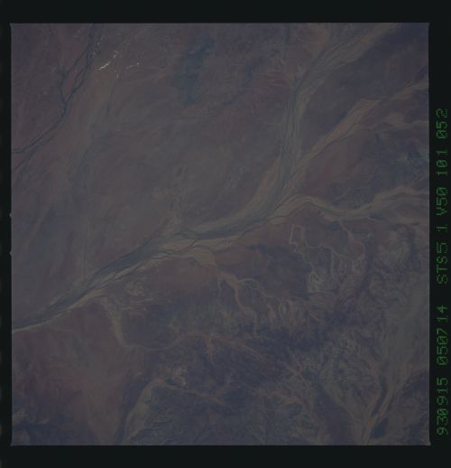
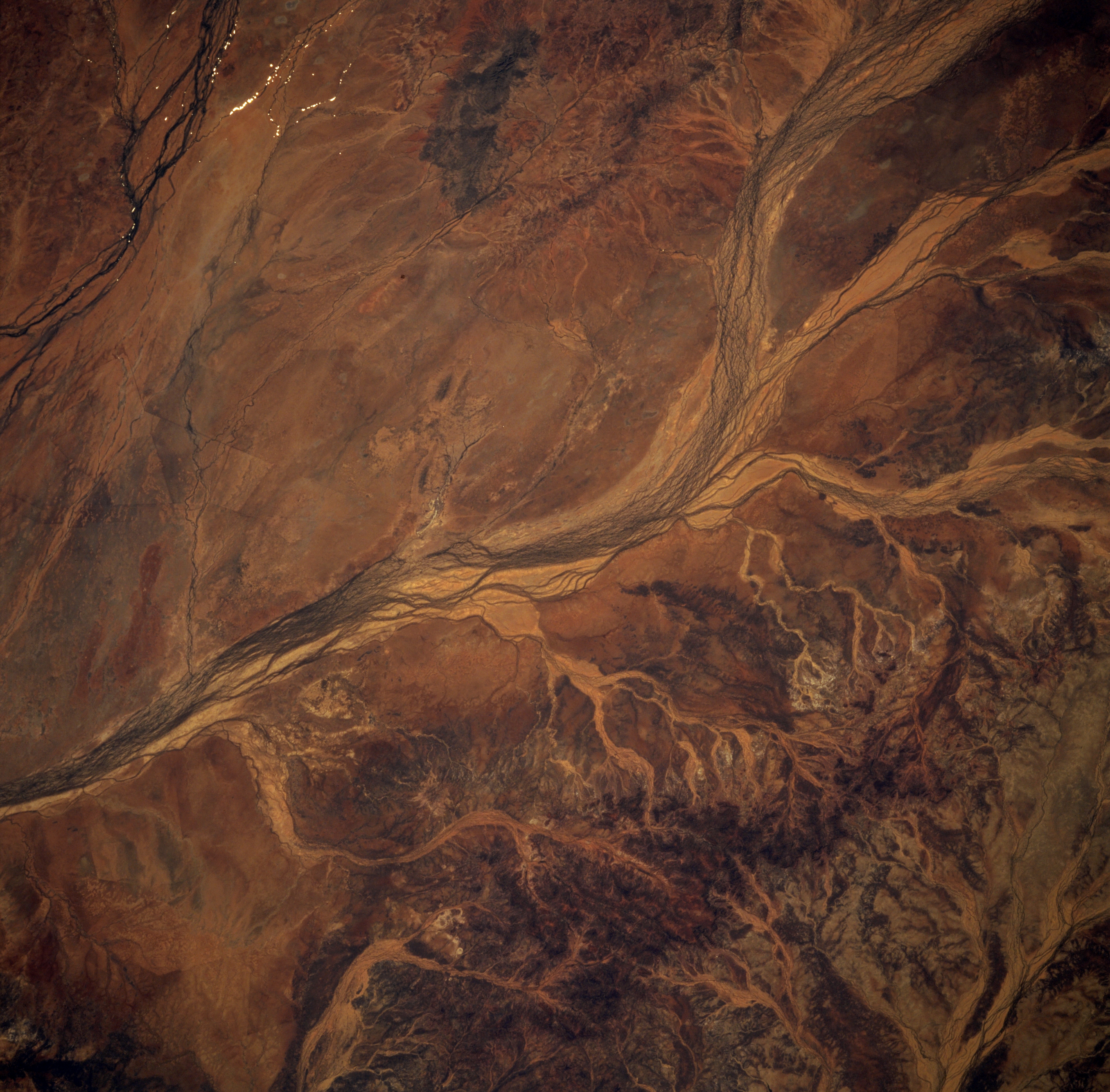
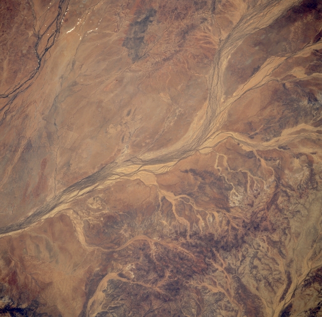
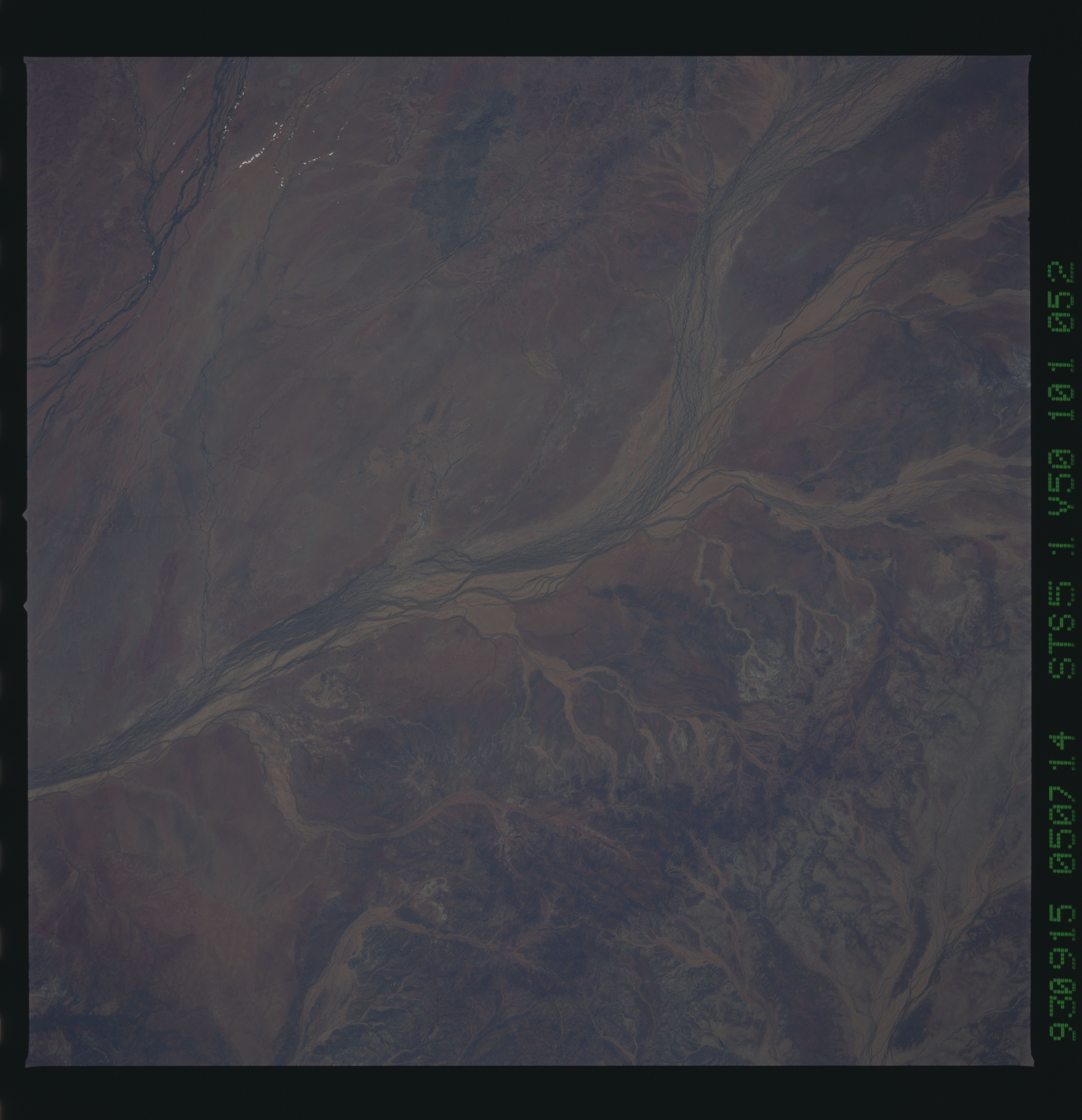
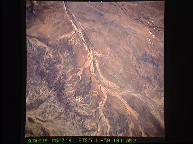
Image Caption: STS051-101-052 Hamilton River, Queensland, Australia September 1993
The Hamilton River is one of many ephermal streams that drains southward towards the interior of the Australian continent and specifically into the Simpson Desert of southwestern Queensland and part of the Northern territory. The multi-braided channels of a fairly broad floodplain of the Hamilton River display a typical appearance for many of the intermittently flowing rivers that traverse the flat to gently undulating terrain in this arid environment. Several light-colored (less-vegetated) erosional tributaries are visible along the southeastern side of the river. A short section of the drainage channels of the Burke River (dark lines) are visible in the upper left corner of the image and the headwaters area of Pot Jostler Creek which drains into the Diamantina River Basin is visible in the lower right corner of the picture.
The Hamilton River is one of many ephermal streams that drains southward towards the interior of the Australian continent and specifically into the Simpson Desert of southwestern Queensland and part of the Northern territory. The multi-braided channels of a fairly broad floodplain of the Hamilton River display a typical appearance for many of the intermittently flowing rivers that traverse the flat to gently undulating terrain in this arid environment. Several light-colored (less-vegetated) erosional tributaries are visible along the southeastern side of the river. A short section of the drainage channels of the Burke River (dark lines) are visible in the upper left corner of the image and the headwaters area of Pot Jostler Creek which drains into the Diamantina River Basin is visible in the lower right corner of the picture.
