STS051-101-42
| NASA Photo ID | STS051-101-42 |
| Focal Length | 100mm |
| Date taken | 1993.09.15 |
| Time taken | 05:05:47 GMT |
Resolutions offered for this image:
3899 x 3870 pixels 639 x 635 pixels 5700 x 5900 pixels 500 x 518 pixels 640 x 480 pixels
3899 x 3870 pixels 639 x 635 pixels 5700 x 5900 pixels 500 x 518 pixels 640 x 480 pixels


Cloud masks available for this image:
Spacecraft nadir point: 22.0° S, 136.7° E
Photo center point: 18.0° S, 135.5° E
Photo center point by machine learning:
Photo center point: 18.0° S, 135.5° E
Photo center point by machine learning:
Nadir to Photo Center: North
Spacecraft Altitude: 162 nautical miles (300km)
Country or Geographic Name: | AUSTRALIA-NT |
Features: | TARRABOOL L., CREEKS |
| Features Found Using Machine Learning: | |
Cloud Cover Percentage: | 0 (no clouds present) |
Sun Elevation Angle: | 48° |
Sun Azimuth: | 302° |
Camera: | Hasselblad |
Focal Length: | 100mm |
Camera Tilt: | Low Oblique |
Format: | VELVI: Fuji, natural color positive, Velvia 50, CS 135-36, ASA 32, standard base |
Film Exposure: | Normal |
| Additional Information | |
| Width | Height | Annotated | Cropped | Purpose | Links |
|---|---|---|---|---|---|
| 3899 pixels | 3870 pixels | No | No | Earth From Space collection | Download Image |
| 639 pixels | 635 pixels | No | No | Earth From Space collection | Download Image |
| 5700 pixels | 5900 pixels | No | No | Download Image | |
| 500 pixels | 518 pixels | No | No | Download Image | |
| 640 pixels | 480 pixels | No | No | Download Image |
Download Packaged File
Download a Google Earth KML for this Image
View photo footprint information
Download a GeoTIFF for this photo
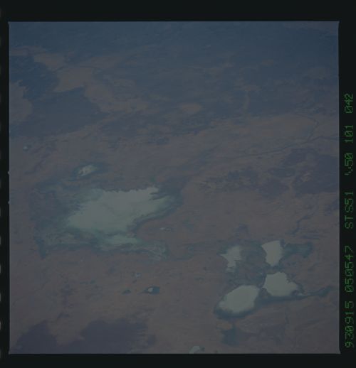
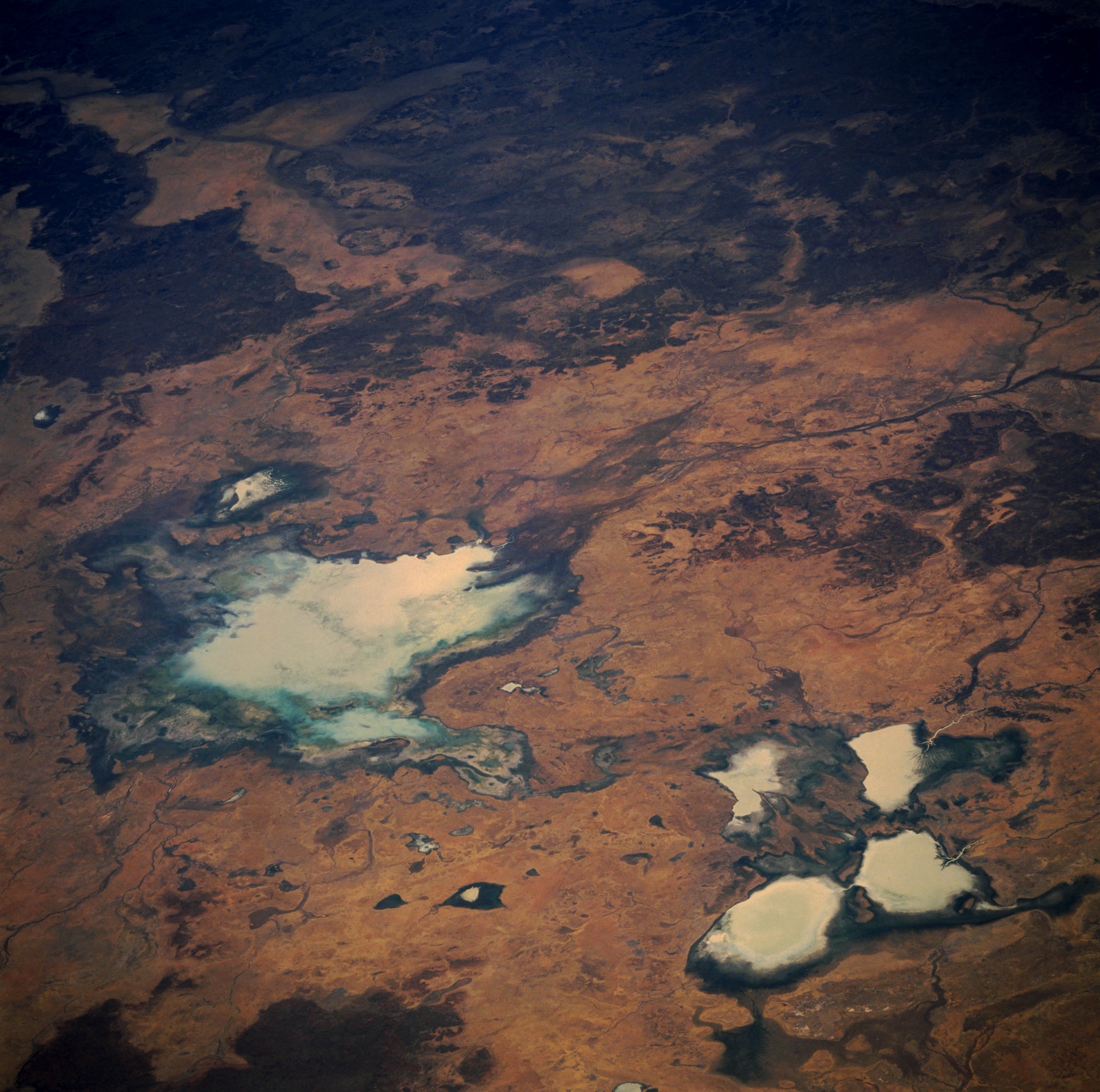
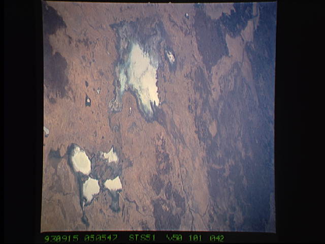
Image Caption: STS051-101-042 Tarrabool Lake, Northern Territory, Australia September 1993
Tarrabool Lake (large, light colored feature slightly left of center) is located on the western fringe of the Barkly Tableland in northeastern Northern Territory. The actual size of the lake fluctuates as a function of the amount of precipitation that the surrounding area receives in any given year. Although the lake is fed by several creeks, it receives most of its runoff from Creswell Creek which can be seen entering the northeast end of the lake. The wooded swampland of the lake is a major breeding area for colonial water birds, especially Australian Pelicans and Straw-necked Ibis. When fully inundated, Tarrabool is the largest wooded swamp in tropical Australia. The four lighter-colored, clustered features in the lower right corner of the image includes Corella Lake and Lake Sylvester. Refer to image STS051-078-013 for a detailed description of these milky-colored lakes.
Tarrabool Lake (large, light colored feature slightly left of center) is located on the western fringe of the Barkly Tableland in northeastern Northern Territory. The actual size of the lake fluctuates as a function of the amount of precipitation that the surrounding area receives in any given year. Although the lake is fed by several creeks, it receives most of its runoff from Creswell Creek which can be seen entering the northeast end of the lake. The wooded swampland of the lake is a major breeding area for colonial water birds, especially Australian Pelicans and Straw-necked Ibis. When fully inundated, Tarrabool is the largest wooded swamp in tropical Australia. The four lighter-colored, clustered features in the lower right corner of the image includes Corella Lake and Lake Sylvester. Refer to image STS051-078-013 for a detailed description of these milky-colored lakes.
