STS050-84-13

| NASA Photo ID | STS050-84-13 |
| Focal Length | 250mm |
| Date taken | 1992.06.26 |
| Time taken | 05:43:48 GMT |
Cloud masks available for this image:
Spacecraft nadir point: 25.0° N, 43.1° E
Photo center point: 26.5° N, 43.5° E
Photo center point by machine learning:
Photo center point: 26.5° N, 43.5° E
Photo center point by machine learning:
Nadir to Photo Center: North
Spacecraft Altitude: 162 nautical miles (300km)
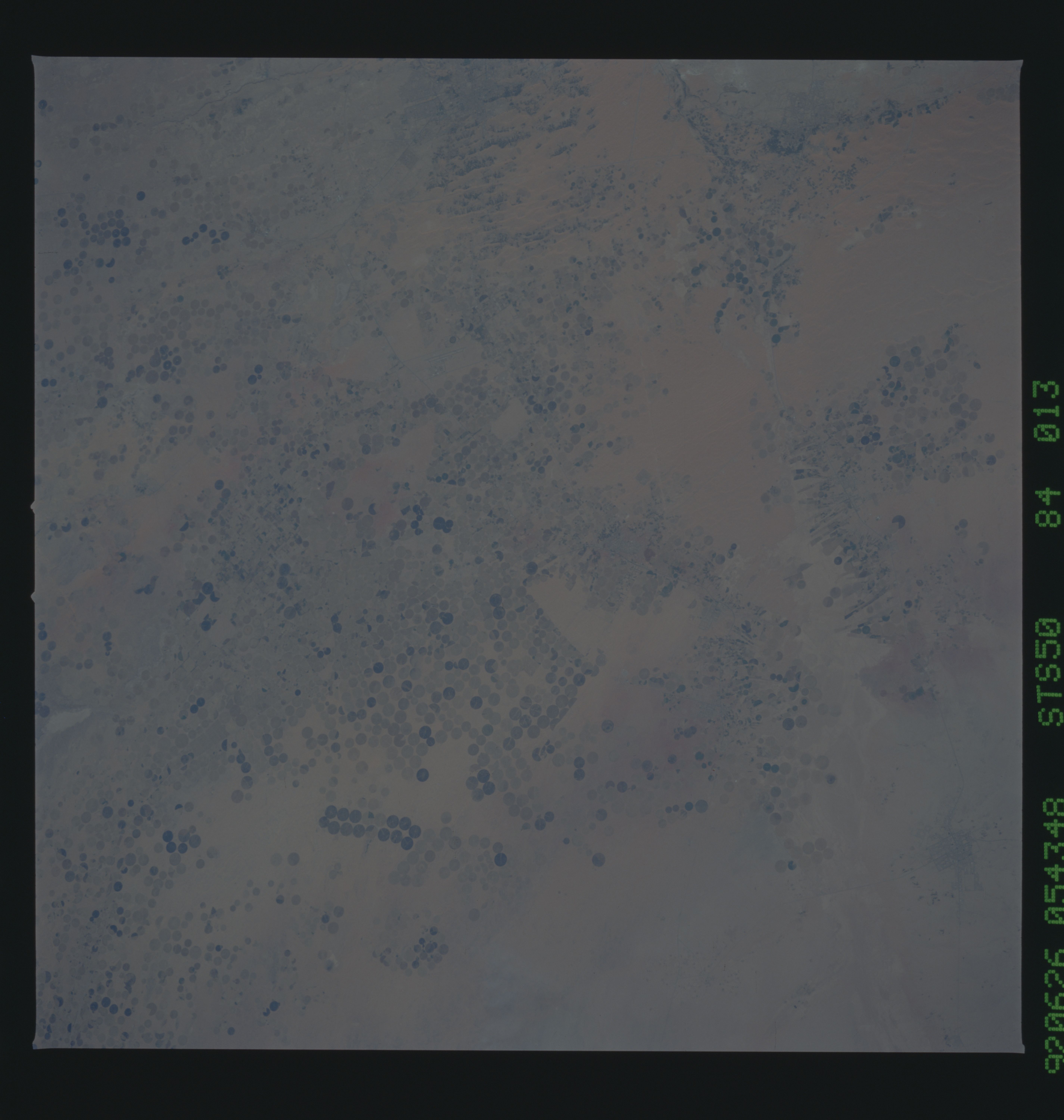
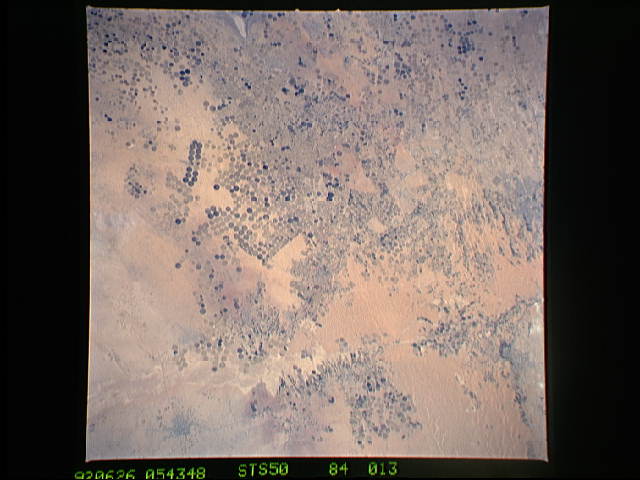
Country or Geographic Name: | SAUDI ARABIA |
Features: | C. PT. IRRIGA., GASSIM |
| Features Found Using Machine Learning: | |
Cloud Cover Percentage: | 0 (no clouds present) |
Sun Elevation Angle: | 43° |
Sun Azimuth: | 80° |
Camera: | Hasselblad |
Focal Length: | 250mm |
Camera Tilt: | 30 degrees |
Format: | 5017: Kodak, natural color positive, Ektachrome, X Professional, ASA 64, standard base |
Film Exposure: | Normal |
| Additional Information | |
| Width | Height | Annotated | Cropped | Purpose | Links |
|---|---|---|---|---|---|
| 5700 pixels | 6000 pixels | No | No | Download Image | |
| 500 pixels | 526 pixels | No | No | Download Image | |
| 640 pixels | 480 pixels | No | No | Download Image |
Download Packaged File
Download a Google Earth KML for this Image
View photo footprint information
Download a GeoTIFF for this photo
Image Caption: This enormous center pivot irrigated agricultural complex in Saudi Arabia (26.5N, 43.5E) is located about 250 miles northwest of the capital city of Riyadh. The darker circular fields are indicative of active growing crops as contrasted to the lighter toned fields indicating that they are either fallow or abandoned. Other recognizable features include Wadi ar Rumah, the cities of Buraydah, Unayzah and Ar Rassan and an airstrip at Gassim.
