STS049-97-U
| NASA Photo ID | STS049-97-U |
| Focal Length | 250mm |
| Date taken | 1992.05.12 |
| Time taken | GMT |
Resolutions offered for this image:
5230 x 5230 pixels 639 x 639 pixels 5700 x 6000 pixels 500 x 526 pixels 640 x 480 pixels
5230 x 5230 pixels 639 x 639 pixels 5700 x 6000 pixels 500 x 526 pixels 640 x 480 pixels
Cloud masks available for this image:
Spacecraft nadir point:
Photo center point: 28.0° N, 97.5° W
Photo center point by machine learning:
Photo center point: 28.0° N, 97.5° W
Photo center point by machine learning:
Nadir to Photo Center:
Spacecraft Altitude: nautical miles (0km)
Country or Geographic Name: | USA-TEXAS |
Features: | CORPUS CHRISTI |
| Features Found Using Machine Learning: | |
Cloud Cover Percentage: | 10 (1-10)% |
Sun Elevation Angle: | ° |
Sun Azimuth: | ° |
Camera: | Hasselblad |
Focal Length: | 250mm |
Camera Tilt: | Low Oblique |
Format: | 5017: Kodak, natural color positive, Ektachrome, X Professional, ASA 64, standard base |
Film Exposure: | Normal |
| Additional Information | |
| Width | Height | Annotated | Cropped | Purpose | Links |
|---|---|---|---|---|---|
| 5230 pixels | 5230 pixels | No | No | Earth From Space collection | Download Image |
| 639 pixels | 639 pixels | No | No | Earth From Space collection | Download Image |
| 5700 pixels | 6000 pixels | No | No | Download Image | |
| 500 pixels | 526 pixels | No | No | Download Image | |
| 640 pixels | 480 pixels | No | No | Download Image |
Download Packaged File
Download a Google Earth KML for this Image
View photo footprint information
Download a GeoTIFF for this photo
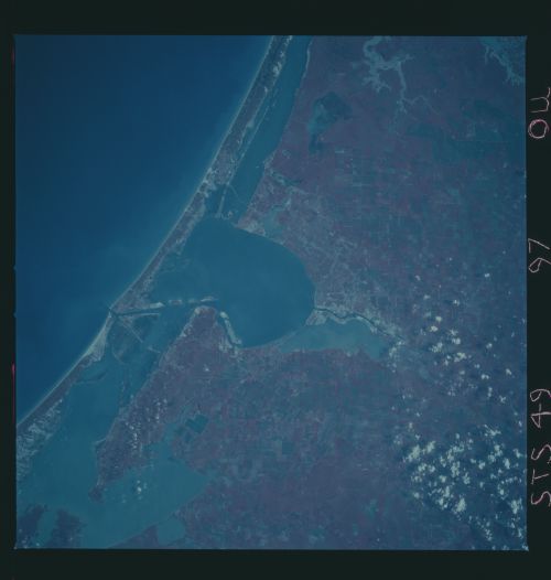
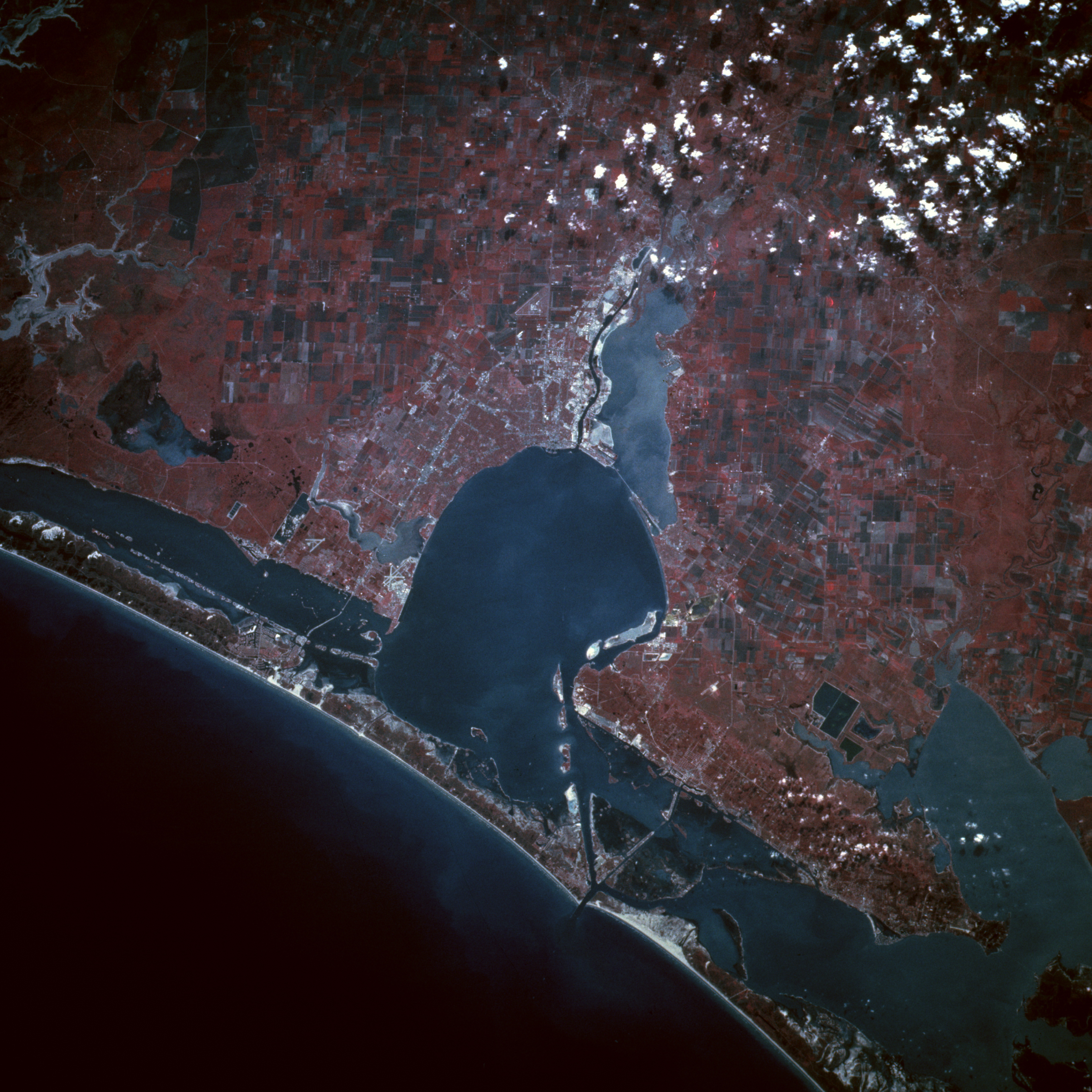
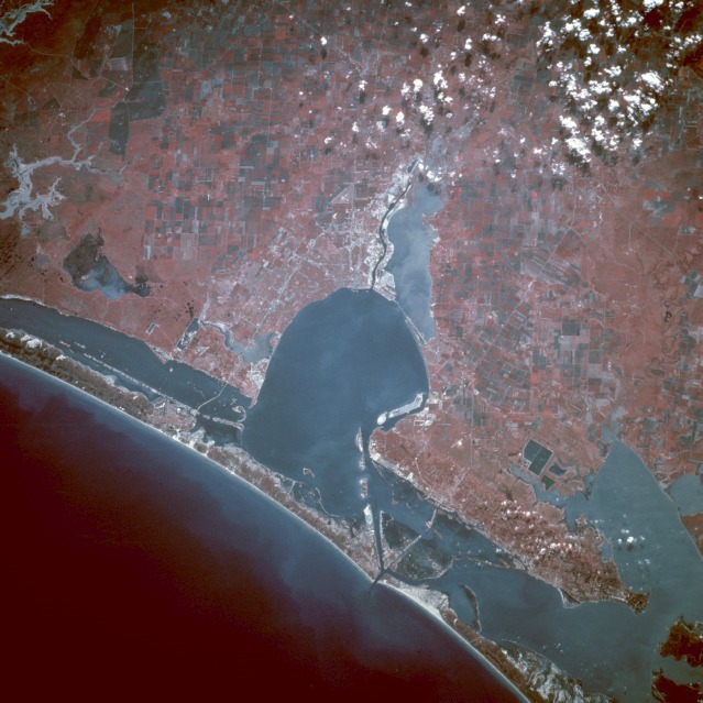
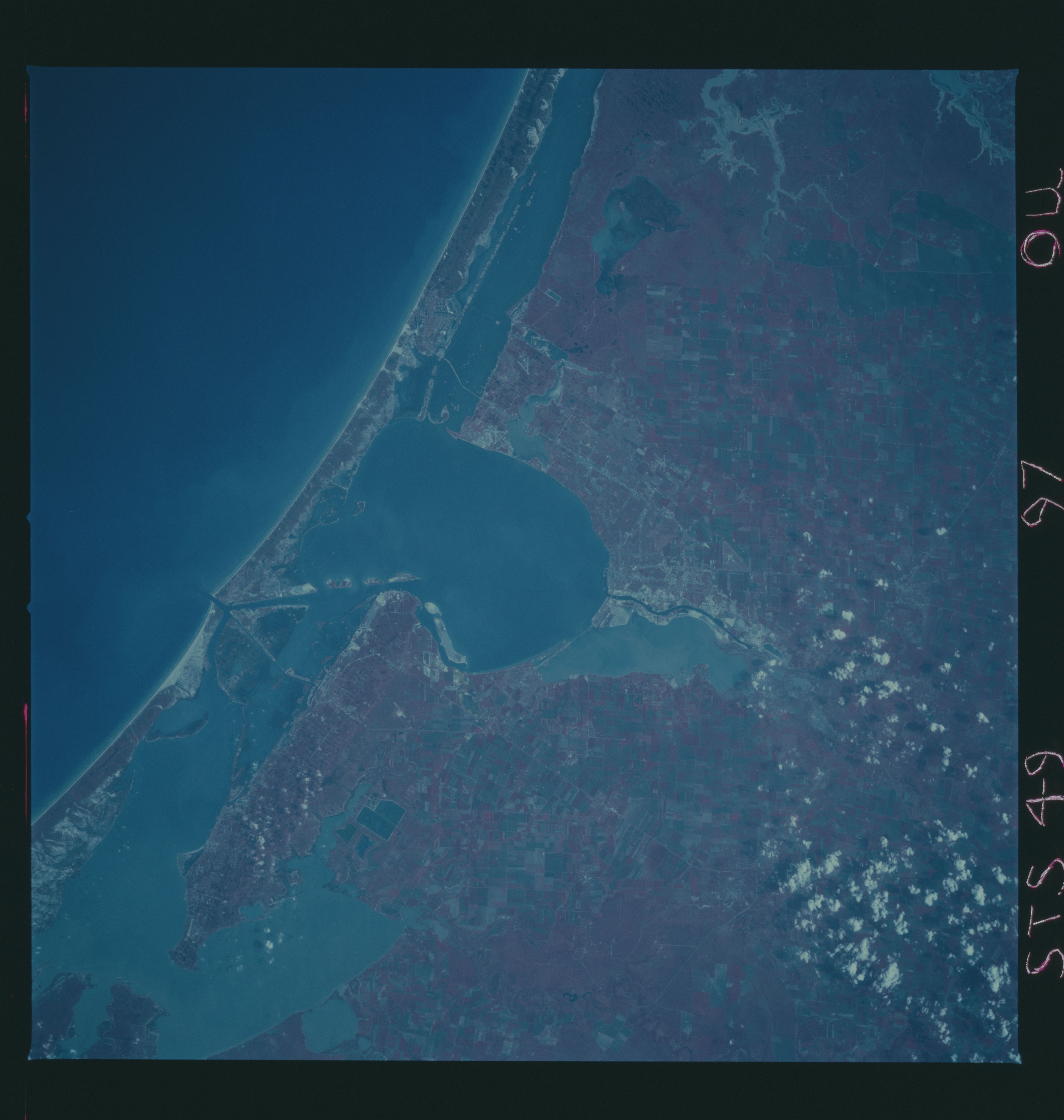
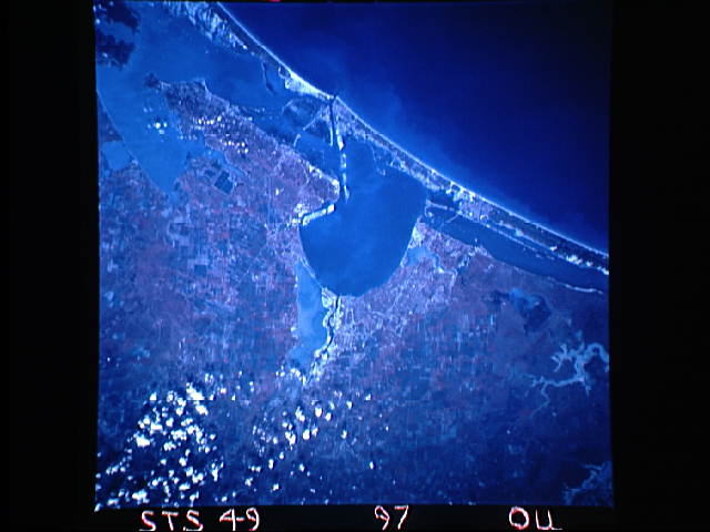
Image Caption: STS049-97-U Corpus Christi, Texas, U.S.A. May 1992
This color infrared southwest-looking, low-oblique photograph emphasizes the blue waters of Corpus Christi Bay and the city of Corpus Christi southwest of the bay. Corpus Christi, with a population of 235 000, is a major petroleum and natural gas center and a port of entry. Major industries include oil refineries, chemicals, cement, aluminum, refined zinc, smelting plants, food processing, and fishing. Tourist and recreational resorts have become a major business on North Padre Island east of the city on the Gulf of Mexico. West of the city, the Nueces River enters Nueces Bay, which, in turn, enters into Corpus Christi Bay. Southeast of the city the runways of the U.S. Naval Air Training Center are seen. West-east Interstate Highway 37 traverses Corpus Christi, crossing Laguna Madre, and terminating on North Padre Island. North-northeast of Corpus Christi Bay are Aransas and Copana Bays. Corpus Christi is subject to occasional hurricanes from the Gulf of Mexico. The last major storm to strike Corpus Christi was Hurricane Celia in 1970. (Refer to STS-026-044-038 for a natural color photograph of the Corpus Christi area.)
This color infrared southwest-looking, low-oblique photograph emphasizes the blue waters of Corpus Christi Bay and the city of Corpus Christi southwest of the bay. Corpus Christi, with a population of 235 000, is a major petroleum and natural gas center and a port of entry. Major industries include oil refineries, chemicals, cement, aluminum, refined zinc, smelting plants, food processing, and fishing. Tourist and recreational resorts have become a major business on North Padre Island east of the city on the Gulf of Mexico. West of the city, the Nueces River enters Nueces Bay, which, in turn, enters into Corpus Christi Bay. Southeast of the city the runways of the U.S. Naval Air Training Center are seen. West-east Interstate Highway 37 traverses Corpus Christi, crossing Laguna Madre, and terminating on North Padre Island. North-northeast of Corpus Christi Bay are Aransas and Copana Bays. Corpus Christi is subject to occasional hurricanes from the Gulf of Mexico. The last major storm to strike Corpus Christi was Hurricane Celia in 1970. (Refer to STS-026-044-038 for a natural color photograph of the Corpus Christi area.)
