STS049-93-79
| NASA Photo ID | STS049-93-79 |
| Focal Length | 100mm |
| Date taken | 1992.05.09 |
| Time taken | 05:17:53 GMT |
Cloud masks available for this image:
Spacecraft nadir point: 24.2° S, 41.6° E
Photo center point: 21.5° S, 45.5° E
Photo center point by machine learning:
Photo center point: 21.5° S, 45.5° E
Photo center point by machine learning:
Nadir to Photo Center: Northeast
Spacecraft Altitude: 183 nautical miles (339km)
Country or Geographic Name: | MADAGASCAR |
Features: | RIVERS IN SUNGLINT, COAST |
| Features Found Using Machine Learning: | |
Cloud Cover Percentage: | 40 (26-50)% |
Sun Elevation Angle: | 20° |
Sun Azimuth: | 59° |
Camera: | Hasselblad |
Focal Length: | 100mm |
Camera Tilt: | High Oblique |
Format: | 5017: Kodak, natural color positive, Ektachrome, X Professional, ASA 64, standard base |
Film Exposure: | Normal |
| Additional Information | |
| Width | Height | Annotated | Cropped | Purpose | Links |
|---|---|---|---|---|---|
| 5700 pixels | 6000 pixels | No | No | Download Image | |
| 500 pixels | 526 pixels | No | No | Download Image | |
| 640 pixels | 480 pixels | No | No | Download Image |
Download Packaged File
Download a Google Earth KML for this Image
View photo footprint information
Download a GeoTIFF for this photo
Image Caption:
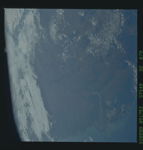
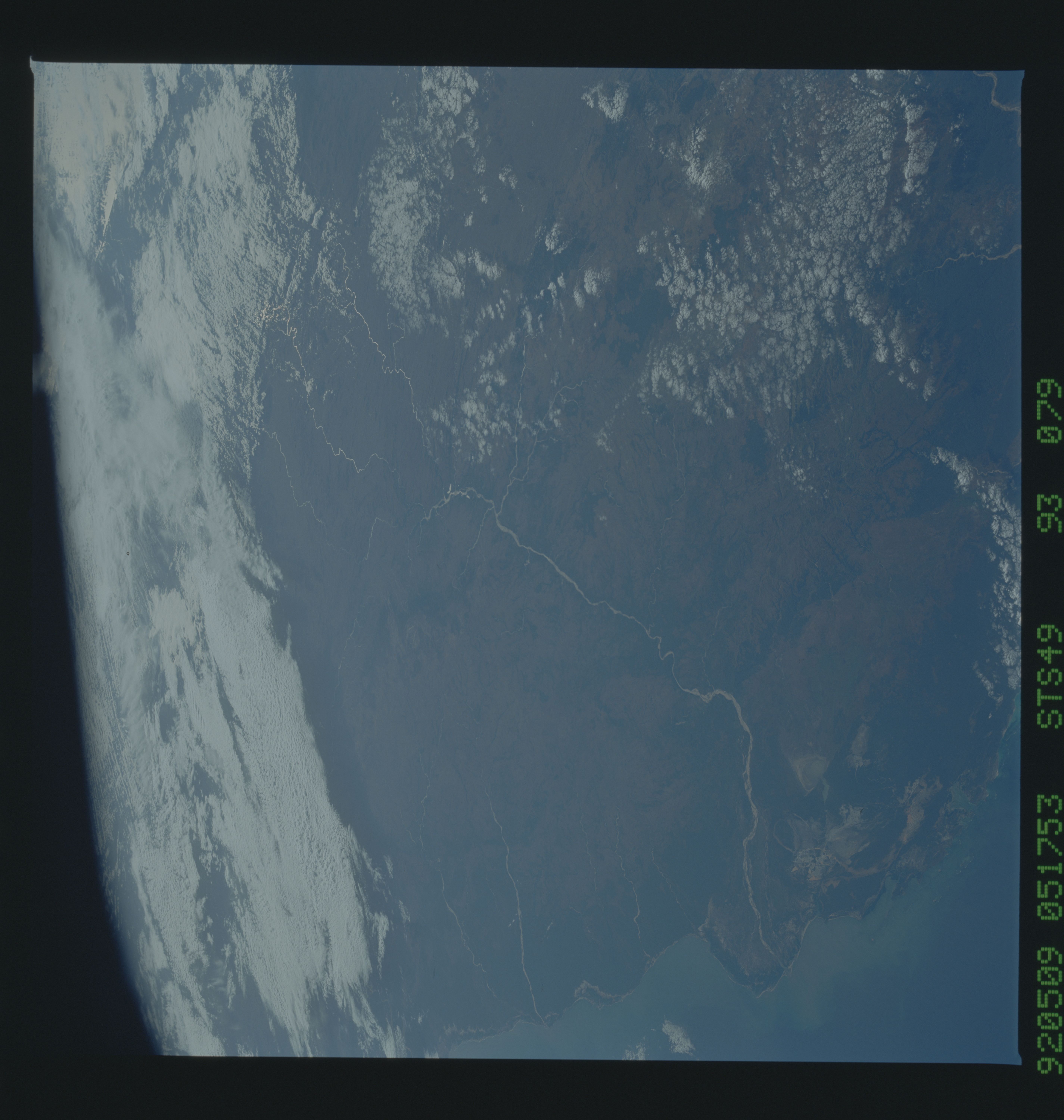
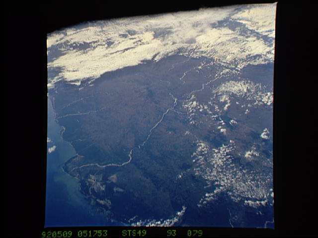
STS49-93-079: Mangoky River Delta The Mangoky River delta and
most of the rest of the Mangoky drainage can be seen etched in
sunglint in the oblique east-looking view which shows the entire
width of the island of Madagascar (the east coast of the island
can be seen at the top of the view among the clouds).
