STS049-91-20

| NASA Photo ID | STS049-91-20 |
| Focal Length | mm |
| Date taken | 1992.05.__ |
| Time taken | GMT |
Cloud masks available for this image:
Spacecraft nadir point:
Photo center point:
Photo center point by machine learning:
Photo center point:
Photo center point by machine learning:
Nadir to Photo Center:
Spacecraft Altitude: nautical miles (0km)
Country or Geographic Name: | |
Features: | NON EARTHOBS |
| Features Found Using Machine Learning: | |
Cloud Cover Percentage: | |
Sun Elevation Angle: | ° |
Sun Azimuth: | ° |
Camera: | Hasselblad |
Focal Length: | mm |
Camera Tilt: | |
Format: | 5017: Kodak, natural color positive, Ektachrome, X Professional, ASA 64, standard base |
Film Exposure: | |
| Additional Information | |
| Width | Height | Annotated | Cropped | Purpose | Links |
|---|---|---|---|---|---|
| 5700 pixels | 6000 pixels | No | No | Download Image | |
| 500 pixels | 526 pixels | No | No | Download Image | |
| 640 pixels | 480 pixels | No | No | Download Image |
Download Packaged File
Download a Google Earth KML for this Image
View photo footprint information
Download a GeoTIFF for this photo
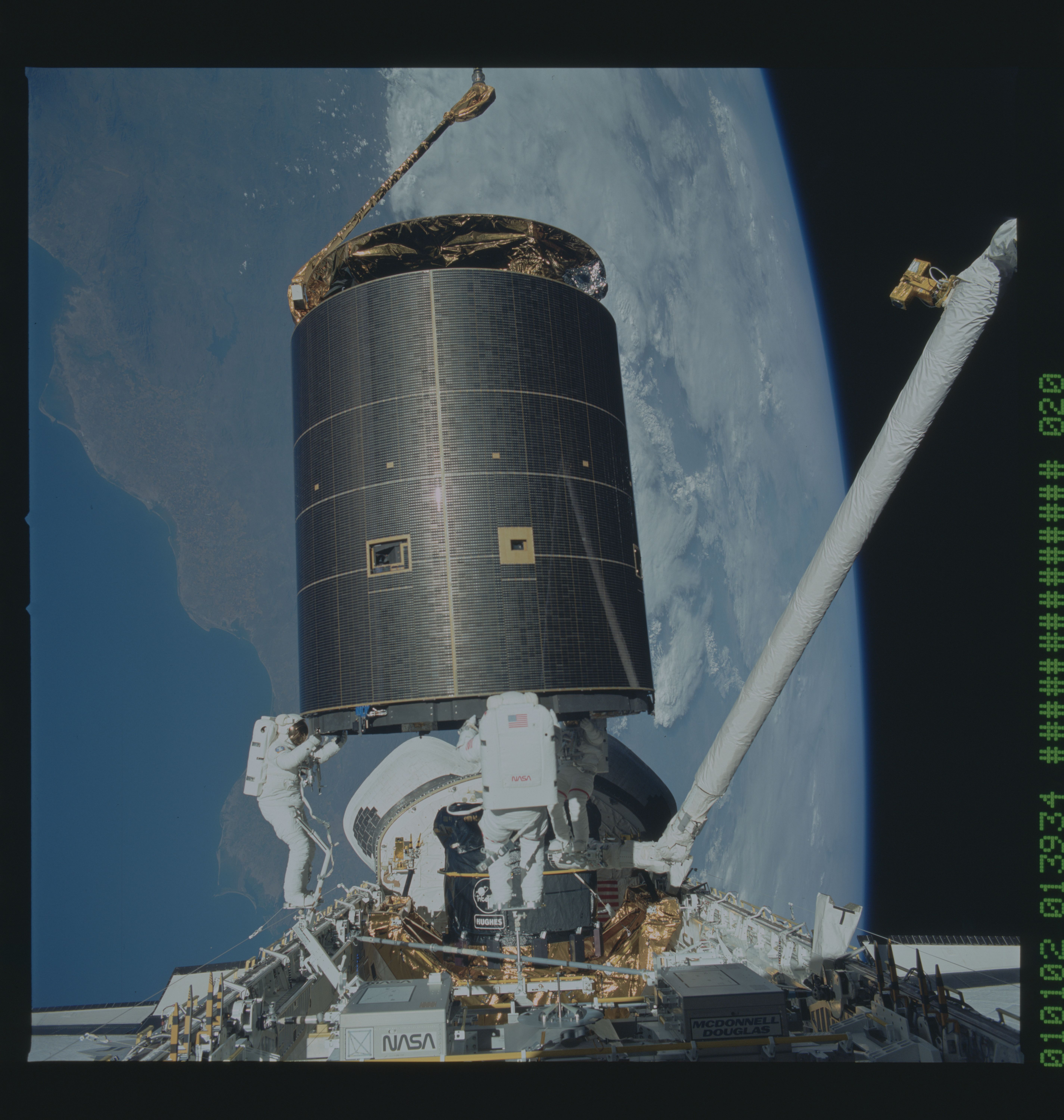
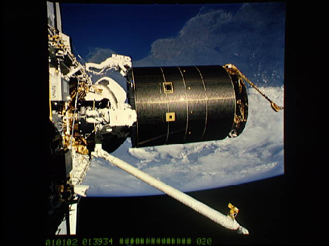
Image Caption: STS-49 crewmembers complete successful capture of the International Telecommunications Organization Satellite (INTELSAT) VI during their third extravehicular activity (EVA) into Endeavour's, Orbiter Vehicle (OV) 105's, payload bay (PLB). Left to right Mission Specialist (MS) Richard J. Hieb, MS Thomas D. Akers, and MS Pierre J. Thuot, positioned on the remote manipulator system (RMS), have handholds on the satellite and prepare to attach capture bar (tethered to Hieb). Mexico is seen on the Earth below including an area from Hermosillo, Sonara to Los Mochis in the state of Sinaloa. In the foreground is the Assembly of Station by EVA Methods (ASEM) multipurpose experiment support structure (MPESS). Behind the three astronauts is the vertical perigee stage which will be attached to the INTELSAT VI prior to its release from the PLB.
