STS049-88-66

| NASA Photo ID | STS049-88-66 |
| Focal Length | 100mm |
| Date taken | 1992.05.08 |
| Time taken | 17:31:44 GMT |
Cloud masks available for this image:
Spacecraft nadir point: 6.5° N, 69.0° W
Photo center point: 6.5° N, 68.5° W
Photo center point by machine learning:
Photo center point: 6.5° N, 68.5° W
Photo center point by machine learning:
Nadir to Photo Center: East
Spacecraft Altitude: 153 nautical miles (283km)
Country or Geographic Name: | VENEZUELA |
Features: | SWAMPS, LINEAR DRAINAGE |
| Features Found Using Machine Learning: | |
Cloud Cover Percentage: | 90 (76-100)% |
Sun Elevation Angle: | 72° |
Sun Azimuth: | 308° |
Camera: | Hasselblad |
Focal Length: | 100mm |
Camera Tilt: | 11 degrees |
Format: | 2443: Kodak Aerochrome 2443, color IR, thin base, EA-5 process thru June 1999, E-6 process afterward |
Film Exposure: | Normal |
| Additional Information | |
| Width | Height | Annotated | Cropped | Purpose | Links |
|---|---|---|---|---|---|
| 5700 pixels | 6000 pixels | No | No | Download Image | |
| 500 pixels | 526 pixels | No | No | Download Image | |
| 640 pixels | 480 pixels | No | No | Download Image |
Download Packaged File
Download a Google Earth KML for this Image
View photo footprint information
Download a GeoTIFF for this photo
Image Caption:
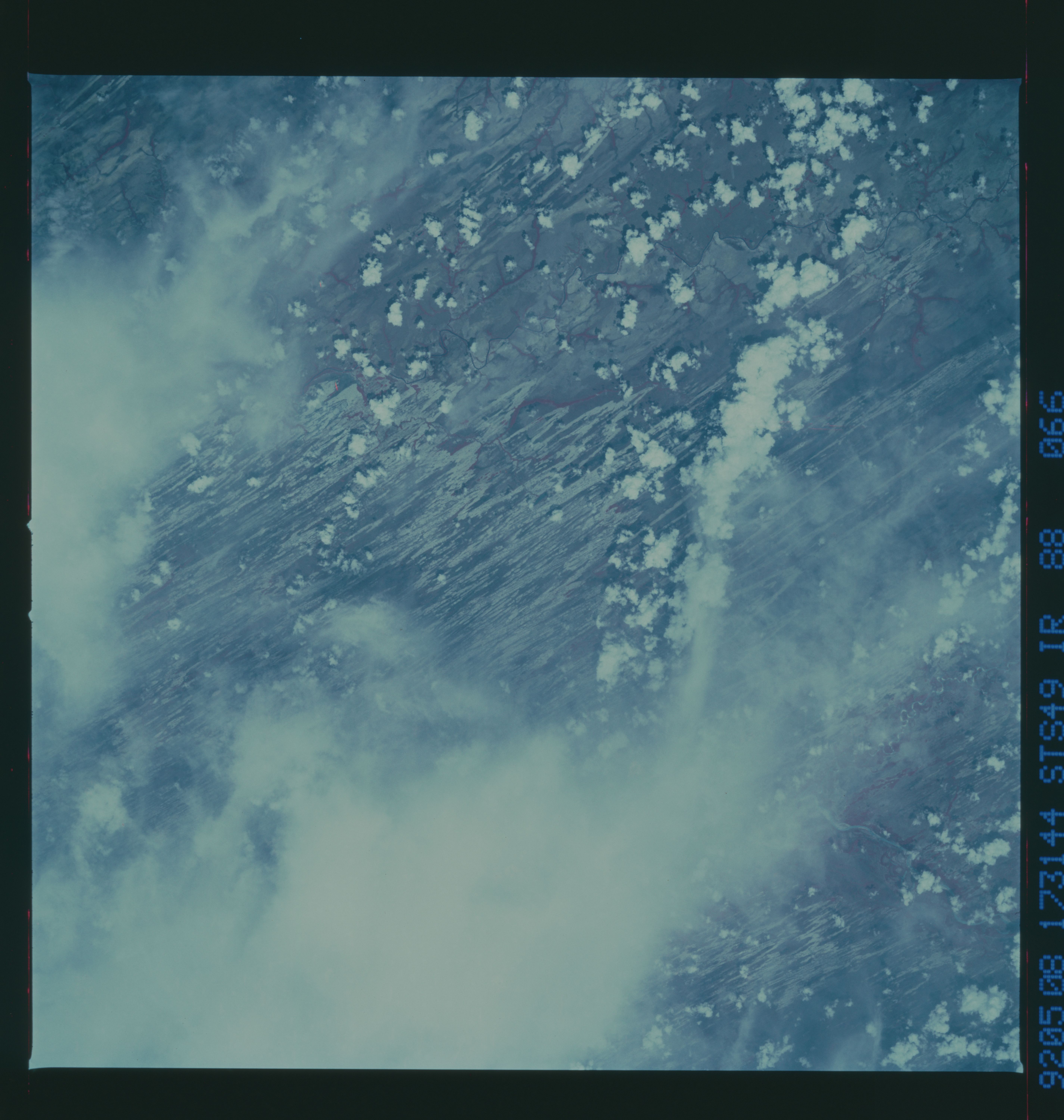
STS49-88-066: LLanos of Venzuela The dry forests of western
Venezuela grow on a soils made of numerous "hairpin" sand dunes
which spread across the llanos country during a drier period of
Earth history. This CVIR image shows the almost continuous
underlying surface of dune sand. The dunes are greater in densi-
ty downwind of the major rivers of the llanos indicating that
sand blew directly out of the dry river courses. Shuttle photog-
raphy has shown the surprising fact that sand blows out of river
beds regularly under the present wetter climate, although dunes
do not form.
