STS049-87-65
| NASA Photo ID | STS049-87-65 |
| Focal Length | 250mm |
| Date taken | 1992.05.15 |
| Time taken | 06:30:58 GMT |

Cloud masks available for this image:
Spacecraft nadir point: 18.0° N, 66.8° E
Photo center point:
Photo center point by machine learning:
Photo center point:
Photo center point by machine learning:
Nadir to Photo Center:
Spacecraft Altitude: 191 nautical miles (354km)
Country or Geographic Name: | ARABIAN SEA |
Features: | OIL SLICK |
| Features Found Using Machine Learning: | |
Cloud Cover Percentage: | 40 (26-50)% |
Sun Elevation Angle: | 76° |
Sun Azimuth: | 83° |
Camera: | Hasselblad |
Focal Length: | 250mm |
Camera Tilt: | Low Oblique |
Format: | 2443: Kodak Aerochrome 2443, color IR, thin base, EA-5 process thru June 1999, E-6 process afterward |
Film Exposure: | Normal |
| Additional Information | |
| Width | Height | Annotated | Cropped | Purpose | Links |
|---|---|---|---|---|---|
| 5700 pixels | 6000 pixels | No | No | Download Image | |
| 500 pixels | 526 pixels | No | No | Download Image | |
| 640 pixels | 480 pixels | No | No | Download Image |
Download Packaged File
Download a Google Earth KML for this Image
View photo footprint information
Download a GeoTIFF for this photo
Image Caption:
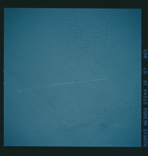
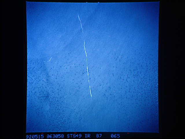
STS49-87-065: Arabian Sea: Ship Wakes and Oil Slicks The pas-
sage of a ship as it dumped its bilges of oil into the Arabian
Sea is seen as a bright line in this view of the sunglint pat-
tern. Such man-made oil slicks can serve to illustrate the rela-
tive movement of surface waters. At the bottom of the frame, the
slick shows where the ship passed a front, where sheer between
the two water masses has distorted the oil slick.
