STS049-87-35

| NASA Photo ID | STS049-87-35 |
| Focal Length | 100mm |
| Date taken | 1992.05.15 |
| Time taken | 06:25:49 GMT |
Resolutions offered for this image:
5221 x 5274 pixels 633 x 640 pixels 5700 x 6000 pixels 500 x 526 pixels 640 x 480 pixels
5221 x 5274 pixels 633 x 640 pixels 5700 x 6000 pixels 500 x 526 pixels 640 x 480 pixels
Cloud masks available for this image:
Spacecraft nadir point: 9.4° N, 49.2° E
Photo center point: 10.5° N, 51.0° E
Photo center point by machine learning:
Photo center point: 10.5° N, 51.0° E
Photo center point by machine learning:
Nadir to Photo Center: Northeast
Spacecraft Altitude: 193 nautical miles (357km)
Country or Geographic Name: | SOMALIA |
Features: | HAFUN, WATER DYNAMICS |
| Features Found Using Machine Learning: | |
Cloud Cover Percentage: | 5 (1-10)% |
Sun Elevation Angle: | 56° |
Sun Azimuth: | 70° |
Camera: | Hasselblad |
Focal Length: | 100mm |
Camera Tilt: | 33 degrees |
Format: | 2443: Kodak Aerochrome 2443, color IR, thin base, EA-5 process thru June 1999, E-6 process afterward |
Film Exposure: | Under Exposed |
| Additional Information | |
| Width | Height | Annotated | Cropped | Purpose | Links |
|---|---|---|---|---|---|
| 5221 pixels | 5274 pixels | No | No | Earth From Space collection | Download Image |
| 633 pixels | 640 pixels | No | No | Earth From Space collection | Download Image |
| 5700 pixels | 6000 pixels | No | No | Download Image | |
| 500 pixels | 526 pixels | No | No | Download Image | |
| 640 pixels | 480 pixels | No | No | Download Image |
Download Packaged File
Download a Google Earth KML for this Image
View photo footprint information
Download a GeoTIFF for this photo
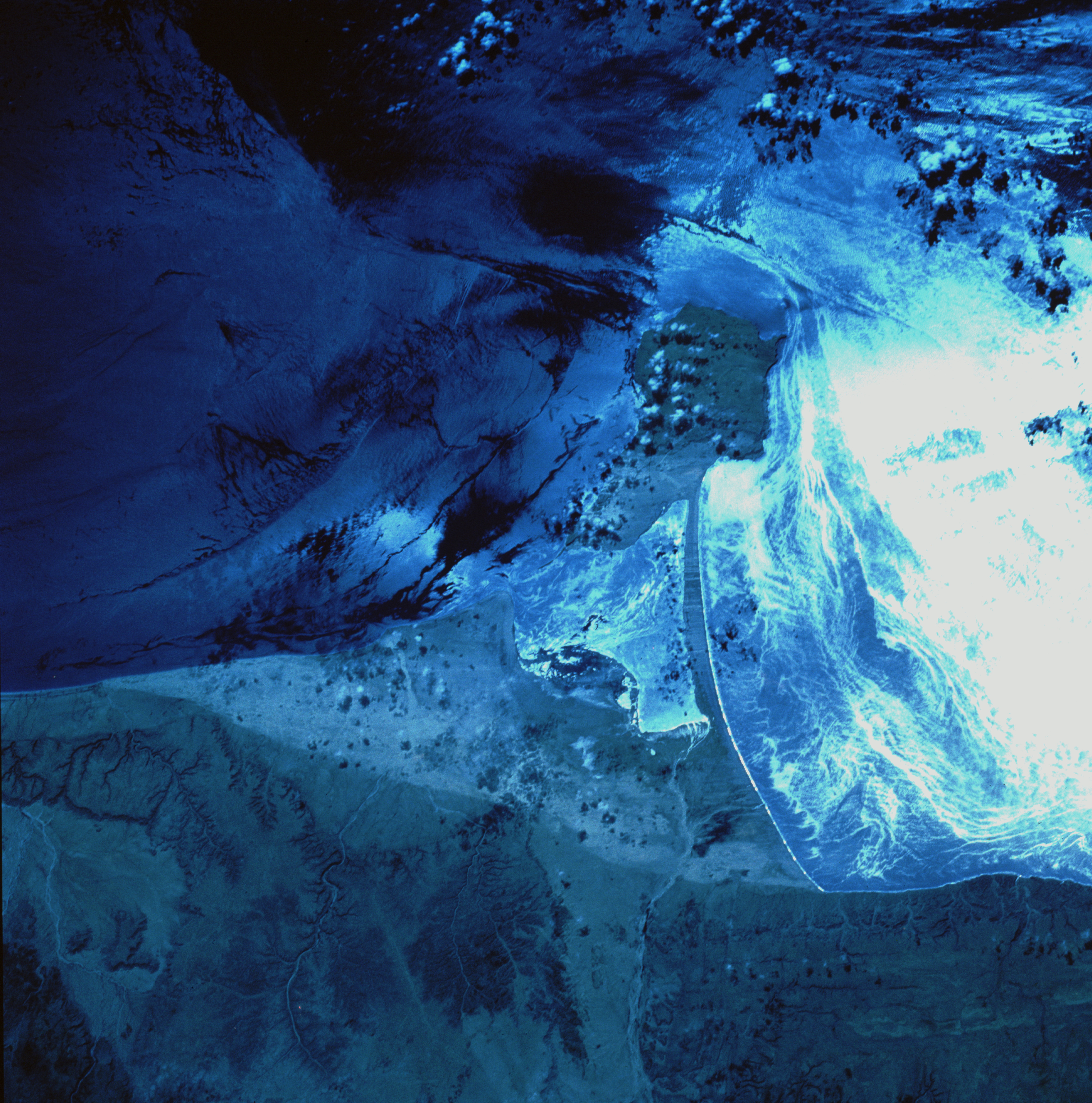
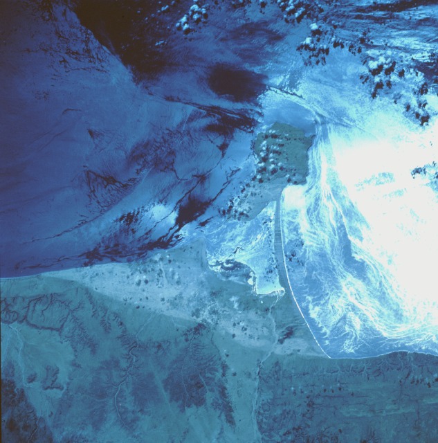
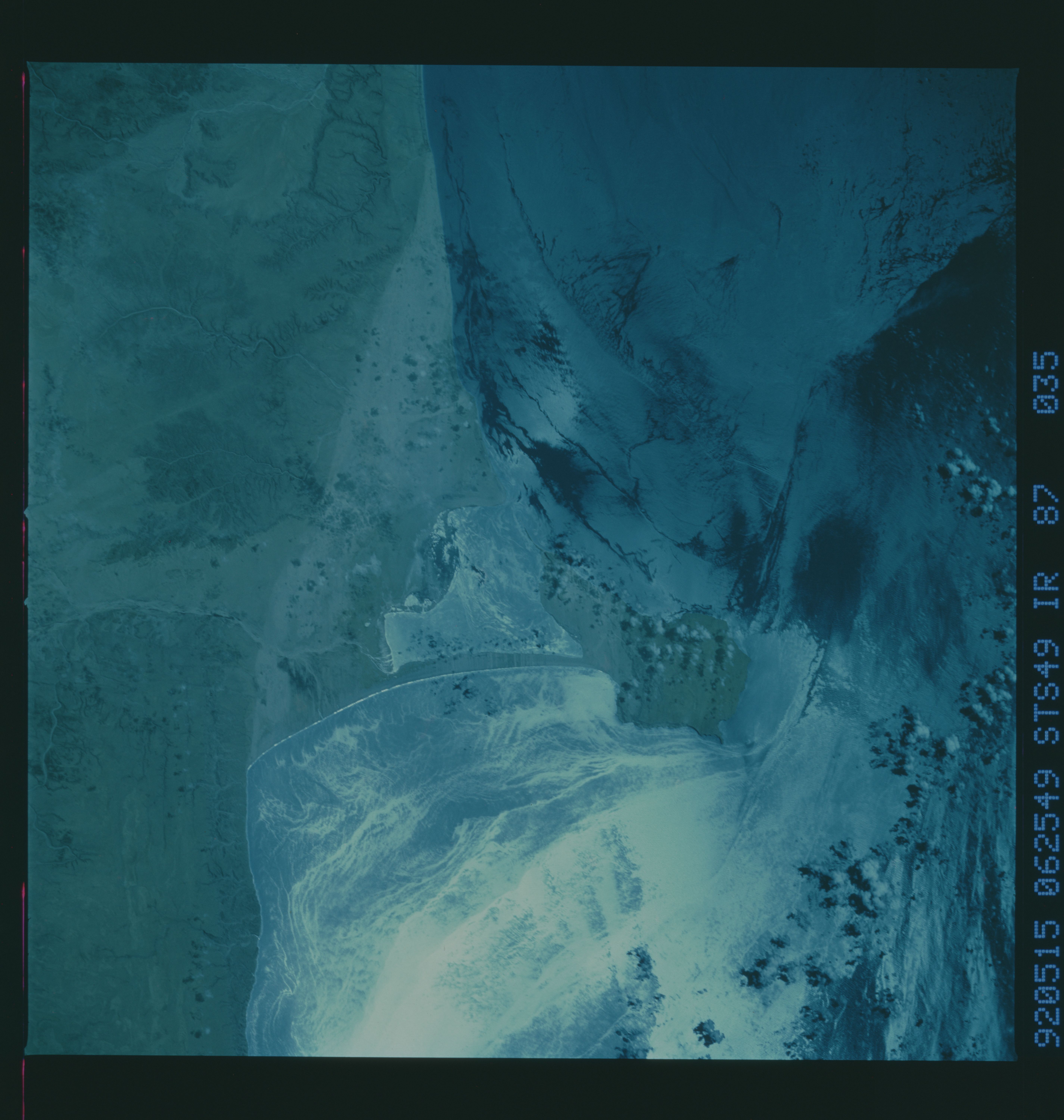
Image Caption: STS049-87-35 Hafun (Raas Xaafuun) Peninsula, Somalia May 1992
This near-vertical, color infrared photograph of the Hafun Peninsula, the eastern extremity of Africa and part of the "Horn of Africa," appears to be complex; however, upon closer inspection, the photograph becomes easier to understand. The highly reflective surface, caused by the Sun reflecting off the surface of the water in Hafun Bay South, enhances the water surface detail (surface roughness and circulation patterns). The darker, less reflective areas in Hafun Bay North provide dynamic surface water information on wave and current patterns. The Hafun Peninsula is a tombolo, a rocky island with a sandy isthmus that connect the island to the mainland. Surface water detail is apparent in the small bay that separates the rocky island from the mainland. Most of the lowland coastal shoreline is composed of sand; yet, a few low beach cliffs--less than 1000 feet (305 meters) in elevation--are observed immediately west of the sandy beach. The reason for the north-south line of color change in some of the beach sand is not known; it might be caused by an elevation change or by differences in moisture content or soil composition of the sand. This entire region is classified as desert.
This near-vertical, color infrared photograph of the Hafun Peninsula, the eastern extremity of Africa and part of the "Horn of Africa," appears to be complex; however, upon closer inspection, the photograph becomes easier to understand. The highly reflective surface, caused by the Sun reflecting off the surface of the water in Hafun Bay South, enhances the water surface detail (surface roughness and circulation patterns). The darker, less reflective areas in Hafun Bay North provide dynamic surface water information on wave and current patterns. The Hafun Peninsula is a tombolo, a rocky island with a sandy isthmus that connect the island to the mainland. Surface water detail is apparent in the small bay that separates the rocky island from the mainland. Most of the lowland coastal shoreline is composed of sand; yet, a few low beach cliffs--less than 1000 feet (305 meters) in elevation--are observed immediately west of the sandy beach. The reason for the north-south line of color change in some of the beach sand is not known; it might be caused by an elevation change or by differences in moisture content or soil composition of the sand. This entire region is classified as desert.
