STS049-87-113
| NASA Photo ID | STS049-87-113 |
| Focal Length | 100mm |
| Date taken | 1992.05.15 |
| Time taken | 06:36:03 GMT |

Cloud masks available for this image:
Spacecraft nadir point: 24.5° N, 85.9° E
Photo center point: 25.0° N, 86.5° E
Photo center point by machine learning:
Photo center point: 25.0° N, 86.5° E
Photo center point by machine learning:
Nadir to Photo Center: Northeast
Spacecraft Altitude: 189 nautical miles (350km)
Country or Geographic Name: | INDIA |
Features: | GANGES RIVER, JAMALPUR |
| Features Found Using Machine Learning: | |
Cloud Cover Percentage: | 0 (no clouds present) |
Sun Elevation Angle: | 82° |
Sun Azimuth: | 226° |
Camera: | Hasselblad |
Focal Length: | 100mm |
Camera Tilt: | 14 degrees |
Format: | 2443: Kodak Aerochrome 2443, color IR, thin base, EA-5 process thru June 1999, E-6 process afterward |
Film Exposure: | Normal |
| Additional Information | |
| Width | Height | Annotated | Cropped | Purpose | Links |
|---|---|---|---|---|---|
| 5700 pixels | 6000 pixels | No | No | Download Image | |
| 500 pixels | 526 pixels | No | No | Download Image | |
| 640 pixels | 480 pixels | No | No | Download Image |
Download Packaged File
Download a Google Earth KML for this Image
View photo footprint information
Download a GeoTIFF for this photo
Image Caption:
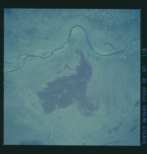
STS49-87-113: Ganges River, Northern India The Ganges River ex-
tends from west to east across the frame, with a large bend to
the north at Jamalpur, Bihar State. Canals, wide deposits of
sediment along the river, and tributaries are displayed. The
color-infrared film clearly illustrates closed-canopy woodland on
the range of hills south of the river, and scattered patches of
growing vegetation throughout the landscape. This scene is the
darkest of a bracketed triplet. Hasselblad camera, 250mm lens,
color-infrared film.
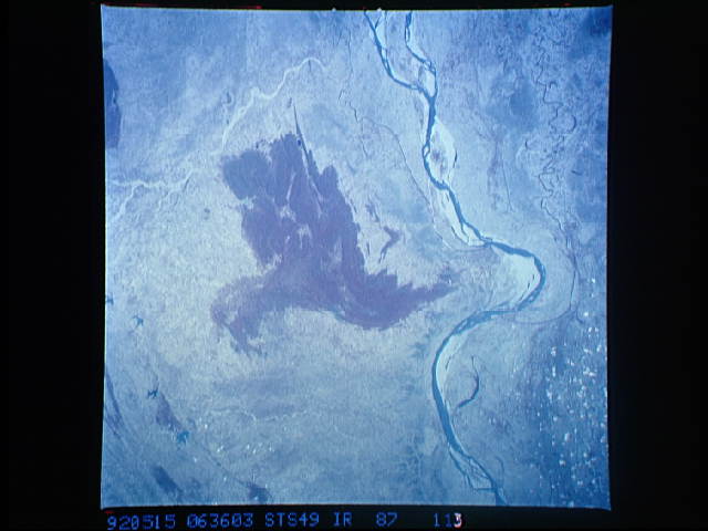
