STS049-85-6
| NASA Photo ID | STS049-85-6 |
| Focal Length | 100mm |
| Date taken | 1992.05.09 |
| Time taken | 21:53:05 GMT |
Cloud masks available for this image:
Spacecraft nadir point: 26.1° S, 137.7° E
Photo center point: 25.0° S, 139.5° E
Photo center point by machine learning:
Photo center point: 25.0° S, 139.5° E
Photo center point by machine learning:
Nadir to Photo Center: Northeast
Spacecraft Altitude: 192 nautical miles (356km)
Country or Geographic Name: | AUSTRALIA-Q |
Features: | L. MACHATTIE, L. MIPIA |
| Features Found Using Machine Learning: | |
Cloud Cover Percentage: | 25 (11-25)% |
Sun Elevation Angle: | 8° |
Sun Azimuth: | 66° |
Camera: | Hasselblad |
Focal Length: | 100mm |
Camera Tilt: | 33 degrees |
Format: | 5017: Kodak, natural color positive, Ektachrome, X Professional, ASA 64, standard base |
Film Exposure: | Over Exposed |
| Additional Information | |
| Width | Height | Annotated | Cropped | Purpose | Links |
|---|---|---|---|---|---|
| 5700 pixels | 6000 pixels | No | No | Download Image | |
| 500 pixels | 526 pixels | No | No | Download Image | |
| 640 pixels | 480 pixels | No | No | Download Image |
Download Packaged File
Download a Google Earth KML for this Image
View photo footprint information
Download a GeoTIFF for this photo
Image Caption:
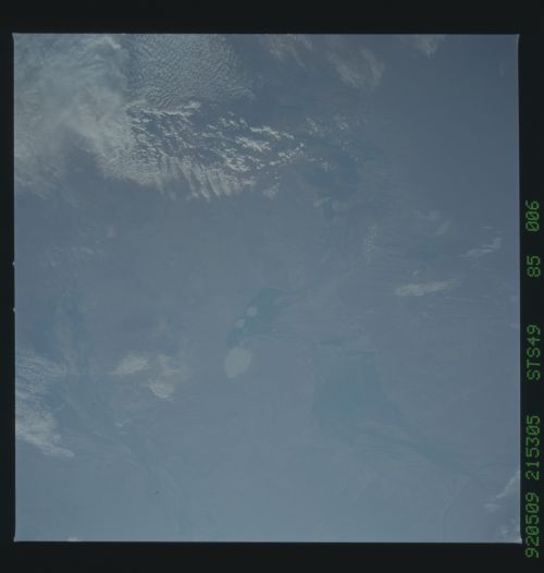
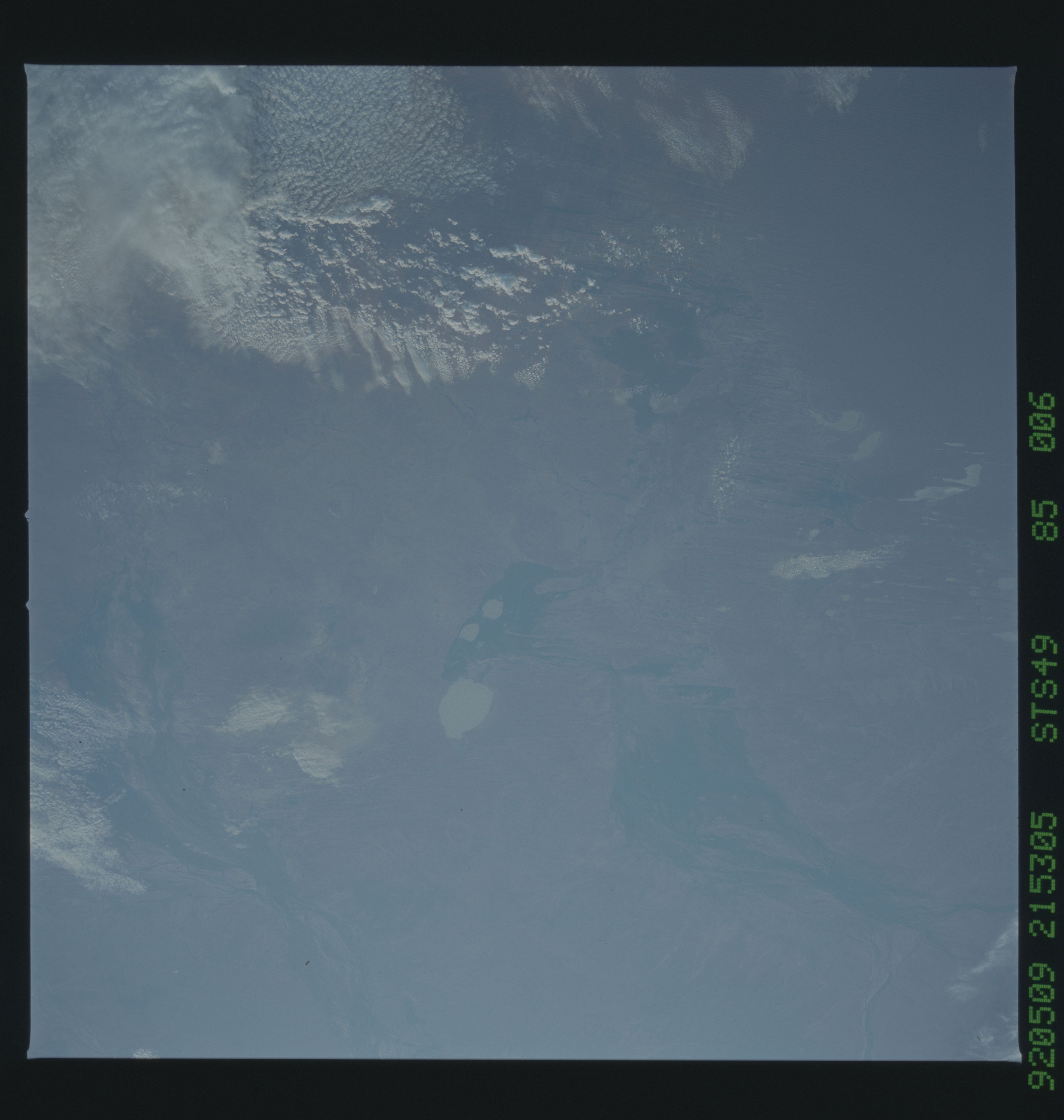
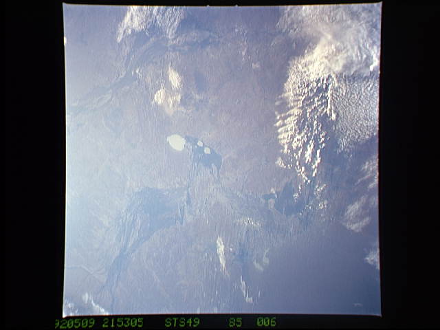
STS49-85-006, paired with STS49-85-009: Channel Country, Western
Queensland, Australia This dramatic view of central Australia
shows the southflowing Georgina River drainage- -Lake Machattie,
the prominent water body, and other lakes show that it has rained
in this desert region in the immediate past. The neighboring
drainage is that of the Diamantina River.
