STS049-82-7
| NASA Photo ID | STS049-82-7 |
| Focal Length | 100mm |
| Date taken | 1992.05.10 |
| Time taken | 01:05:25 GMT |
Cloud masks available for this image:
Spacecraft nadir point: 13.9° S, 127.1° E
Photo center point: 15.0° S, 129.0° E
Photo center point by machine learning:
Photo center point: 15.0° S, 129.0° E
Photo center point by machine learning:
Nadir to Photo Center: Southeast
Spacecraft Altitude: 191 nautical miles (354km)
Country or Geographic Name: | AUSTRALIA-NT |
Features: | TURTLE PT., SEDIMENT |
| Features Found Using Machine Learning: | |
Cloud Cover Percentage: | 0 (no clouds present) |
Sun Elevation Angle: | 50° |
Sun Azimuth: | 45° |
Camera: | Hasselblad |
Focal Length: | 100mm |
Camera Tilt: | 35 degrees |
Format: | 5017: Kodak, natural color positive, Ektachrome, X Professional, ASA 64, standard base |
Film Exposure: | Normal |
| Additional Information | |
| Width | Height | Annotated | Cropped | Purpose | Links |
|---|---|---|---|---|---|
| 5700 pixels | 6000 pixels | No | No | Download Image | |
| 500 pixels | 526 pixels | No | No | Download Image | |
| 640 pixels | 480 pixels | No | No | Download Image |
Download Packaged File
Download a Google Earth KML for this Image
View photo footprint information
Download a GeoTIFF for this photo
Image Caption:
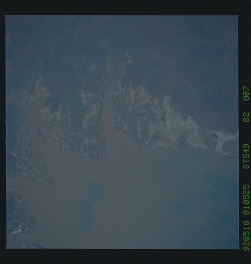
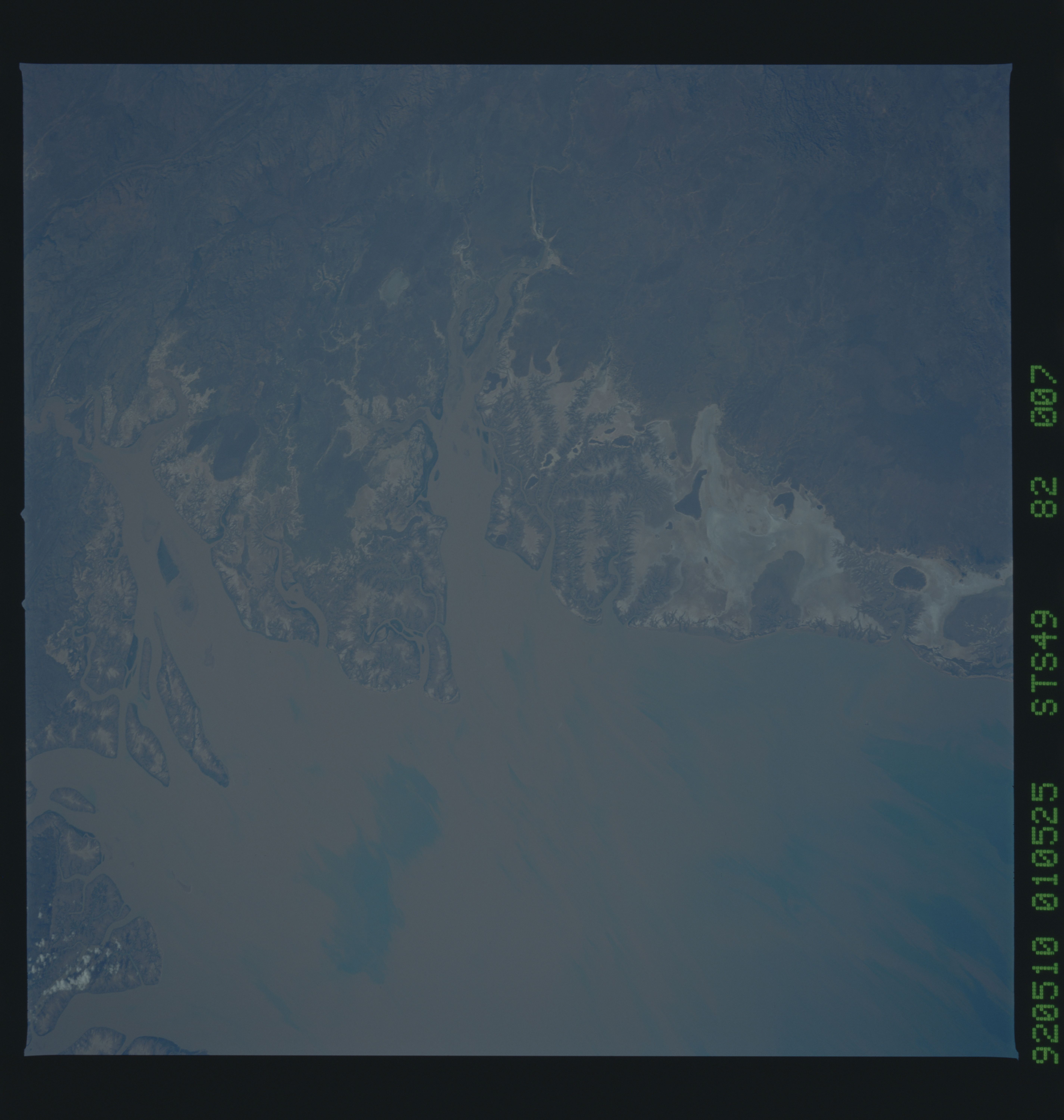
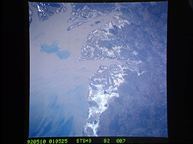
STS49-82-007: Tidal Delta, Coast of Northern Australia An intri-
cate pattern of tidal creeks and gullies is outlined at low tide
along the southeastern coast of Joseph Bonaparte Gulf (border of
Western Australia and Northern Territories; 15S, 129E). The muddy
water of the estuary illustrates sediment brought down from Vic-
toria and Fitzmaurice Rivers, some of which is deposited on the
tidal flats at high tide. Hasselblad camera, 250mm lens, color
film.
