STS049-79-27
| NASA Photo ID | STS049-79-27 |
| Focal Length | 250mm |
| Date taken | 1992.05.11 |
| Time taken | 04:49:30 GMT |
Resolutions offered for this image:
5700 x 6000 pixels 500 x 526 pixels 640 x 480 pixels 2269 x 2184 pixels
5700 x 6000 pixels 500 x 526 pixels 640 x 480 pixels 2269 x 2184 pixels
Cloud masks available for this image:
Spacecraft nadir point: 15.6° N, 120.2° E
Photo center point: 15.0° N, 120.5° E
Photo center point by machine learning:
Photo center point: 15.0° N, 120.5° E
Photo center point by machine learning:
Nadir to Photo Center: South
Spacecraft Altitude: 198 nautical miles (367km)
Country or Geographic Name: | PHILIPPINES |
Features: | MT PINATUBO |
| Features Found Using Machine Learning: | |
Cloud Cover Percentage: | 10 (1-10)% |
Sun Elevation Angle: | 77° |
Sun Azimuth: | 281° |
Camera: | Hasselblad |
Focal Length: | 250mm |
Camera Tilt: | 11 degrees |
Format: | 5017: Kodak, natural color positive, Ektachrome, X Professional, ASA 64, standard base |
Film Exposure: | Normal |
| Additional Information | |
| Width | Height | Annotated | Cropped | Purpose | Links |
|---|---|---|---|---|---|
| 5700 pixels | 6000 pixels | No | No | Download Image | |
| 500 pixels | 526 pixels | No | No | Download Image | |
| 640 pixels | 480 pixels | No | No | Download Image | |
| 2269 pixels | 2184 pixels | Download Image |
Download Packaged File
Download a Google Earth KML for this Image
View photo footprint information
Download a GeoTIFF for this photo
Image Caption:
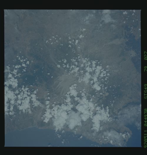
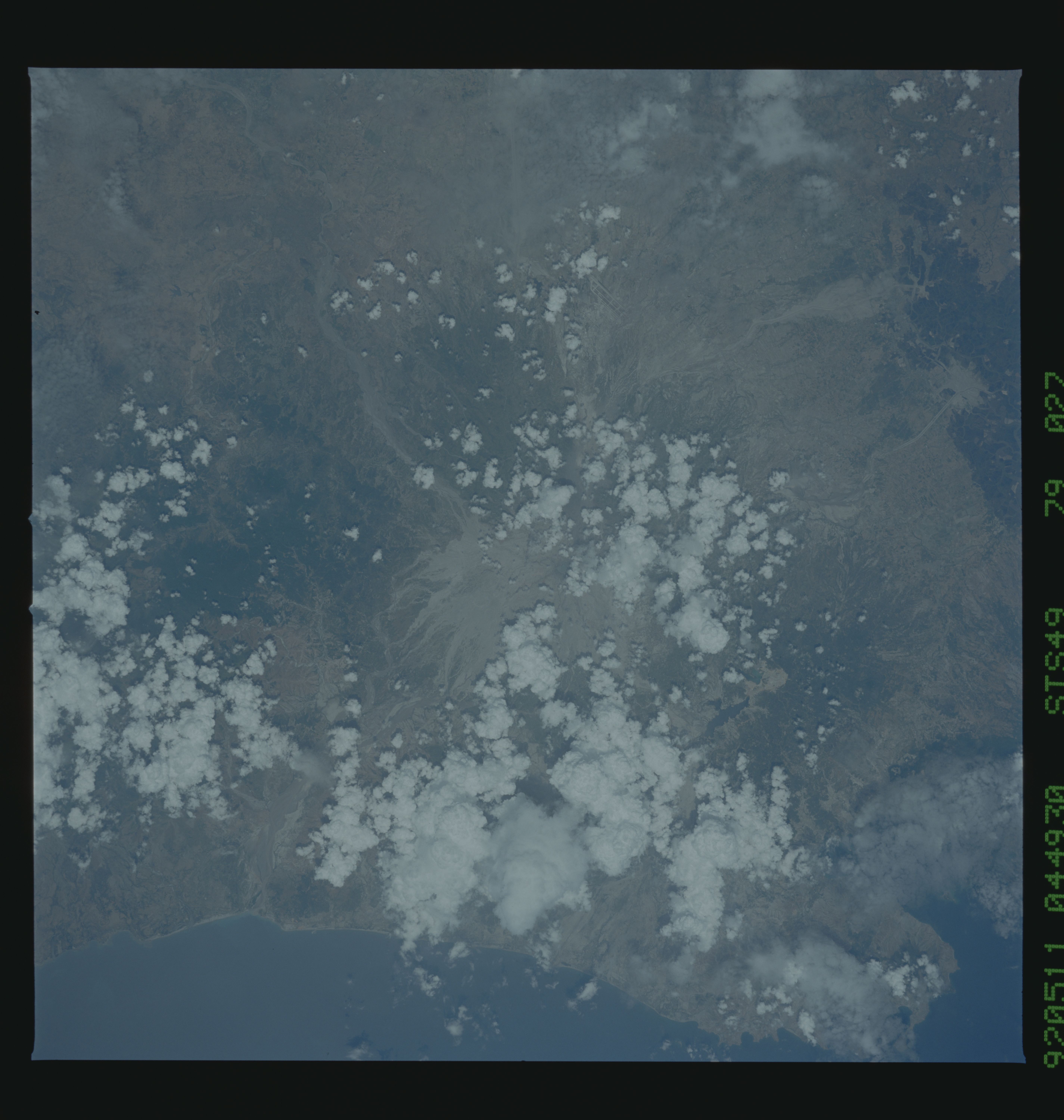
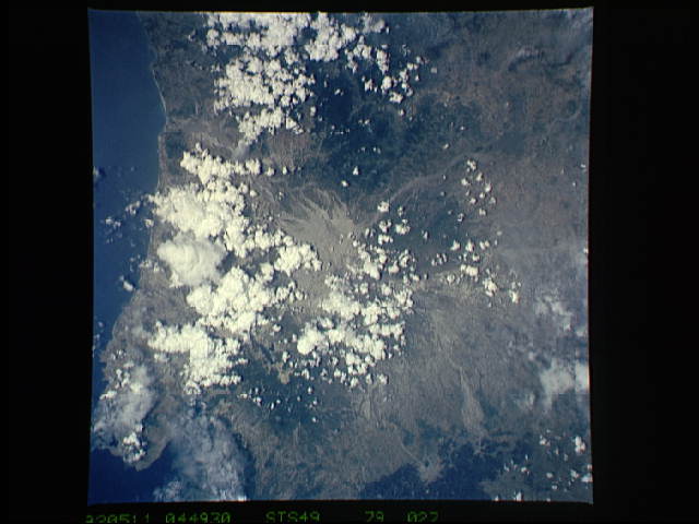
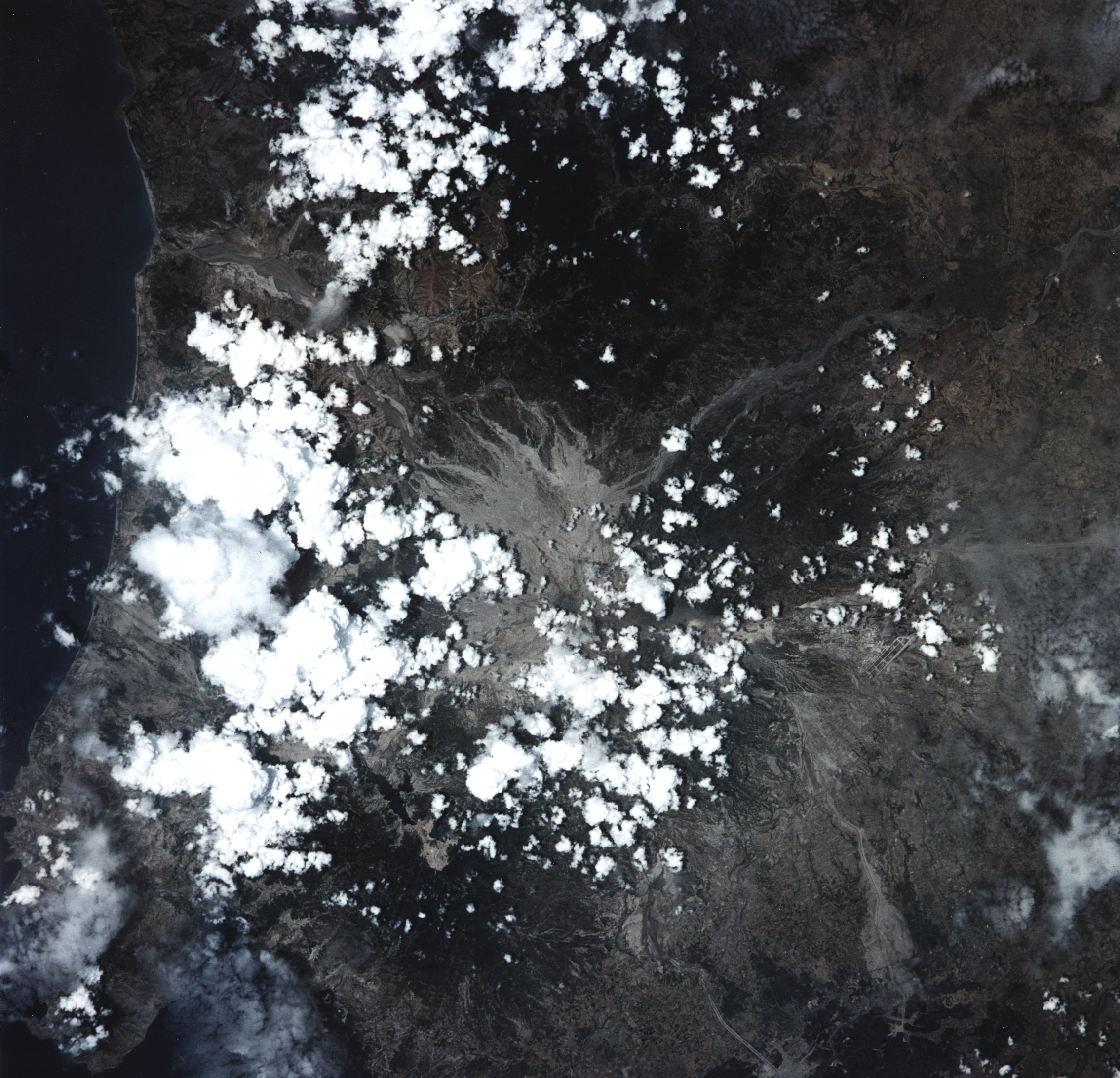
STS049-79-027 - Mount Pinatubo, Luzon, Philippine Islands
Mount Pinatubo, north of Manila, erupted violently in June 1991.
[Are you a prophet? This did say, RJune 1992.S IUm not much of
a historian. Was it 1990?] This is the first fairly [IUd put the
cloud cover at 30%. That doesnUt justify Rnearly.S] cloud-free
Shuttle photograph since the eruption. The summit area and the
extensive ash and mudflows that spread from the volcano are well
shown. Runways of Clark Air Force Base, abandoned in August
1991, [Same question.] can be seen clearly east of the volcano.
Hasselblad camera, 250-mm lens, color film.
Mt. Pinatubo on the island of Luzon (15.0N, 120.5E) erupted catastrophically in June 1991 after over 600 years of inactivity. Even in this cloudy view, the full extent of the eruption is obvious. Thick layers of ash completely surrounds the crater and the effect of mudflows in this previously heavily forested and agricultural region can be traced as ribbons flowing downhill. Clark AFB, once the crossroads of the SW Pacific can only partially be seen.
