STS049-71-42
| NASA Photo ID | STS049-71-42 |
| Focal Length | 250mm |
| Date taken | 1992.05.08 |
| Time taken | 05:29:09 GMT |
Resolutions offered for this image:
5700 x 6000 pixels 500 x 526 pixels 640 x 480 pixels 1236 x 621 pixels 640 x 1274 pixels
5700 x 6000 pixels 500 x 526 pixels 640 x 480 pixels 1236 x 621 pixels 640 x 1274 pixels
Cloud masks available for this image:
Spacecraft nadir point: 8.9° N, 120.6° E
Photo center point: 9.0° N, 120.0° E
Photo center point by machine learning:
Photo center point: 9.0° N, 120.0° E
Photo center point by machine learning:
Nadir to Photo Center: West
Spacecraft Altitude: 151 nautical miles (280km)
Country or Geographic Name: | SULU SEA |
Features: | TUBBATAHA REEFS, SGLINT |
| Features Found Using Machine Learning: | |
Cloud Cover Percentage: | 20 (11-25)% |
Sun Elevation Angle: | ° |
Sun Azimuth: | ° |
Camera: | Hasselblad |
Focal Length: | 250mm |
Camera Tilt: | 14 degrees |
Format: | 5017: Kodak, natural color positive, Ektachrome, X Professional, ASA 64, standard base |
Film Exposure: | Normal |
| Additional Information | |
| Width | Height | Annotated | Cropped | Purpose | Links |
|---|---|---|---|---|---|
| 5700 pixels | 6000 pixels | No | No | Download Image | |
| 500 pixels | 526 pixels | No | No | Download Image | |
| 640 pixels | 480 pixels | No | No | Download Image | |
| 1236 pixels | 621 pixels | ReefBase pilot | Download Image | ||
| 640 pixels | 1274 pixels | Download Image |
Download Packaged File
Download a Google Earth KML for this Image
View photo footprint information
Download a GeoTIFF for this photo
Image Caption:
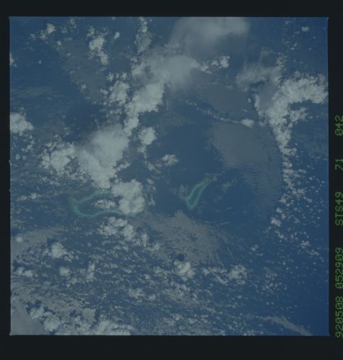
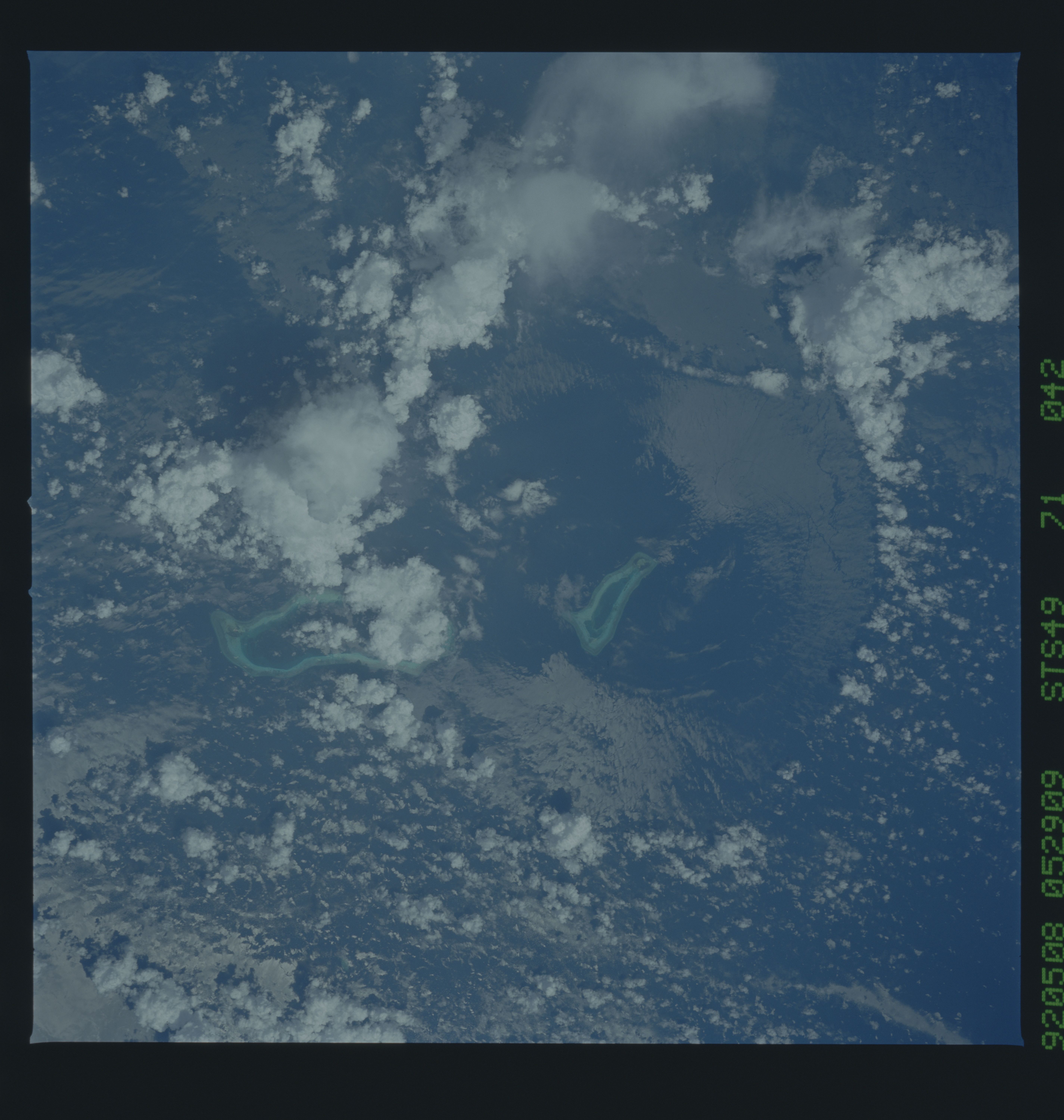
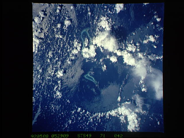
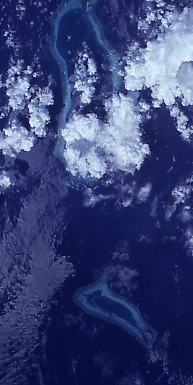
STS49-71-042: Collapsed Thunderstorm, Southwestern Pacific Ocean
The clouds were pushed from this circular area of the oceanUs
surface by relatively cool air that spread downward and outward
from a dying thunderstorm. Around the edges of the downdrafted
air, new, though smaller, storms are developing. Sunglint
highlights the radial pattern of sea-surface roughness associated
with the downdraft. This event was photographed May 8, 1992,
between Borneo and the Philippine island of Mindoro. Two coral
atolls can be seen near the center of the photograph. Hasselblad
camera, 250-mm lens, color film.
STS49-71-043, cf. STS49-71-042: Frame 043 was taken 15 seconds
later than frame 042, after about 60 nautical miles of travel by
the Orbiter. The circular thunderstorm downdraft is no longer
within the sunglint pattern and is not highlighted so dramatical-
ly. Furthermore, the increased distance from the subject has re-
duced scale and increased atmospheric haze, producing a much less
striking image. Hasselblad camera, 250mm lens, color film.
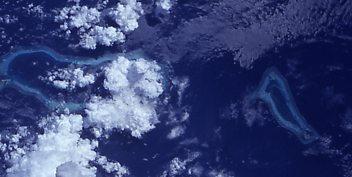
STS49-71-042: Tubbataha Reef, Sulu Sea An area of down-rushing
air is seen roughening the water surface in a circular pattern in
the Sulu Sea. In the center of the circular pattern is Tubbataha
Reef. Wind streaks appear to spread radially out from the center
of the circular area. A ring of low-level clouds forms at the
periphery of the circular area as the spreading air is forced
back upwards by the surrounding air.
This collapsed thunderstorm was observed over the open ocean (9.0N, 120.0E) between the Philippine island of Mindoro and Borneo, Malaysia. The cleared area in the center is the result of the clouds being driven from there by the sudden rush of katabatic air spreading downward and outward from the dying thunderstorm. Around the edges of the downdrafted air, new though smaller storms are developing. The two small coral atolls are the Tubbataha Reefs.
STS49-71-042: Collapsed Thunderstorm, Southwestern Pacific Ocean
The clouds were pushed from this circular area of the oceanUs
surface by relatively cool air that spread downward and outward
from a dying thunderstorm. Around the edges of the downdrafted
air, new, though smaller, storms are developing. Sunglint
highlights the radial pattern of sea-surface roughness associated
with the downdraft. This event was photographed May 8, 1992,
between Borneo and the Philippine island of Mindoro. Two coral
atolls can be seen near the center of the photograph. Hasselblad
camera, 250-mm lens, color film.
STS49-71-043, cf. STS49-71-042: Frame 043 was taken 15 seconds
later than frame 042, after about 60 nautical miles of travel by
the Orbiter. The circular thunderstorm downdraft is no longer
within the sunglint pattern and is not highlighted so dramatical-
ly. Furthermore, the increased distance from the subject has re-
duced scale and increased atmospheric haze, producing a much less
striking image. Hasselblad camera, 250mm lens, color film.
STS49-71-042: Tubbataha Reef, Sulu Sea An area of down-rushing
air is seen roughening the water surface in a circular pattern in
the Sulu Sea. In the center of the circular pattern is Tubbataha
Reef. Wind streaks appear to spread radially out from the center
of the circular area. A ring of low-level clouds forms at the
periphery of the circular area as the spreading air is forced
back upwards by the surrounding air.
This collapsed thunderstorm was observed over the open ocean (9.0N, 120.0E) between the Philippine island of Mindoro and Borneo, Malaysia. The cleared area in the center is the result of the clouds being driven from there by the sudden rush of katabatic air spreading downward and outward from the dying thunderstorm. Around the edges of the downdrafted air, new though smaller storms are developing. The two small coral atolls are the Tubbataha Reefs.
