STS049-151-223
| NASA Photo ID | STS049-151-223 |
| Focal Length | 250mm |
| Date taken | 1992.05.__ |
| Time taken | GMT |
Resolutions offered for this image:
640 x 480 pixels
640 x 480 pixels
Cloud masks available for this image:
Spacecraft nadir point:
Photo center point: 15.0° N, 120.5° E
Photo center point by machine learning:
Photo center point: 15.0° N, 120.5° E
Photo center point by machine learning:
Nadir to Photo Center:
Spacecraft Altitude: nautical miles (0km)
Country or Geographic Name: | PHILIPPINES |
Features: | PINATUBO VOLCANO AREA |
| Features Found Using Machine Learning: | |
Cloud Cover Percentage: | 50 (26-50)% |
Sun Elevation Angle: | ° |
Sun Azimuth: | ° |
Camera: | Linhof |
Focal Length: | 250mm |
Camera Tilt: | Low Oblique |
Format: | QX868: Kodak, natural color positive, Ektachrome QX868(5017 emulsion), ASA 64, thin base |
Film Exposure: | Normal |
| Additional Information | |
| Width | Height | Annotated | Cropped | Purpose | Links |
|---|---|---|---|---|---|
| 640 pixels | 480 pixels | No | No | ISD 1 | Download Image |
Download Packaged File
Download a Google Earth KML for this Image
View photo footprint information
Download a GeoTIFF for this photo
Image Caption:
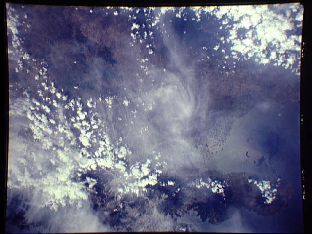
STS49-151-223: Mount Pinatubo, Philippine Islands The region
from northern Manila Bay to well north of Mount Pinatubo peeks
through wispy clouds and cumulus. Sunglint highlights canals and
ditches on the north side of the bay. Mount Pinatubo, marked by
the octopus shape of mud and ash flows, is seen as the northern-
most of a chain of four large volcanoes. Compare to STS49-79-027
(70mm color) and STS49-96-065, 066, and 067 (color infrared).
Linhof camera, 250mm lens, color film.
