STS049-100-68
| NASA Photo ID | STS049-100-68 |
| Focal Length | 50mm |
| Date taken | 1992.05.16 |
| Time taken | 16:08:55 GMT |
Cloud masks available for this image:
Spacecraft nadir point: 26.3° N, 59.6° W
Photo center point:
Photo center point by machine learning:
Photo center point:
Photo center point by machine learning:
Nadir to Photo Center:
Spacecraft Altitude: 191 nautical miles (354km)
Country or Geographic Name: | ATLANTIC OCEAN |
Features: | CYCLONIC CIRCULATION |
| Features Found Using Machine Learning: | |
Cloud Cover Percentage: | 60 (51-75)% |
Sun Elevation Angle: | 83° |
Sun Azimuth: | 201° |
Camera: | Hasselblad |
Focal Length: | 50mm |
Camera Tilt: | High Oblique |
Format: | 5017: Kodak, natural color positive, Ektachrome, X Professional, ASA 64, standard base |
Film Exposure: | Normal |
| Additional Information | |
| Width | Height | Annotated | Cropped | Purpose | Links |
|---|---|---|---|---|---|
| 5700 pixels | 6000 pixels | No | No | Download Image | |
| 500 pixels | 526 pixels | No | No | Download Image | |
| 640 pixels | 480 pixels | No | No | Download Image |
Download Packaged File
Download a Google Earth KML for this Image
View photo footprint information
Download a GeoTIFF for this photo
Image Caption:
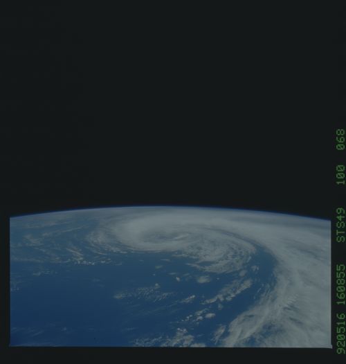
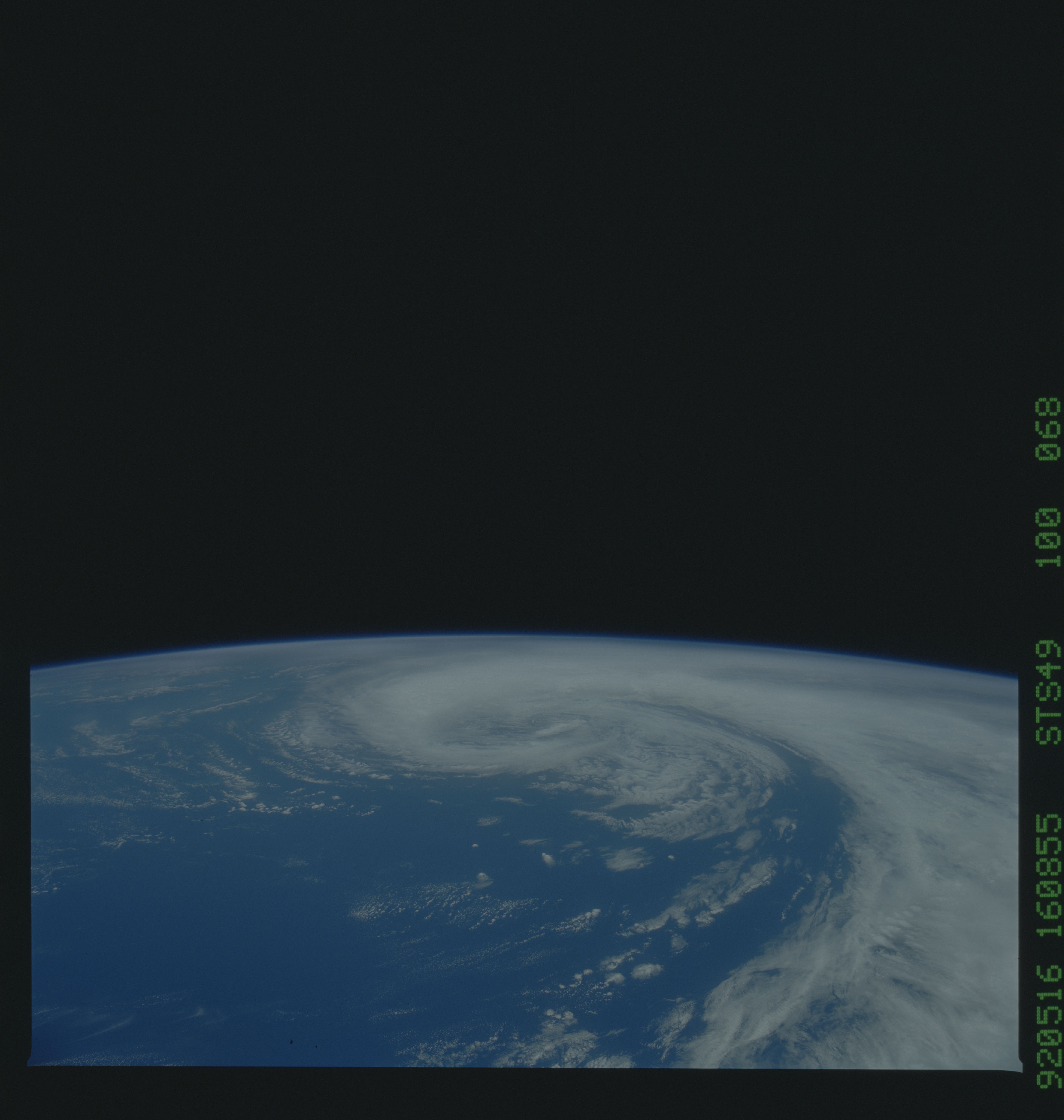
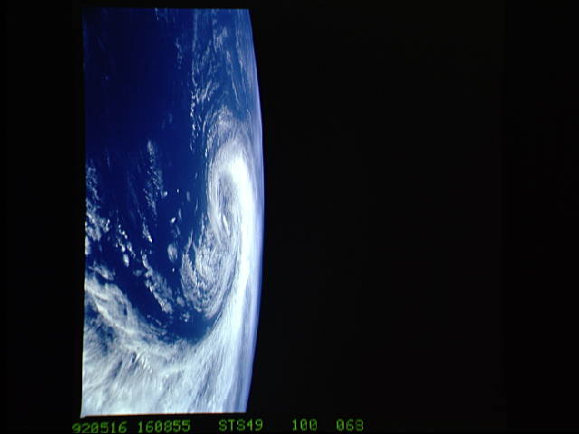
STS049-100-068 - Atlantic Cloud Swirl, near Bermuda
A strong extra-tropical (mid-latitude) low-pressure system is
moving slowly eastward (away from the viewer). This system
formed over the Gulf Stream near Cape Hatteras and developed ra-
pidly into the occluded (cold core) spiral. Winds within these
systems gust to 50 knots and produce swells 15-20 feet
high,creating dangerous sailing conditions during the fall,
winter, and spring. When the photo was taken, the Space Shuttle
was located at 26.4! N, 59.8! W; the center point of the scene is
about 32! N, 59! W.
This unnamed tropical storm near Bermuda (26.5N, 59.5W) was the result of a strong mid-latitude low pressure system that formed over the Gulf Stream near Cape Hatteras. It rapidly developed into a spiral gyre with internal wind speeds of up to 50 knots and whipped up the sea surface with swells of 15 to 20 feet creating dangerous boating conditions. These sub-hurricane storms are frequent occurances in this region during the fall, winter and spring.
