STS048-84-3

| NASA Photo ID | STS048-84-3 |
| Focal Length | 250mm |
| Date taken | 1991.09.13 |
| Time taken | 23:02:30 GMT |

Cloud masks available for this image:
Spacecraft nadir point: 18.3° N, 90.4° W
Photo center point: 19.0° N, 92.0° W
Photo center point by machine learning:
Photo center point: 19.0° N, 92.0° W
Photo center point by machine learning:
Nadir to Photo Center: West
Spacecraft Altitude: 293 nautical miles (543km)
Country or Geographic Name: | GULF OF MEXICO |
Features: | OIL WELL FIRES, SMOKE |
| Features Found Using Machine Learning: | |
Cloud Cover Percentage: | 5 (1-10)% |
Sun Elevation Angle: | 14° |
Sun Azimuth: | 269° |
Camera: | Hasselblad |
Focal Length: | 250mm |
Camera Tilt: | 20 degrees |
Format: | 5017: Kodak, natural color positive, Ektachrome, X Professional, ASA 64, standard base |
Film Exposure: | Normal |
| Additional Information | |
| Width | Height | Annotated | Cropped | Purpose | Links |
|---|---|---|---|---|---|
| 5700 pixels | 6000 pixels | No | No | Download Image | |
| 500 pixels | 526 pixels | No | No | Download Image | |
| 640 pixels | 480 pixels | No | No | Download Image |
Download Packaged File
Download a Google Earth KML for this Image
View photo footprint information
Download a GeoTIFF for this photo
Image Caption:
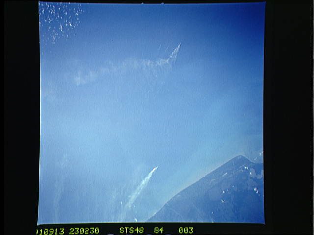
S48-84-03: CVIS of probable oil platform flares in the Bay of
Campeche off the north side of the Yucatan Peninsula, Mexico.
This photo is included to illustrate the point that the atmos-
pheric conditions that prevailed during your mission are truly
multi-causal: Kuwait, smog, burns, Mt. Pinatubo and Hudson,
methanic burps from cows, and Gawd knows what. I will also point
out that we seldom see these oil platforms in the large offshore
fields here in the southern Gulf of Mexico flaring to this ex-
tent.
