STS048-616-32
| NASA Photo ID | STS048-616-32 |
| Focal Length | 250mm |
| Date taken | 1991.09.16 |
| Time taken | 05:13:00 GMT |
Resolutions offered for this image:
3936 x 3903 pixels 639 x 634 pixels 5700 x 6000 pixels 500 x 526 pixels 640 x 480 pixels
3936 x 3903 pixels 639 x 634 pixels 5700 x 6000 pixels 500 x 526 pixels 640 x 480 pixels
Cloud masks available for this image:
Spacecraft nadir point: 22.5° S, 137.6° E
Photo center point: 17.0° S, 139.5° E
Photo center point by machine learning:
Photo center point: 17.0° S, 139.5° E
Photo center point by machine learning:
Nadir to Photo Center: North
Spacecraft Altitude: 307 nautical miles (569km)
Country or Geographic Name: | AUSTRALIA-Q |
Features: | MORNINGTON ISLAND, COASTLINE |
| Features Found Using Machine Learning: | |
Cloud Cover Percentage: | 0 (no clouds present) |
Sun Elevation Angle: | 32° |
Sun Azimuth: | 269° |
Camera: | Rolleiflex |
Focal Length: | 250mm |
Camera Tilt: | 49 degrees |
Format: | 5017: Kodak, natural color positive, Ektachrome, X Professional, ASA 64, standard base |
Film Exposure: | Normal |
| Additional Information | |
| Width | Height | Annotated | Cropped | Purpose | Links |
|---|---|---|---|---|---|
| 3936 pixels | 3903 pixels | No | No | Earth From Space collection | Download Image |
| 639 pixels | 634 pixels | No | No | Earth From Space collection | Download Image |
| 5700 pixels | 6000 pixels | No | No | Download Image | |
| 500 pixels | 526 pixels | No | No | Download Image | |
| 640 pixels | 480 pixels | No | No | Download Image |
Download Packaged File
Download a Google Earth KML for this Image
View photo footprint information
Download a GeoTIFF for this photo
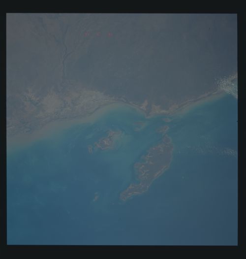
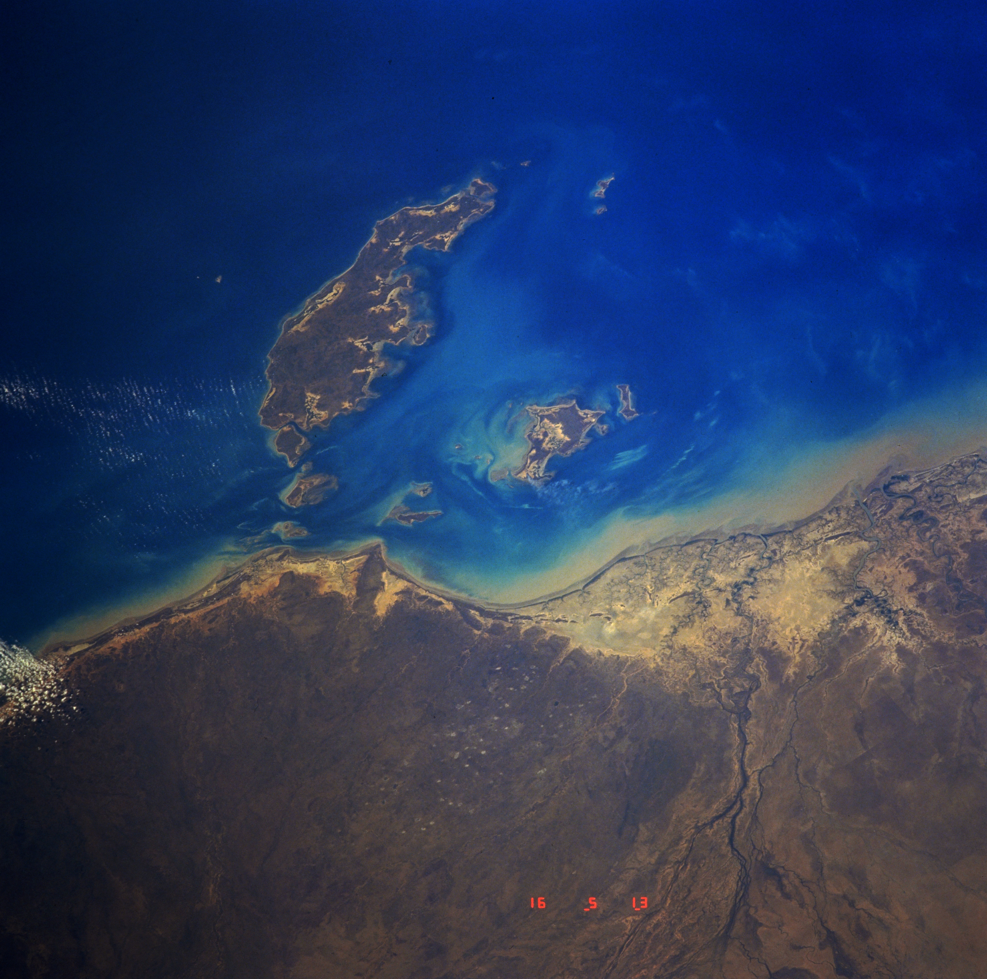
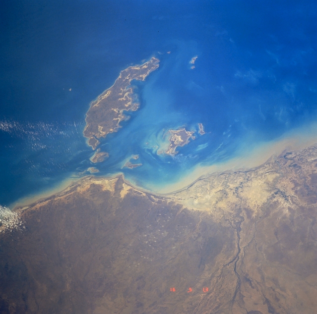
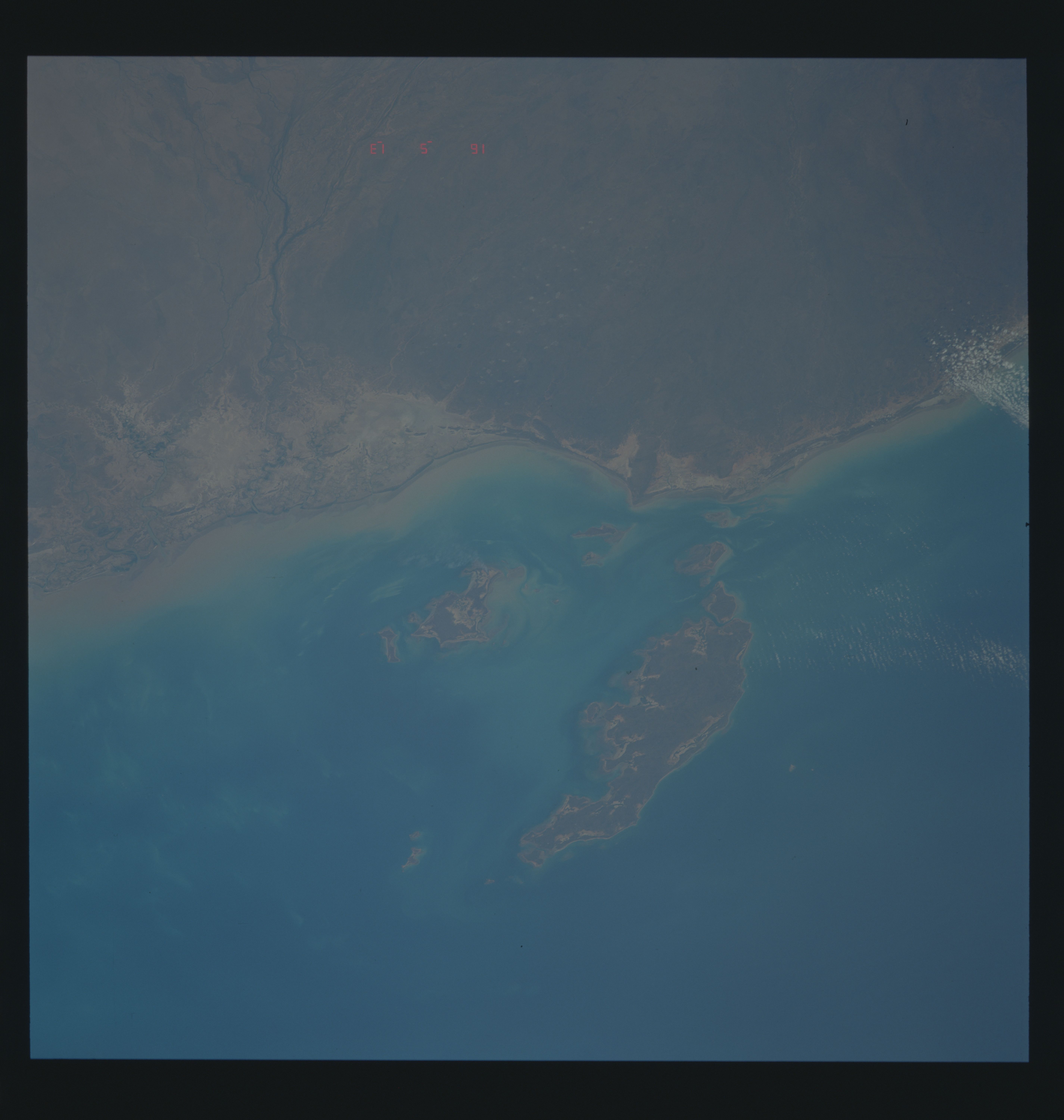
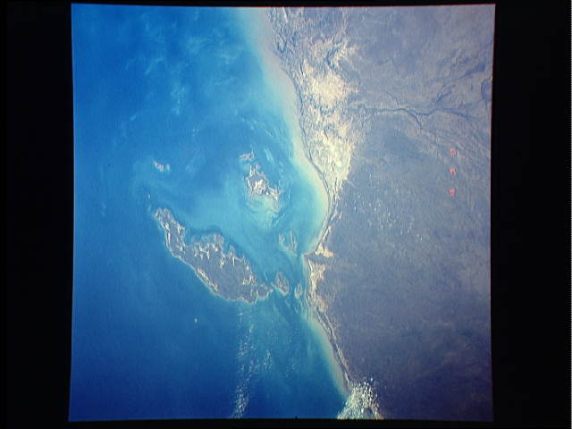
Image Caption: STS048-616-032 Mornington Island, Queensland, Australia September 1991
Mornington Island, the large island off the northwest coast of Queensland, is one of several that make up the group known as the Wellesley Islands. These islands are located along the southern end of the Gulf of Carpentaria. Ninety-five percent of Mornington Island's population is Aboriginal. The general topography of the island is flat with the maximum elevation of 500 feet (150 meters). Several creeks and rivers converge (darker, dendritic pattern) near the coast (lower right) to form a sandy delta, immediately south of Bentinck Island (second largest island in scene). A significant band of brownish sediment can be seen hugging most of the coastline in the image.
Mornington Island, the large island off the northwest coast of Queensland, is one of several that make up the group known as the Wellesley Islands. These islands are located along the southern end of the Gulf of Carpentaria. Ninety-five percent of Mornington Island's population is Aboriginal. The general topography of the island is flat with the maximum elevation of 500 feet (150 meters). Several creeks and rivers converge (darker, dendritic pattern) near the coast (lower right) to form a sandy delta, immediately south of Bentinck Island (second largest island in scene). A significant band of brownish sediment can be seen hugging most of the coastline in the image.
