STS048-152-1
| NASA Photo ID | STS048-152-1 |
| Focal Length | 250mm |
| Date taken | 1991.09.14 |
| Time taken | 06:54:43 GMT |
Resolutions offered for this image:
640 x 480 pixels
640 x 480 pixels
Cloud masks available for this image:
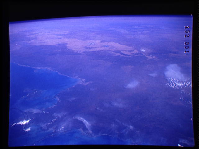
Spacecraft nadir point: 5.7° S, 133.9° E
Photo center point: 14.0° S, 135.0° E
Photo center point by machine learning:
Photo center point: 14.0° S, 135.0° E
Photo center point by machine learning:
Nadir to Photo Center: South
Spacecraft Altitude: 307 nautical miles (569km)
Country or Geographic Name: | AUSTRALIA-NT |
Features: | ARNHEM LAND |
| Features Found Using Machine Learning: | |
Cloud Cover Percentage: | 5 (1-10)% |
Sun Elevation Angle: | 29° |
Sun Azimuth: | 275° |
Camera: | Linhof |
Focal Length: | 250mm |
Camera Tilt: | High Oblique |
Format: | QX868: Kodak, natural color positive, Ektachrome QX868(5017 emulsion), ASA 64, thin base |
Film Exposure: | Normal |
| Additional Information | |
| Width | Height | Annotated | Cropped | Purpose | Links |
|---|---|---|---|---|---|
| 640 pixels | 480 pixels | No | No | ISD 1 | Download Image |
Download Packaged File
Download a Google Earth KML for this Image
View photo footprint information
Download a GeoTIFF for this photo
Image Caption: View southward along the western edge of the Gulf of Carpentaria into Arnhein Land, Northern Territory. Blue Mud Bay inshore from Groote Island, Limmen Bight at the corner of the Gulf. Lake Woods, Tarrabool Lake, and Lakes Corelia/Sylvester from right to left in the sea of brown grass.
