STS047-97-23
| NASA Photo ID | STS047-97-23 |
| Focal Length | 100mm |
| Date taken | 1992.09.15 |
| Time taken | 16:30:50 GMT |
Resolutions offered for this image:
3904 x 3904 pixels 639 x 639 pixels 5700 x 6000 pixels 500 x 526 pixels 640 x 480 pixels
3904 x 3904 pixels 639 x 639 pixels 5700 x 6000 pixels 500 x 526 pixels 640 x 480 pixels

Cloud masks available for this image:
Spacecraft nadir point: 43.2° N, 111.8° W
Photo center point: 42.0° N, 111.0° W
Photo center point by machine learning:
Photo center point: 42.0° N, 111.0° W
Photo center point by machine learning:
Nadir to Photo Center: Southeast
Spacecraft Altitude: 168 nautical miles (311km)
Country or Geographic Name: | USA-UTAH |
Features: | BEAR LAKE AREA |
| Features Found Using Machine Learning: | |
Cloud Cover Percentage: | 20 (11-25)% |
Sun Elevation Angle: | 35° |
Sun Azimuth: | 124° |
Camera: | Hasselblad |
Focal Length: | 100mm |
Camera Tilt: | 27 degrees |
Format: | VELVI: Fuji, natural color positive, Velvia 50, CS 135-36, ASA 32, standard base |
Film Exposure: | Normal |
| Additional Information | |
| Width | Height | Annotated | Cropped | Purpose | Links |
|---|---|---|---|---|---|
| 3904 pixels | 3904 pixels | No | No | Earth From Space collection | Download Image |
| 639 pixels | 639 pixels | No | No | Earth From Space collection | Download Image |
| 5700 pixels | 6000 pixels | No | No | Download Image | |
| 500 pixels | 526 pixels | No | No | Download Image | |
| 640 pixels | 480 pixels | No | No | Download Image |
Download Packaged File
Download a Google Earth KML for this Image
View photo footprint information
Download a GeoTIFF for this photo
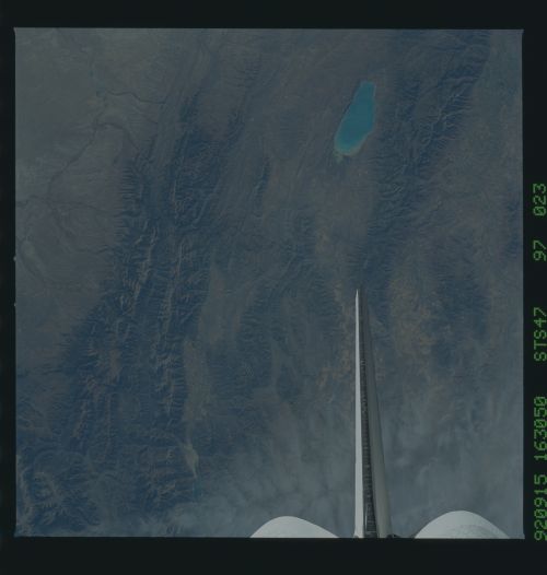
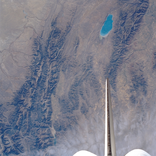
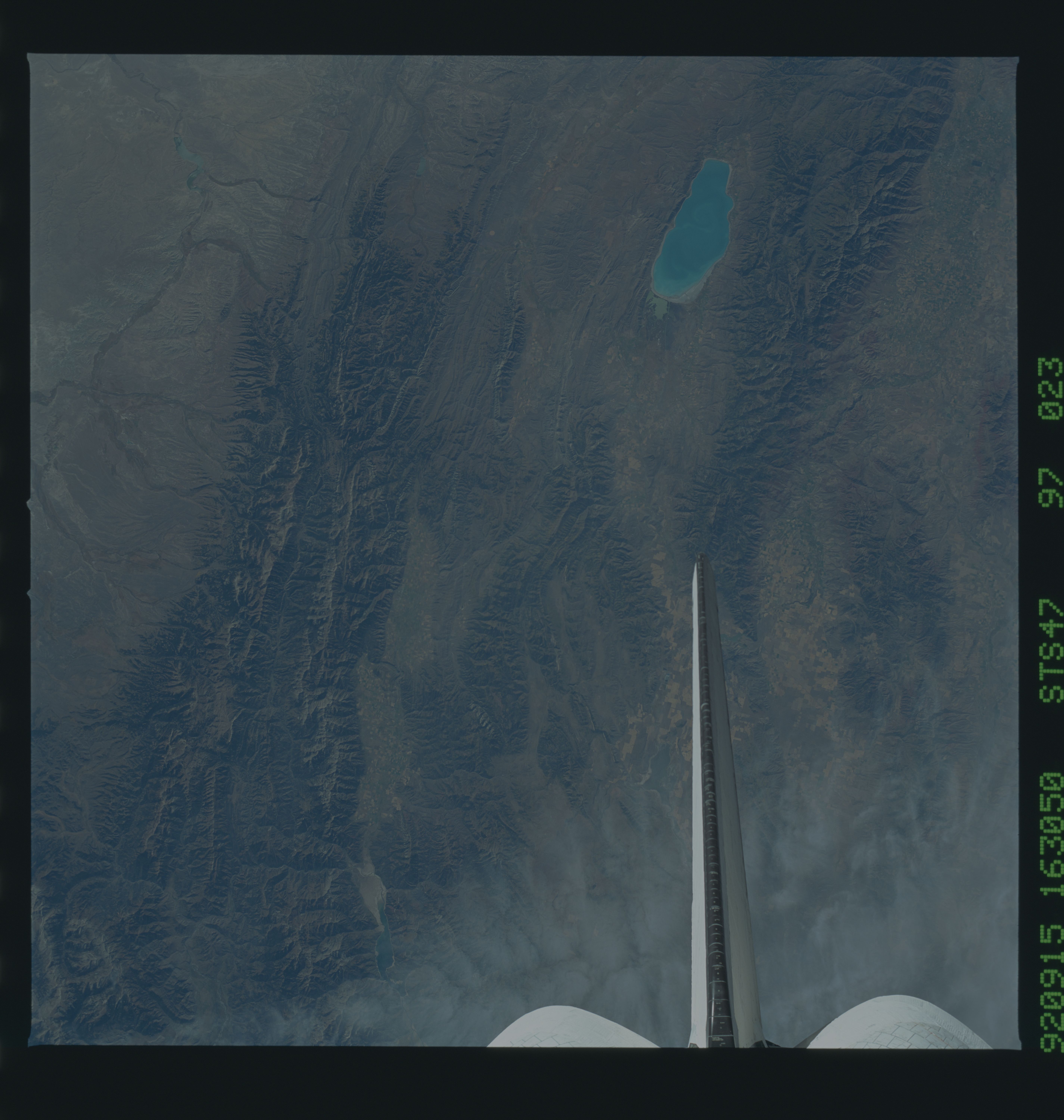
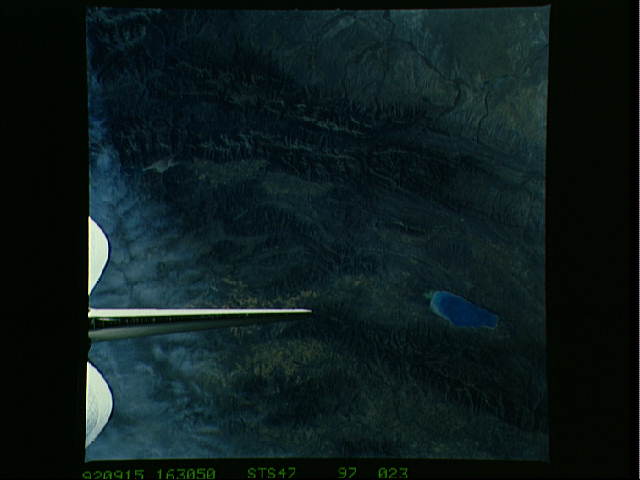
Image Caption: STS047-097-023 Southern Salt River Range, Wasatch Range, and Bear Lake, Idaho, Utah, and Wyoming, U.S.A. September 1992
Featured in this south-southeast-looking, low-oblique photograph are the Salt River Range of southwestern Wyoming, Commissary Ridge (top center), and the northern portion of the Wasatch Range of northeastern Utah. East of the Wasatch Range is Bear Lake, a recreational lake 20 miles (32 kilometers) long, 7 miles (11 kilometers) wide, and 36 feet (11 meters) deep. The lake is drained by a tributary at its north end.
Featured in this south-southeast-looking, low-oblique photograph are the Salt River Range of southwestern Wyoming, Commissary Ridge (top center), and the northern portion of the Wasatch Range of northeastern Utah. East of the Wasatch Range is Bear Lake, a recreational lake 20 miles (32 kilometers) long, 7 miles (11 kilometers) wide, and 36 feet (11 meters) deep. The lake is drained by a tributary at its north end.
