STS047-96-66
| NASA Photo ID | STS047-96-66 |
| Focal Length | 250mm |
| Date taken | 1992.09.17 |
| Time taken | 16:49:36 GMT |
Resolutions offered for this image:
793 x 788 pixels 5265 x 5265 pixels 639 x 639 pixels 5700 x 6000 pixels 500 x 526 pixels 640 x 480 pixels
793 x 788 pixels 5265 x 5265 pixels 639 x 639 pixels 5700 x 6000 pixels 500 x 526 pixels 640 x 480 pixels

Cloud masks available for this image:
Spacecraft nadir point: 45.6° N, 123.9° W
Photo center point: 45.5° N, 122.5° W
Photo center point by machine learning:
Photo center point: 45.5° N, 122.5° W
Photo center point by machine learning:
Nadir to Photo Center: East
Spacecraft Altitude: 168 nautical miles (311km)
Country or Geographic Name: | USA-OREGON |
Features: | PORTLAND AREA |
| Features Found Using Machine Learning: | |
Cloud Cover Percentage: | 0 (no clouds present) |
Sun Elevation Angle: | 28° |
Sun Azimuth: | 119° |
Camera: | Hasselblad |
Focal Length: | 250mm |
Camera Tilt: | 27 degrees |
Format: | VELVI: Fuji, natural color positive, Velvia 50, CS 135-36, ASA 32, standard base |
Film Exposure: | Normal |
| Additional Information | |
| Width | Height | Annotated | Cropped | Purpose | Links |
|---|---|---|---|---|---|
| 793 pixels | 788 pixels | No | No | Cities collection | Download Image |
| 5265 pixels | 5265 pixels | No | No | Earth From Space collection | Download Image |
| 639 pixels | 639 pixels | No | No | Earth From Space collection | Download Image |
| 5700 pixels | 6000 pixels | No | No | Download Image | |
| 500 pixels | 526 pixels | No | No | Download Image | |
| 640 pixels | 480 pixels | No | No | Download Image |
Download Packaged File
Download a Google Earth KML for this Image
View photo footprint information
Download a GeoTIFF for this photo
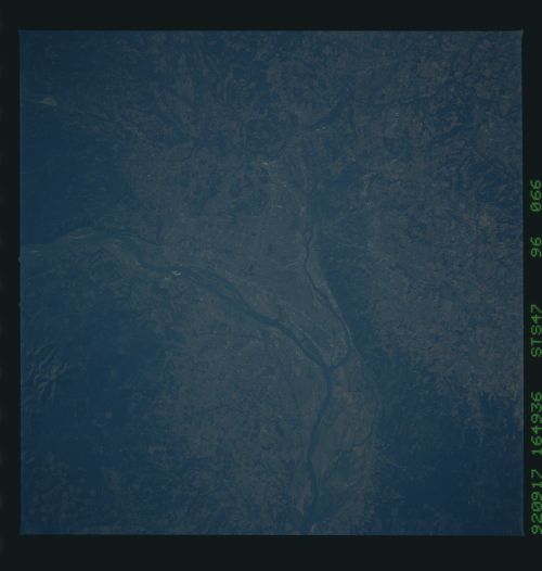
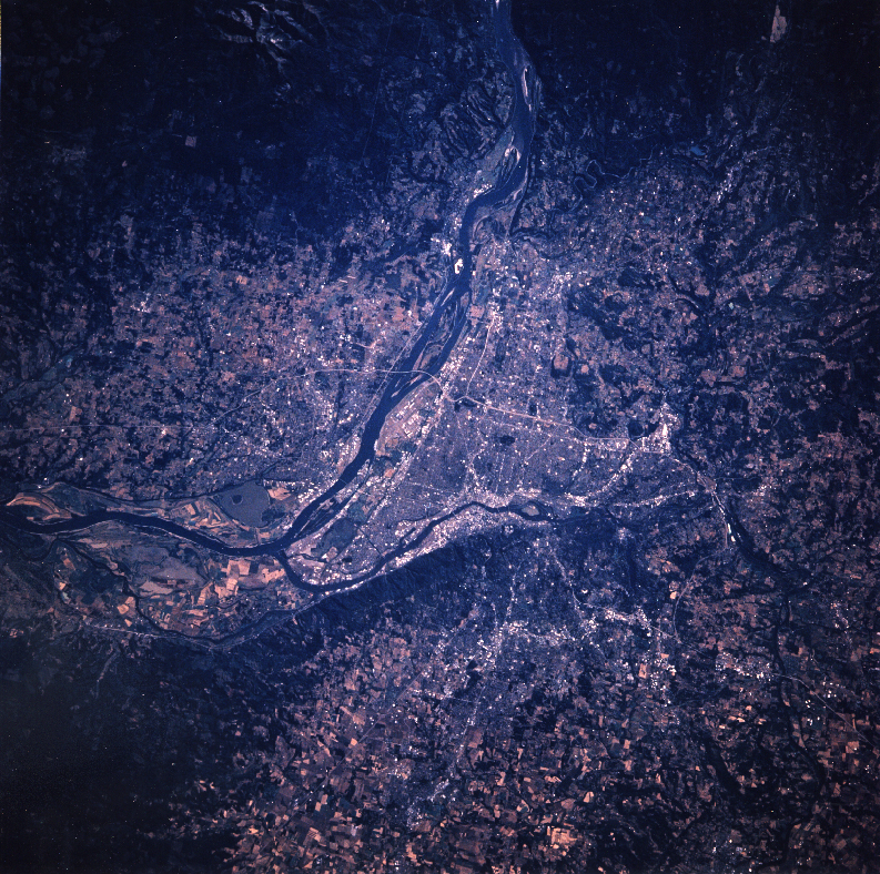
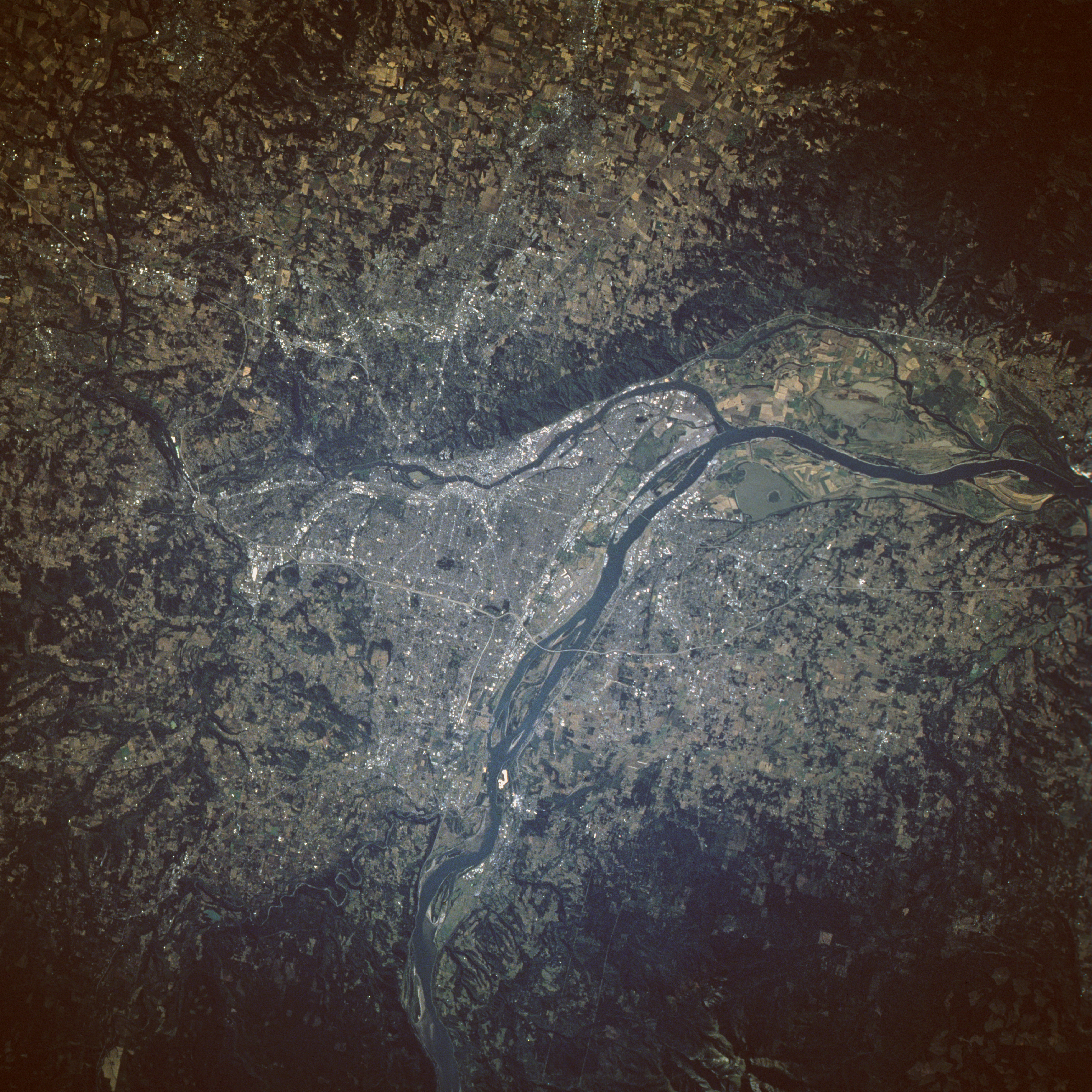
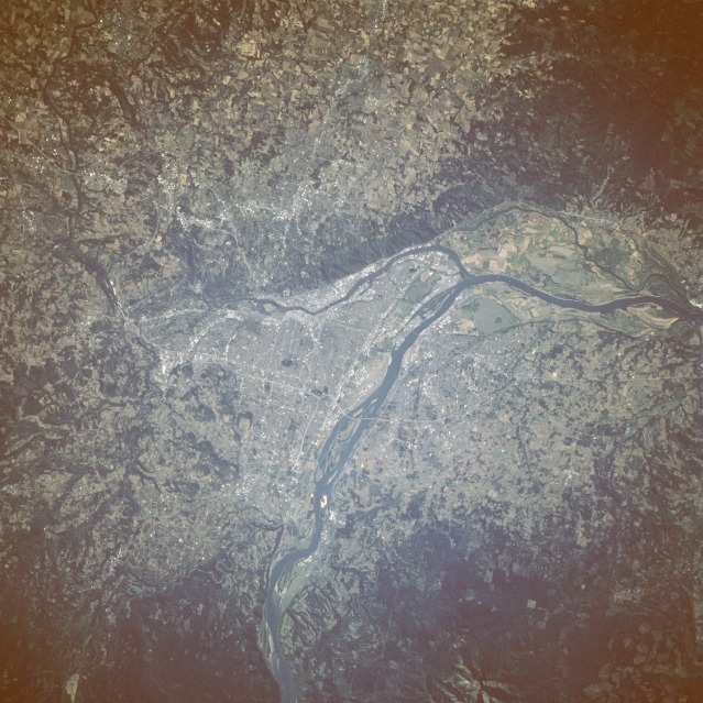
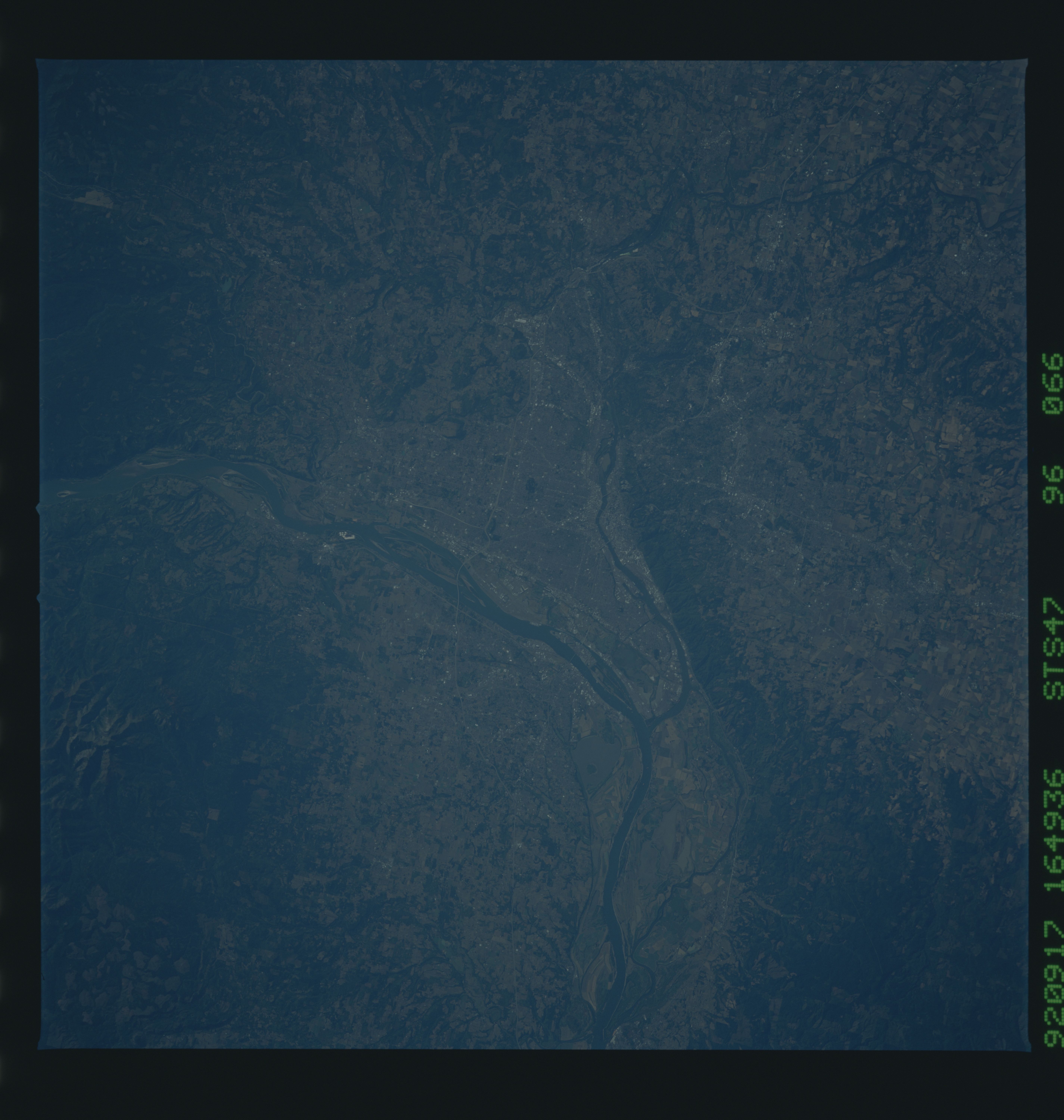
Image Caption: STS047-096-066 Portland and Willamette River, Oregon, U.S.A. September 1992
This west-looking, low-oblique photograph shows the metropolitan area of the "City of Roses," Portland, Oregon. South of the Columbia River (center of the photograph), Portland lies on the Willamette River just 10 miles (16 kilometers) from the river's confluence with the Columbia River. Portland, an important deepwater port with many shipyards, is also a leading financial and industrial center. Manufacturing industries include lumber, wood products, paper, metals, machinery, foodstuffs, woolen textiles, clothing, electronic components, dairy products, paint, and furniture. The city served as a major supply center during the gold rushes in California in the late 1840s and in Alaska in the late 1880s and 1890s. Vancouver, Washington, visible on the north bank of the Columbia River opposite Portland, is also a deepwater port with many shipyards, shipbuilding facilities, lumber mills, and an enormous grain elevator. Vancouver is headquarters for the Gifford Pinchot National Forest in which Mount Saint Helens Volcano is located. The Willamette River, 294 miles (473 kilometers) long, rises in the Cascade Range of southern Oregon and flows north through the wide, fertile Willamette Valley, a major fruit-growing and dairy-producing region. Numerous dams and reservoirs have harnessed the river and its tributaries to provide flood control, navigation, and hydroelectric power production.
This west-looking, low-oblique photograph shows the metropolitan area of the "City of Roses," Portland, Oregon. South of the Columbia River (center of the photograph), Portland lies on the Willamette River just 10 miles (16 kilometers) from the river's confluence with the Columbia River. Portland, an important deepwater port with many shipyards, is also a leading financial and industrial center. Manufacturing industries include lumber, wood products, paper, metals, machinery, foodstuffs, woolen textiles, clothing, electronic components, dairy products, paint, and furniture. The city served as a major supply center during the gold rushes in California in the late 1840s and in Alaska in the late 1880s and 1890s. Vancouver, Washington, visible on the north bank of the Columbia River opposite Portland, is also a deepwater port with many shipyards, shipbuilding facilities, lumber mills, and an enormous grain elevator. Vancouver is headquarters for the Gifford Pinchot National Forest in which Mount Saint Helens Volcano is located. The Willamette River, 294 miles (473 kilometers) long, rises in the Cascade Range of southern Oregon and flows north through the wide, fertile Willamette Valley, a major fruit-growing and dairy-producing region. Numerous dams and reservoirs have harnessed the river and its tributaries to provide flood control, navigation, and hydroelectric power production.
