STS047-94-32
| NASA Photo ID | STS047-94-32 |
| Focal Length | 250mm |
| Date taken | 1992.09.15 |
| Time taken | 16:29:09 GMT |
Resolutions offered for this image:
1019 x 766 pixels 540 x 406 pixels 5700 x 6000 pixels 500 x 526 pixels 640 x 480 pixels 1280 x 1291 pixels 598 x 622 pixels
1019 x 766 pixels 540 x 406 pixels 5700 x 6000 pixels 500 x 526 pixels 640 x 480 pixels 1280 x 1291 pixels 598 x 622 pixels


Cloud masks available for this image:
Spacecraft nadir point: 38.5° N, 117.8° W
Photo center point: 38.0° N, 119.0° W
Photo center point by machine learning:
Photo center point: 38.0° N, 119.0° W
Photo center point by machine learning:
Nadir to Photo Center: West
Spacecraft Altitude: 167 nautical miles (309km)
Country or Geographic Name: | USA-CALIFORNIA |
Features: | MONO LAKE AREA |
| Features Found Using Machine Learning: | |
Cloud Cover Percentage: | 0 (no clouds present) |
Sun Elevation Angle: | 34° |
Sun Azimuth: | 117° |
Camera: | Hasselblad |
Focal Length: | 250mm |
Camera Tilt: | 25 degrees |
Format: | VELVI: Fuji, natural color positive, Velvia 50, CS 135-36, ASA 32, standard base |
Film Exposure: | Normal |
| Additional Information | |
| Width | Height | Annotated | Cropped | Purpose | Links |
|---|---|---|---|---|---|
| 1019 pixels | 766 pixels | Photographic Highlights | Download Image | ||
| 540 pixels | 406 pixels | Photographic Highlights | Download Image | ||
| 5700 pixels | 6000 pixels | No | No | Download Image | |
| 500 pixels | 526 pixels | No | No | Download Image | |
| 640 pixels | 480 pixels | No | No | Download Image | |
| 1280 pixels | 1291 pixels | No | No | Download Image | |
| 598 pixels | 622 pixels | No | No | Download Image |
Download Packaged File
Download a Google Earth KML for this Image
View photo footprint information
Download a GeoTIFF for this photo
Image Caption:
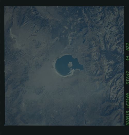
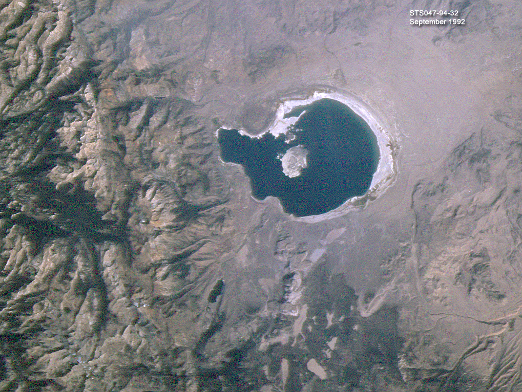
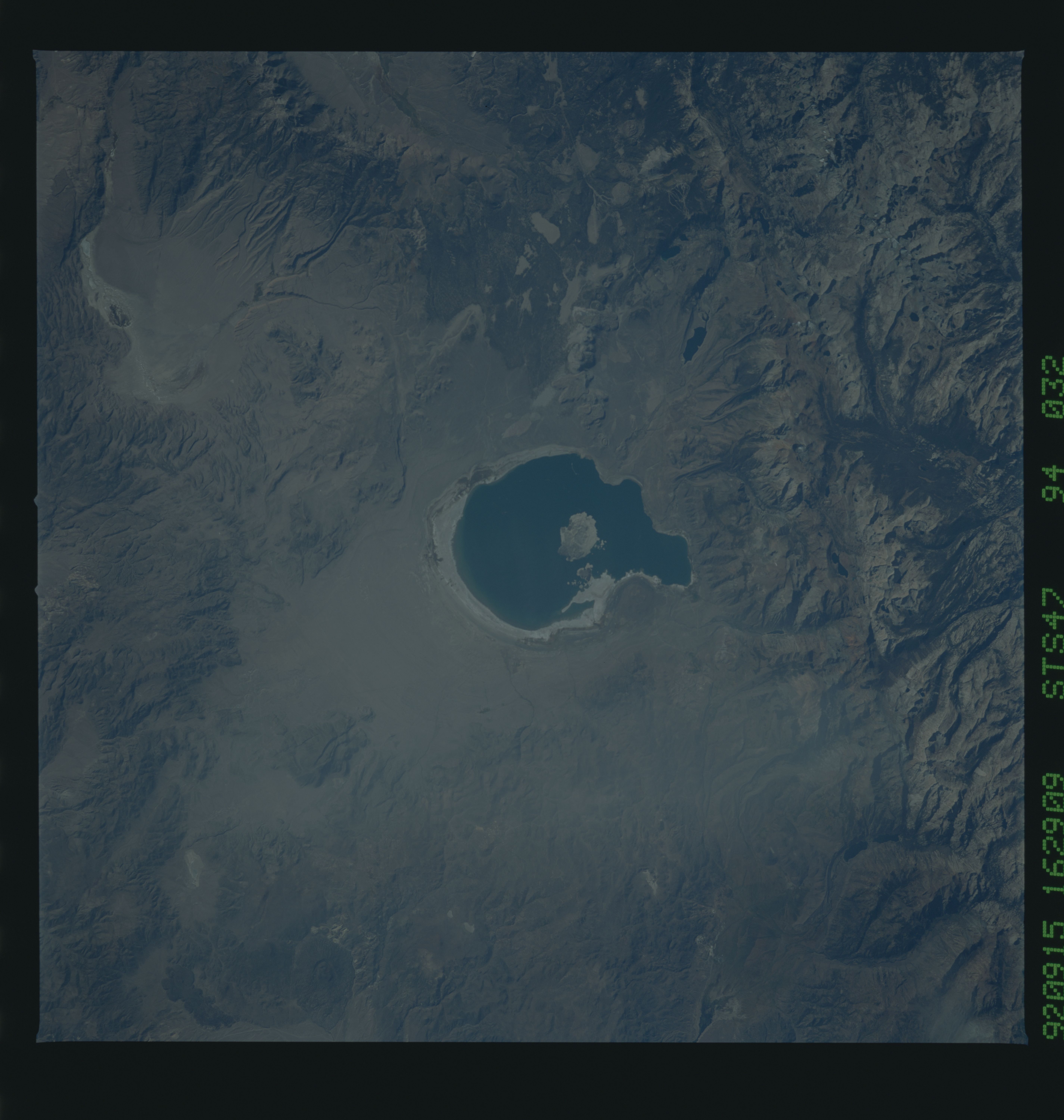
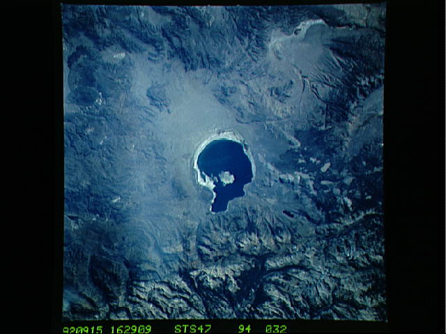
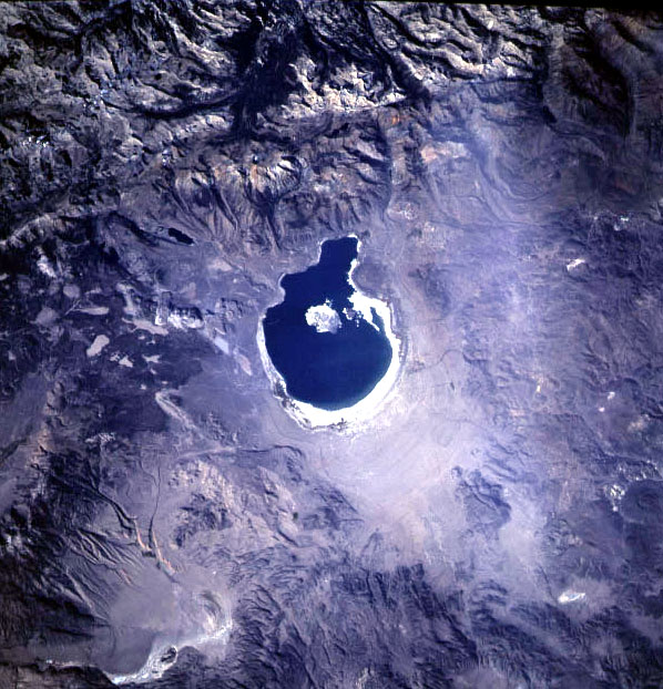
STS047-94-032 Mono Lake and Inyo Craters, California. Mono Lake
sits at the north end of the Long Valley Caldera, one of north
America's active seismic and volcanic regions. The string of
domes and craters south of Mono Lake show clearly in the low
light. Also visible is the Mammoth Mountain ski area. Note that
there is no snow cover in the high Sierra.
