STS047-90-93

| NASA Photo ID | STS047-90-93 |
| Focal Length | 250mm |
| Date taken | 1992.09.14 |
| Time taken | 23:58:35 GMT |
Resolutions offered for this image:
5276 x 5276 pixels 640 x 640 pixels 5700 x 6000 pixels 500 x 526 pixels 640 x 480 pixels 651 x 639 pixels
5276 x 5276 pixels 640 x 640 pixels 5700 x 6000 pixels 500 x 526 pixels 640 x 480 pixels 651 x 639 pixels


Cloud masks available for this image:
Spacecraft nadir point: 52.1° N, 158.7° E
Photo center point: 52.0° N, 157.5° E
Photo center point by machine learning:
Photo center point: 52.0° N, 157.5° E
Photo center point by machine learning:
Nadir to Photo Center: West
Spacecraft Altitude: 170 nautical miles (315km)
Country or Geographic Name: | RUSSIAN FEDERATION |
Features: | S. END OF KAMCHATKA |
| Features Found Using Machine Learning: | |
Cloud Cover Percentage: | 10 (1-10)% |
Sun Elevation Angle: | 38° |
Sun Azimuth: | 155° |
Camera: | Hasselblad |
Focal Length: | 250mm |
Camera Tilt: | 23 degrees |
Format: | VELVI: Fuji, natural color positive, Velvia 50, CS 135-36, ASA 32, standard base |
Film Exposure: | Normal |
| Additional Information | |
| Width | Height | Annotated | Cropped | Purpose | Links |
|---|---|---|---|---|---|
| 5276 pixels | 5276 pixels | No | No | Earth From Space collection | Download Image |
| 640 pixels | 640 pixels | No | No | Earth From Space collection | Download Image |
| 5700 pixels | 6000 pixels | No | No | Download Image | |
| 500 pixels | 526 pixels | No | No | Download Image | |
| 640 pixels | 480 pixels | No | No | Download Image | |
| 651 pixels | 639 pixels | Yes | No | Download Image |
Download Packaged File
Download a Google Earth KML for this Image
View photo footprint information
Download a GeoTIFF for this photo
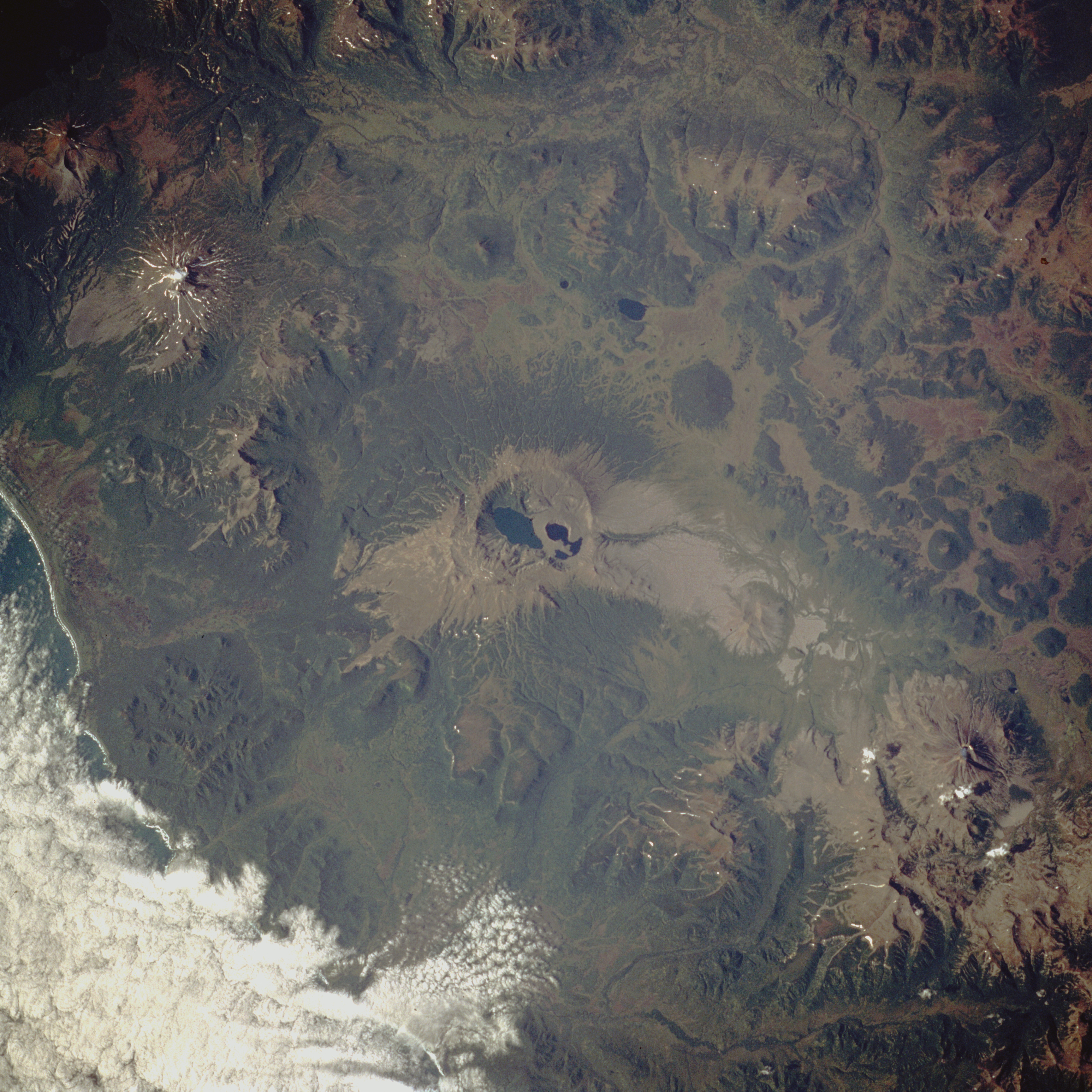
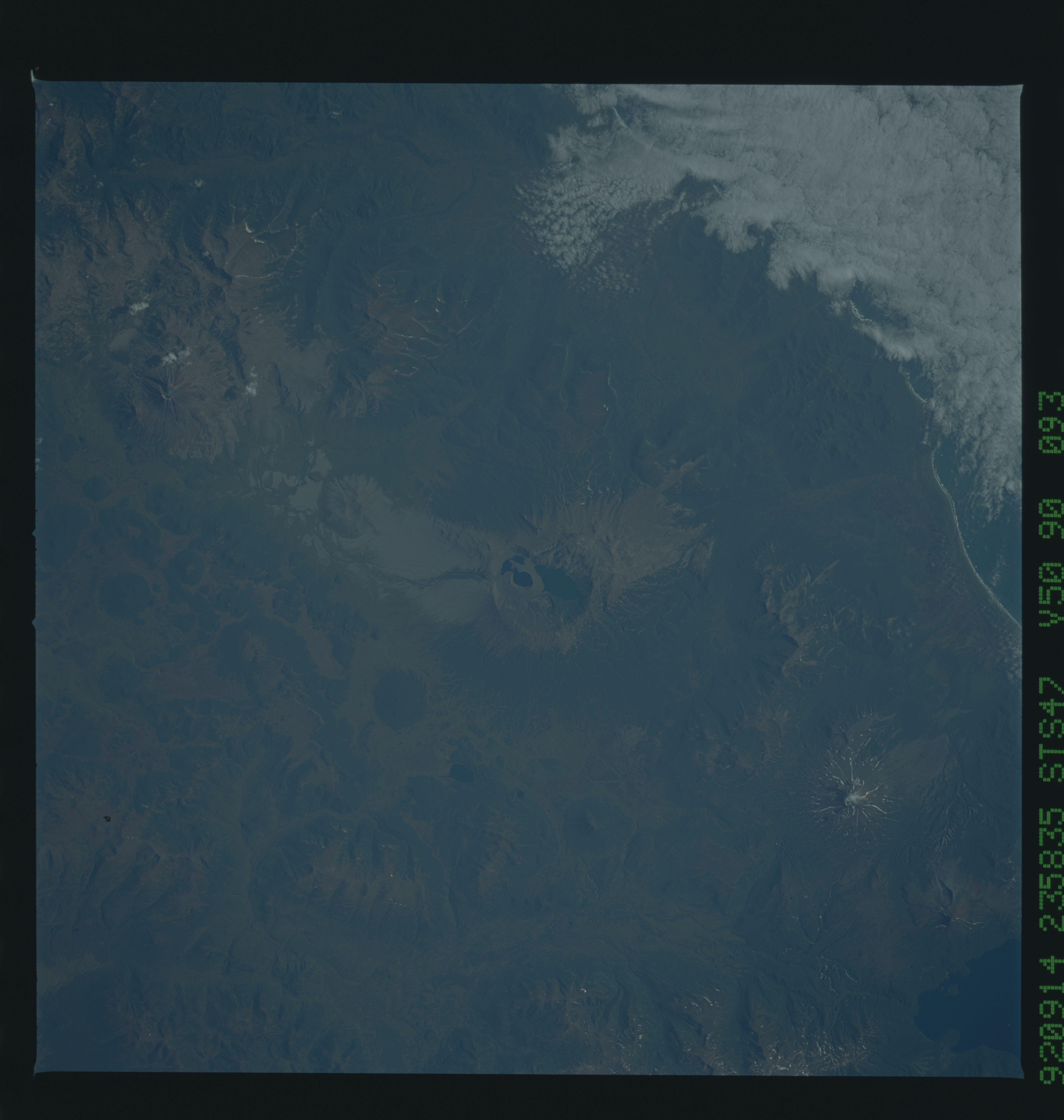
Image Caption: STS047-90-93 Volcanoes, Kamchatka Peninsula, Russia September 1992
Kamchatka Peninsula in extreme eastern Russia offers a living laboratory for the study of volcanoes. Experts estimate that of approximately 80 volcanoes on Kamchatka, about 33 are classified as active. This photograph of the southeast coast of Kamchatka Peninsula shows a very rugged volcanic landscape without snow cover, which can conceal some of the more subtle volcanic features. A very large, water-filled caldera is clearly visible in the center of the photograph. The maximum elevation of the rim of this caldera is 3504 feet (1068 meters). Twenty miles (32 kilometers) northeast of this caldera stands Mount Khodutka, a stratovolcano [peak elevation is 6857 feet (2090 meters)], and 20 miles (32 kilometers) southwest of the large caldera stands Mount Zheltovskaya, another stratovolcano, rising 6142 feet (1870 meters) above sea level. Numerous smaller volcanoes can be identified by their dark, (forested) generally circular shapes. (Refer to photographs STS068-214-43 and STS068-273-33 that show Klyuchevskaya Volcano erupting in October 1994.)
Kamchatka Peninsula in extreme eastern Russia offers a living laboratory for the study of volcanoes. Experts estimate that of approximately 80 volcanoes on Kamchatka, about 33 are classified as active. This photograph of the southeast coast of Kamchatka Peninsula shows a very rugged volcanic landscape without snow cover, which can conceal some of the more subtle volcanic features. A very large, water-filled caldera is clearly visible in the center of the photograph. The maximum elevation of the rim of this caldera is 3504 feet (1068 meters). Twenty miles (32 kilometers) northeast of this caldera stands Mount Khodutka, a stratovolcano [peak elevation is 6857 feet (2090 meters)], and 20 miles (32 kilometers) southwest of the large caldera stands Mount Zheltovskaya, another stratovolcano, rising 6142 feet (1870 meters) above sea level. Numerous smaller volcanoes can be identified by their dark, (forested) generally circular shapes. (Refer to photographs STS068-214-43 and STS068-273-33 that show Klyuchevskaya Volcano erupting in October 1994.)
