STS047-90-85
| NASA Photo ID | STS047-90-85 |
| Focal Length | 250mm |
| Date taken | 1992.09.14 |
| Time taken | 23:57:38 GMT |
Resolutions offered for this image:
5301 x 5301 pixels 639 x 639 pixels 5700 x 6000 pixels 500 x 526 pixels 640 x 480 pixels
5301 x 5301 pixels 639 x 639 pixels 5700 x 6000 pixels 500 x 526 pixels 640 x 480 pixels

Cloud masks available for this image:
Spacecraft nadir point: 50.2° N, 153.7° E
Photo center point: 49.0° N, 154.5° E
Photo center point by machine learning:
Photo center point: 49.0° N, 154.5° E
Photo center point by machine learning:
Nadir to Photo Center: Southeast
Spacecraft Altitude: 170 nautical miles (315km)
Country or Geographic Name: | RUSSIAN FEDERATION |
Features: | KURIL I, KHARIMKOTAN I. |
| Features Found Using Machine Learning: | |
Cloud Cover Percentage: | 0 (no clouds present) |
Sun Elevation Angle: | 38° |
Sun Azimuth: | 148° |
Camera: | Hasselblad |
Focal Length: | 250mm |
Camera Tilt: | 27 degrees |
Format: | VELVI: Fuji, natural color positive, Velvia 50, CS 135-36, ASA 32, standard base |
Film Exposure: | Normal |
| Additional Information | |
| Width | Height | Annotated | Cropped | Purpose | Links |
|---|---|---|---|---|---|
| 5301 pixels | 5301 pixels | No | No | Earth From Space collection | Download Image |
| 639 pixels | 639 pixels | No | No | Earth From Space collection | Download Image |
| 5700 pixels | 6000 pixels | No | No | Download Image | |
| 500 pixels | 526 pixels | No | No | Download Image | |
| 640 pixels | 480 pixels | No | No | Download Image |
Download Packaged File
Download a Google Earth KML for this Image
View photo footprint information
Download a GeoTIFF for this photo
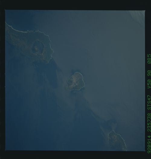
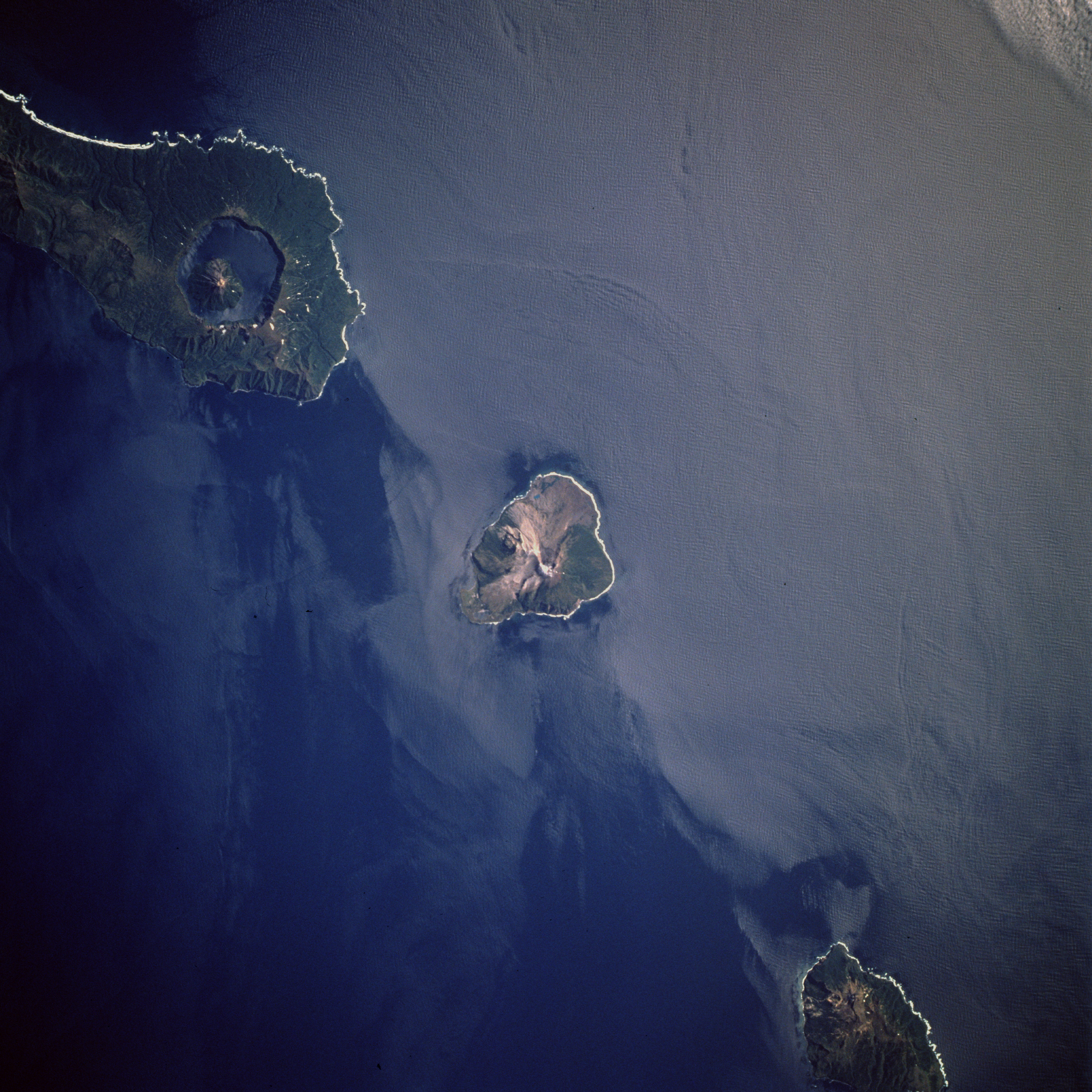
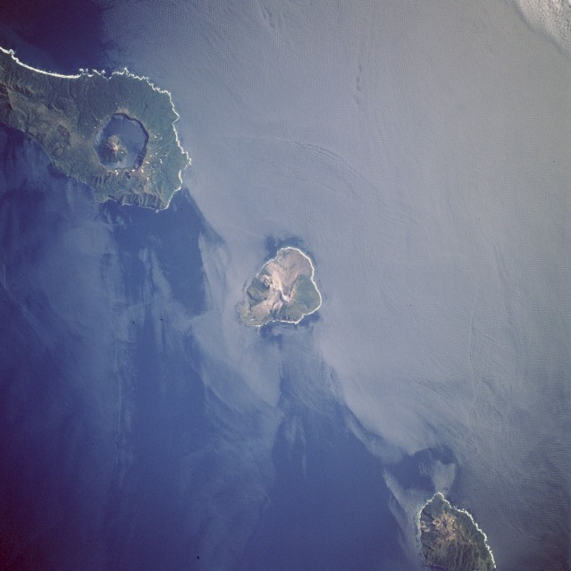
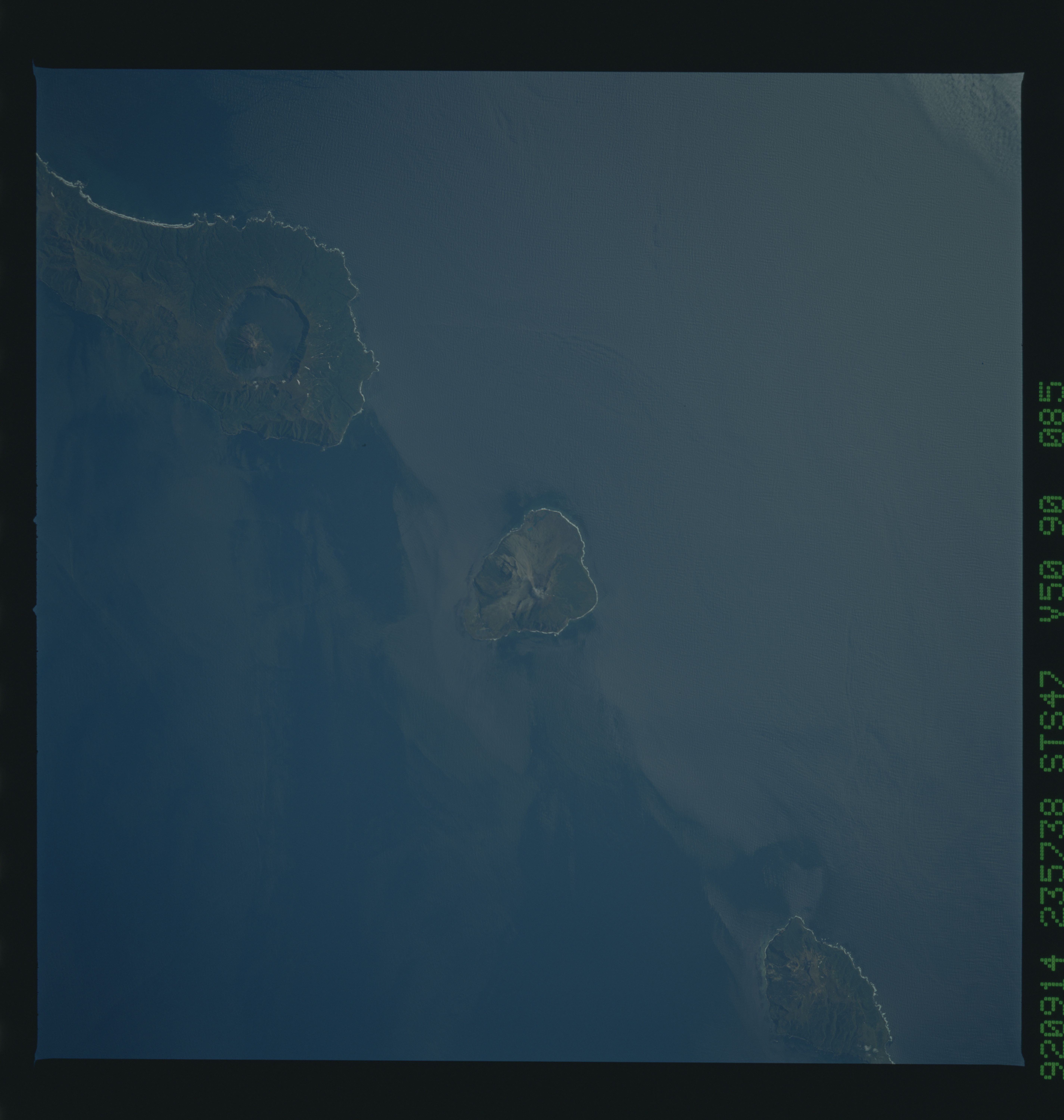
Image Caption: STS047-90-85 Onekotan and Kharmkotan, Kurile Islands, Russia September 1992
The Kurile Islands are a chain of more than thirty volcanic islands stretching 775 miles (1245 km)between the Kamchatka Peninsula to the north and the Japanese Island of Hokkaido to the south, and are part of the "Ring of Fire" that encircles the Pacific Ocean. The Kurile islands are very young and active volcanoes, evidenced by their very pristine volcanic forms. This view shows three volcanic islands of the Kuriles, Onekotan (top left), Kharmkotan (center), and Shiashkotan. The low sunlight highlights the steep volcanic shapes on these islands. For scale, the small, circular volcano located within the caldera lake on Onekotan Island (upper left) reaches an altitude of 4367 feet (1330 meters).
The Kurile Islands are a chain of more than thirty volcanic islands stretching 775 miles (1245 km)between the Kamchatka Peninsula to the north and the Japanese Island of Hokkaido to the south, and are part of the "Ring of Fire" that encircles the Pacific Ocean. The Kurile islands are very young and active volcanoes, evidenced by their very pristine volcanic forms. This view shows three volcanic islands of the Kuriles, Onekotan (top left), Kharmkotan (center), and Shiashkotan. The low sunlight highlights the steep volcanic shapes on these islands. For scale, the small, circular volcano located within the caldera lake on Onekotan Island (upper left) reaches an altitude of 4367 feet (1330 meters).
