STS047-88-20
| NASA Photo ID | STS047-88-20 |
| Focal Length | 250mm |
| Date taken | 1992.09.14 |
| Time taken | 04:14:42 GMT |
Resolutions offered for this image:
3950 x 3956 pixels 639 x 640 pixels 5700 x 6000 pixels 500 x 526 pixels 640 x 480 pixels 648 x 639 pixels
3950 x 3956 pixels 639 x 640 pixels 5700 x 6000 pixels 500 x 526 pixels 640 x 480 pixels 648 x 639 pixels

Cloud masks available for this image:
Spacecraft nadir point: 36.0° N, 71.2° E
Photo center point:
Photo center point by machine learning:
Photo center point:
Photo center point by machine learning:
Nadir to Photo Center:
Spacecraft Altitude: 167 nautical miles (309km)
Country or Geographic Name: | AFGHANISTAN |
Features: | HINDU KUSH, GLACIERS |
| Features Found Using Machine Learning: | |
Cloud Cover Percentage: | 5 (1-10)% |
Sun Elevation Angle: | 38° |
Sun Azimuth: | 118° |
Camera: | Hasselblad |
Focal Length: | 250mm |
Camera Tilt: | |
Format: | VELVI: Fuji, natural color positive, Velvia 50, CS 135-36, ASA 32, standard base |
Film Exposure: | Normal |
| Additional Information | |
| Width | Height | Annotated | Cropped | Purpose | Links |
|---|---|---|---|---|---|
| 3950 pixels | 3956 pixels | No | No | Earth From Space collection | Download Image |
| 639 pixels | 640 pixels | No | No | Earth From Space collection | Download Image |
| 5700 pixels | 6000 pixels | No | No | Download Image | |
| 500 pixels | 526 pixels | No | No | Download Image | |
| 640 pixels | 480 pixels | No | No | Download Image | |
| 648 pixels | 639 pixels | No | No | Download Image |
Download Packaged File
Download a Google Earth KML for this Image
View photo footprint information
Download a GeoTIFF for this photo
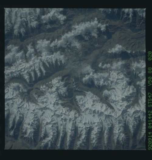
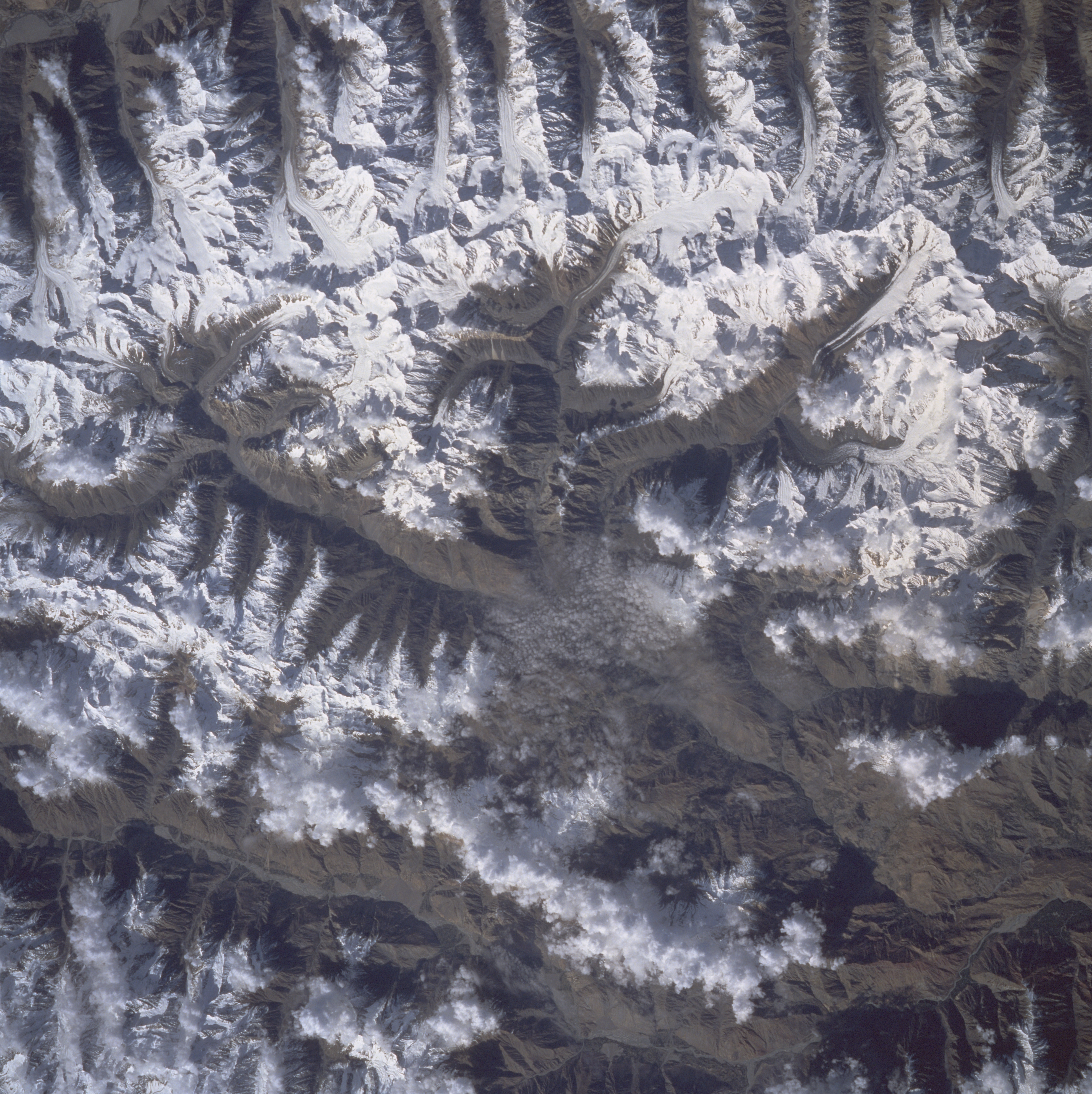
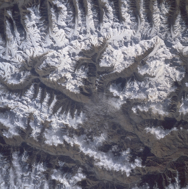
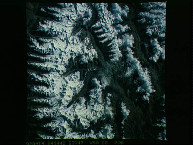
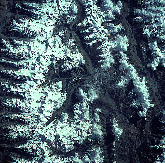
Image Caption: STS047-088-020 Hindu Kush Mountains, Pakistan September 1992
A section of one of the major mountain systems in central Asia, the Hindu Kush, is visible in this near-vertical view of rugged mountainous terrain in northern Pakistan and northeast Afghanistan. The region has snow and ice covered peaks, ridgelines, and deep, ice carved valleys. Many of the higher elevations throughout the region exceed 20000 feet (6096 meters) above sea level, while the valleys (darker-looking areas) are below 9000 feet (2745 meters) in elevation. Notice at the bottom of the image that the snow covered mountain ridges alternate with the glacial valleys (glaciers are visible in many valleys). The Wakhan Corridor (a mountainous area with several passes), a narrow strip of land that connects Afghanistan with western China, lies just off of the bottom edge of the image (northern flanks of the mountains). This is an excellent image to test your ability to discriminate clouds from the snow-covered mountains because of the clouds over the mountainous terrain in the top half of the picture. Shadows (dark areas) from clouds and from the mountainous relief obscure some of the landforms. The Matue River Valley can be identified along the top of the image.
A section of one of the major mountain systems in central Asia, the Hindu Kush, is visible in this near-vertical view of rugged mountainous terrain in northern Pakistan and northeast Afghanistan. The region has snow and ice covered peaks, ridgelines, and deep, ice carved valleys. Many of the higher elevations throughout the region exceed 20000 feet (6096 meters) above sea level, while the valleys (darker-looking areas) are below 9000 feet (2745 meters) in elevation. Notice at the bottom of the image that the snow covered mountain ridges alternate with the glacial valleys (glaciers are visible in many valleys). The Wakhan Corridor (a mountainous area with several passes), a narrow strip of land that connects Afghanistan with western China, lies just off of the bottom edge of the image (northern flanks of the mountains). This is an excellent image to test your ability to discriminate clouds from the snow-covered mountains because of the clouds over the mountainous terrain in the top half of the picture. Shadows (dark areas) from clouds and from the mountainous relief obscure some of the landforms. The Matue River Valley can be identified along the top of the image.
