STS047-85-92

| NASA Photo ID | STS047-85-92 |
| Focal Length | 250mm |
| Date taken | 1992.09.13 |
| Time taken | 10:05:36 GMT |
Resolutions offered for this image:
5266 x 5320 pixels 633 x 640 pixels 5700 x 6000 pixels 500 x 526 pixels 640 x 480 pixels
5266 x 5320 pixels 633 x 640 pixels 5700 x 6000 pixels 500 x 526 pixels 640 x 480 pixels


Cloud masks available for this image:
Spacecraft nadir point: 29.1° N, 19.1° W
Photo center point: 28.5° N, 18.0° W
Photo center point by machine learning:
Photo center point: 28.5° N, 18.0° W
Photo center point by machine learning:
Nadir to Photo Center: Southeast
Spacecraft Altitude: 166 nautical miles (307km)
Country or Geographic Name: | CANARY ISLANDS |
Features: | LA PALMA I, ISLAND WAKE |
| Features Found Using Machine Learning: | |
Cloud Cover Percentage: | 30 (26-50)% |
Sun Elevation Angle: | 40° |
Sun Azimuth: | 112° |
Camera: | Hasselblad |
Focal Length: | 250mm |
Camera Tilt: | 24 degrees |
Format: | VELVI: Fuji, natural color positive, Velvia 50, CS 135-36, ASA 32, standard base |
Film Exposure: | Normal |
| Additional Information | |
| Width | Height | Annotated | Cropped | Purpose | Links |
|---|---|---|---|---|---|
| 5266 pixels | 5320 pixels | No | No | Earth From Space collection | Download Image |
| 633 pixels | 640 pixels | No | No | Earth From Space collection | Download Image |
| 5700 pixels | 6000 pixels | No | No | Download Image | |
| 500 pixels | 526 pixels | No | No | Download Image | |
| 640 pixels | 480 pixels | No | No | Download Image |
Download Packaged File
Download a Google Earth KML for this Image
View photo footprint information
Download a GeoTIFF for this photo
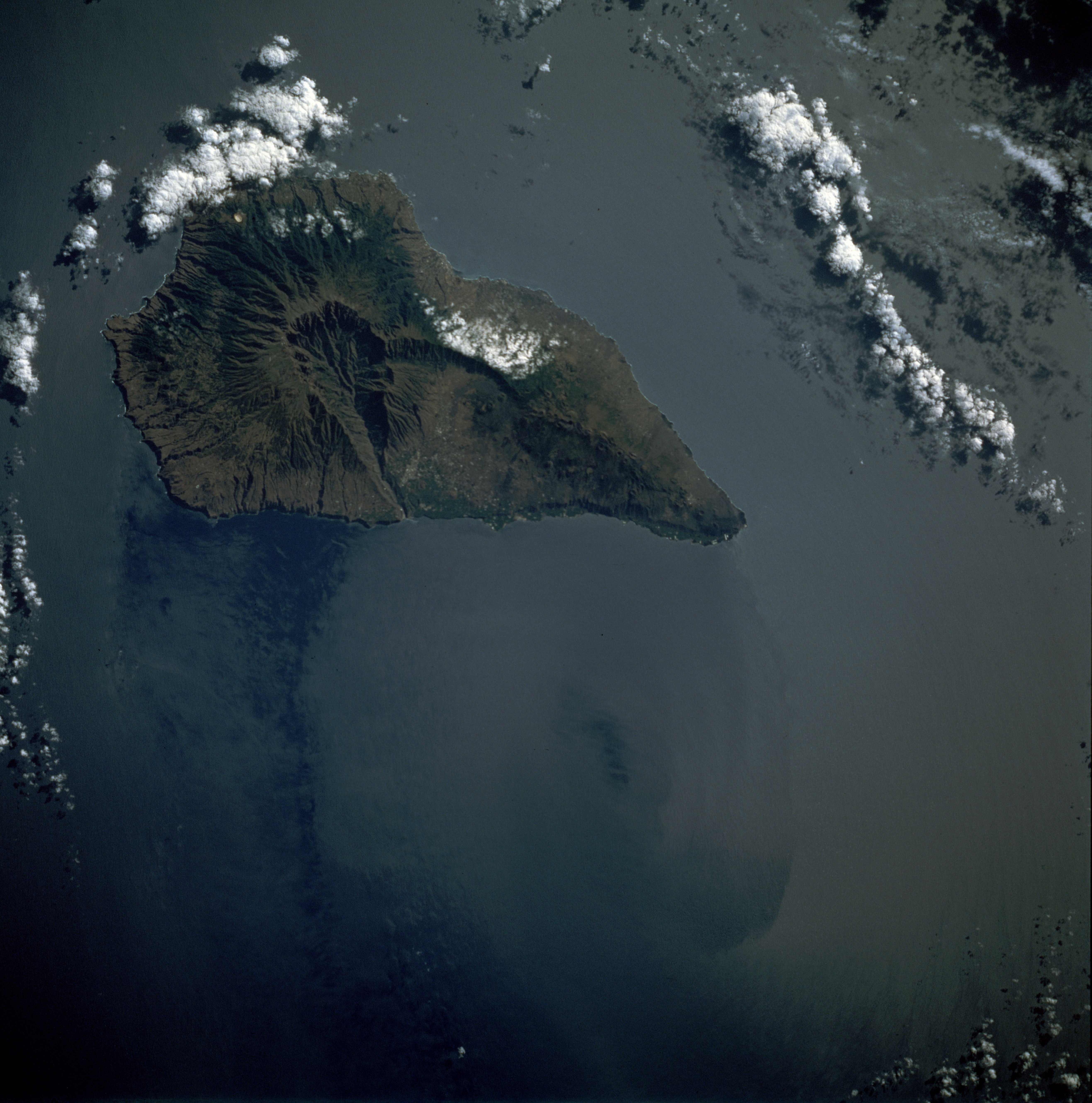
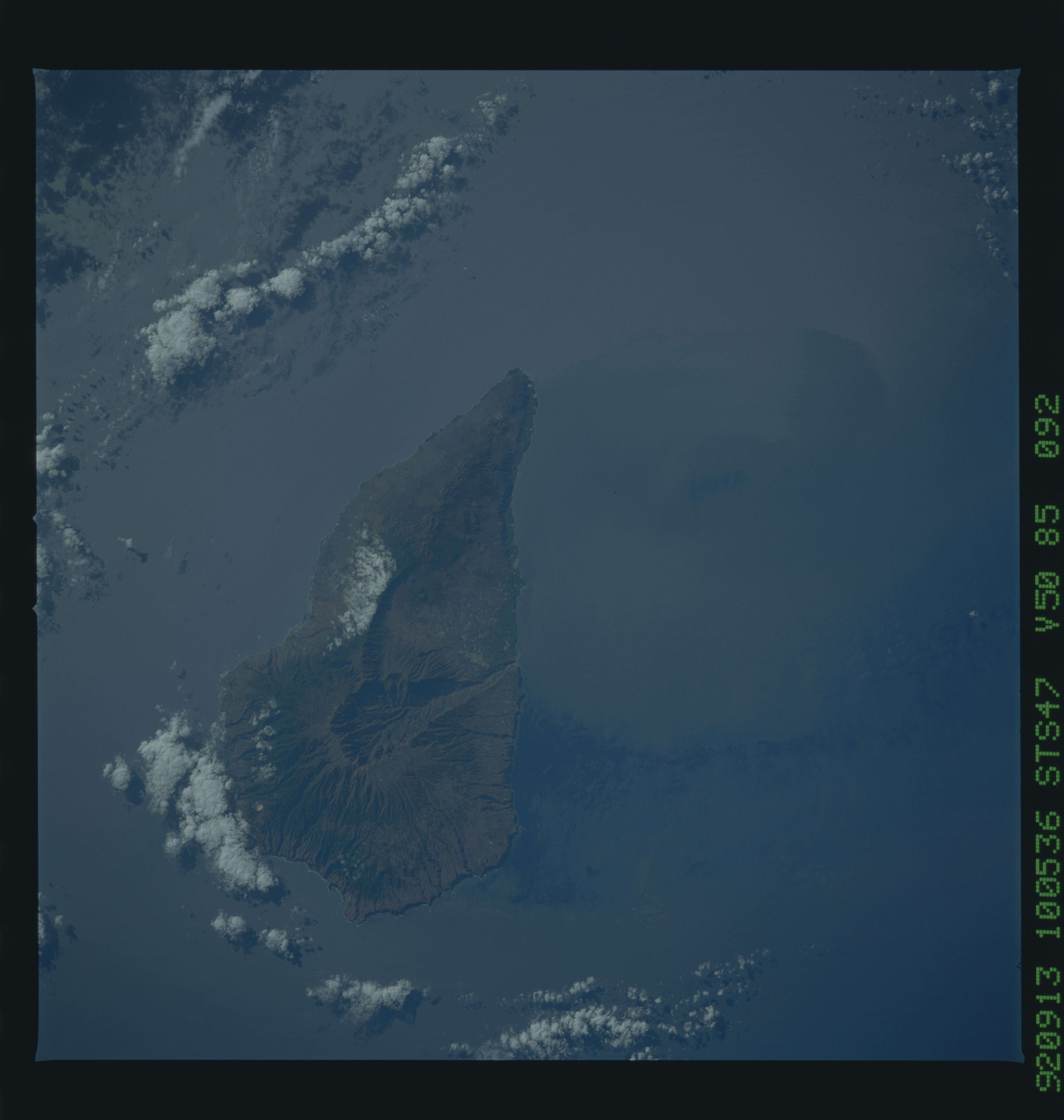
Image Caption: STS047-085-092 La Palma Island, Canary Islands September 1992
Volcanic, mountainous La Palma, covering 280 square miles (725 square kilometers), dominates this east-looking, low-oblique photograph. The large caldera near the center of the island is the remains of the collapsed, extinct Roque de los Muchachos Volcano. Tourism and agriculture are the major industries; sugar cane is the main agricultural crop, but other crops include bananas, tomatoes, potatoes, and tobacco. Irrigation is important, especially in the coastal and lowland regions where rainfall is minimal. Industrial development is limited on the island by the lack of water. Santa Cruz de la Palma, the chief city and port, is located on the eastern side of the island. Because of predominating eastern winds and ocean currents, an island wake is discernible on the western side of the island.
Volcanic, mountainous La Palma, covering 280 square miles (725 square kilometers), dominates this east-looking, low-oblique photograph. The large caldera near the center of the island is the remains of the collapsed, extinct Roque de los Muchachos Volcano. Tourism and agriculture are the major industries; sugar cane is the main agricultural crop, but other crops include bananas, tomatoes, potatoes, and tobacco. Irrigation is important, especially in the coastal and lowland regions where rainfall is minimal. Industrial development is limited on the island by the lack of water. Santa Cruz de la Palma, the chief city and port, is located on the eastern side of the island. Because of predominating eastern winds and ocean currents, an island wake is discernible on the western side of the island.
