STS047-80-86
| NASA Photo ID | STS047-80-86 |
| Focal Length | 250mm |
| Date taken | 1992.09.15 |
| Time taken | 13:29:52 GMT |

Cloud masks available for this image:
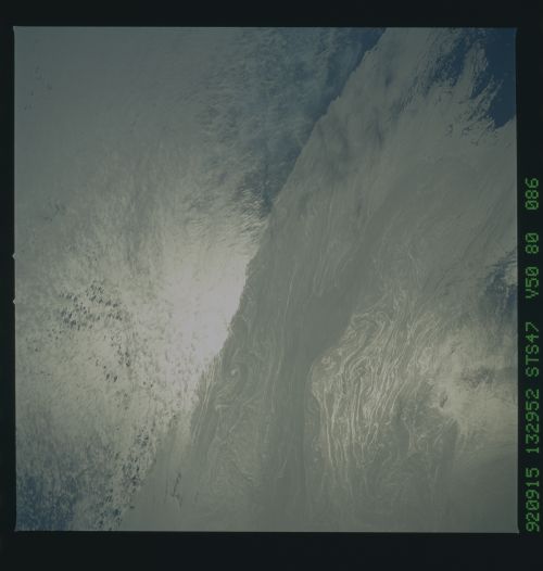
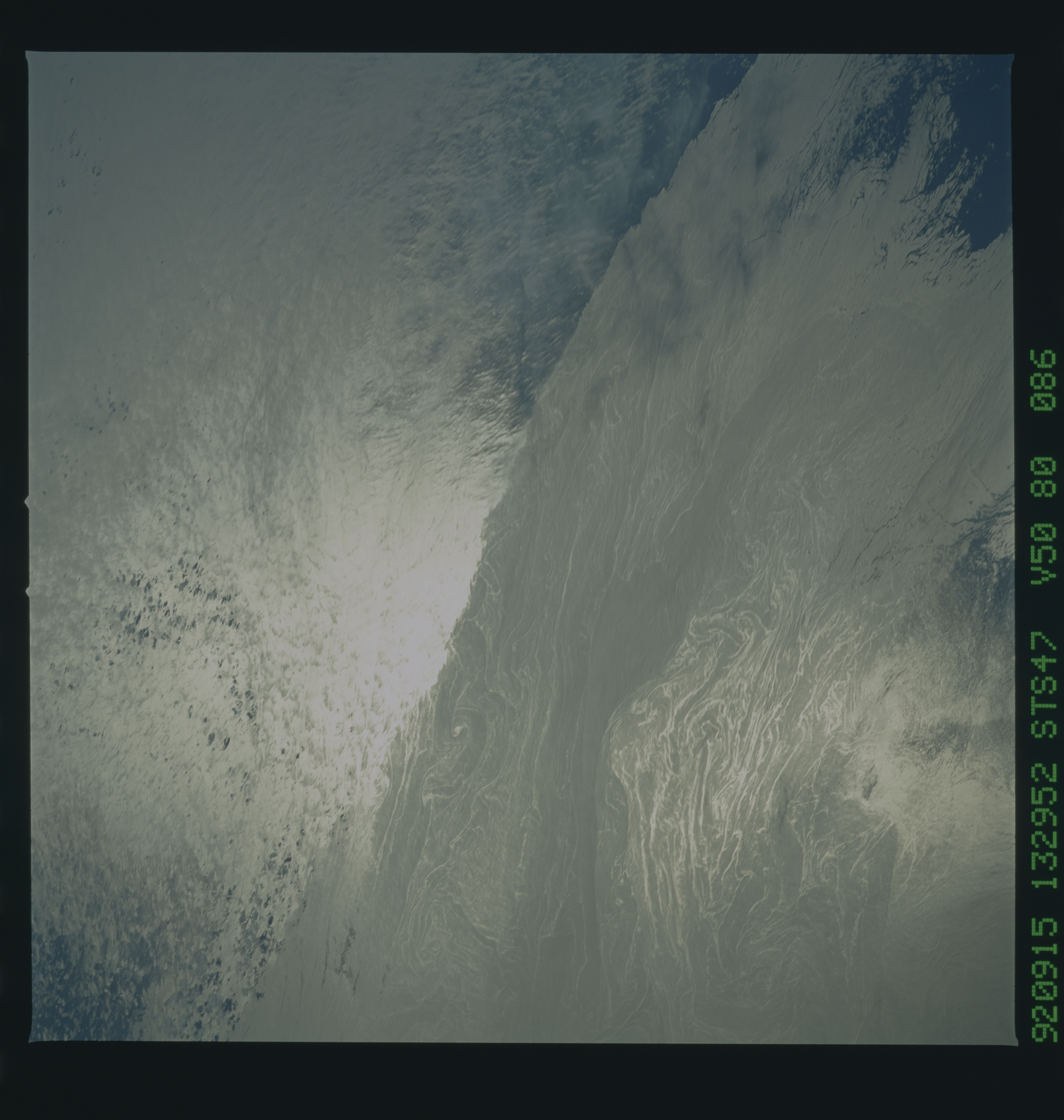
Spacecraft nadir point: 43.5° N, 65.4° W
Photo center point:
Photo center point by machine learning:
Photo center point:
Photo center point by machine learning:
Nadir to Photo Center:
Spacecraft Altitude: 168 nautical miles (311km)
Country or Geographic Name: | ATLANTIC OCEAN |
Features: | CURRENT BOUND., SUNGLINT |
| Features Found Using Machine Learning: | |
Cloud Cover Percentage: | 5 (1-10)% |
Sun Elevation Angle: | 35° |
Sun Azimuth: | 126° |
Camera: | Hasselblad |
Focal Length: | 250mm |
Camera Tilt: | Low Oblique |
Format: | VELVI: Fuji, natural color positive, Velvia 50, CS 135-36, ASA 32, standard base |
Film Exposure: | Normal |
| Additional Information | |
| Width | Height | Annotated | Cropped | Purpose | Links |
|---|---|---|---|---|---|
| 5700 pixels | 6000 pixels | No | No | Download Image | |
| 500 pixels | 526 pixels | No | No | Download Image | |
| 640 pixels | 480 pixels | No | No | Download Image |
Download Packaged File
Download a Google Earth KML for this Image
View photo footprint information
Download a GeoTIFF for this photo
Image Caption: This view of the ocean current boundry between the Gulf Stream of the North Atlantic Ocean and the coastal currents off the eastern seaboard of North America (43.5N, 65.5W), is an excellent study in ocean dynamics. The warm waters of the Gulf Stream are clearly visible as a dynamic rapidly flowing current with many internal wave patterns and a rougher surface versus the cooler and less active coastal shelf waters having a smoother surface.
