STS047-79-83
| NASA Photo ID | STS047-79-83 |
| Focal Length | 100mm |
| Date taken | 1992.09.15 |
| Time taken | 05:59:18 GMT |
Resolutions offered for this image:
540 x 543 pixels 764 x 768 pixels 3926 x 3926 pixels 640 x 640 pixels 5700 x 6000 pixels 500 x 526 pixels 640 x 480 pixels 2508 x 2544 pixels 2508 x 2544 pixels
540 x 543 pixels 764 x 768 pixels 3926 x 3926 pixels 640 x 640 pixels 5700 x 6000 pixels 500 x 526 pixels 640 x 480 pixels 2508 x 2544 pixels 2508 x 2544 pixels


Cloud masks available for this image:
Spacecraft nadir point: 49.1° N, 59.3° E
Photo center point: 45.0° N, 60.0° E
Photo center point by machine learning:
Photo center point: 45.0° N, 60.0° E
Photo center point by machine learning:
Nadir to Photo Center: South
Spacecraft Altitude: 169 nautical miles (313km)
Country or Geographic Name: | KAZAKHSTAN |
Features: | ARAL SEA |
| Features Found Using Machine Learning: | |
Cloud Cover Percentage: | 0 (no clouds present) |
Sun Elevation Angle: | 37° |
Sun Azimuth: | 142° |
Camera: | Hasselblad |
Focal Length: | 100mm |
Camera Tilt: | Low Oblique |
Format: | VELVI: Fuji, natural color positive, Velvia 50, CS 135-36, ASA 32, standard base |
Film Exposure: | Normal |
| Additional Information | |
| Width | Height | Annotated | Cropped | Purpose | Links |
|---|---|---|---|---|---|
| 540 pixels | 543 pixels | Photographic Highlights | Download Image | ||
| 764 pixels | 768 pixels | Photographic Highlights | Download Image | ||
| 3926 pixels | 3926 pixels | No | No | Earth From Space collection | Download Image |
| 640 pixels | 640 pixels | No | No | Earth From Space collection | Download Image |
| 5700 pixels | 6000 pixels | No | No | Download Image | |
| 500 pixels | 526 pixels | No | No | Download Image | |
| 640 pixels | 480 pixels | No | No | Download Image | |
| 2508 pixels | 2544 pixels | Download Image | |||
| 2508 pixels | 2544 pixels | Download Image |
Download Packaged File
Download a Google Earth KML for this Image
View photo footprint information
Download a GeoTIFF for this photo
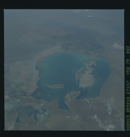
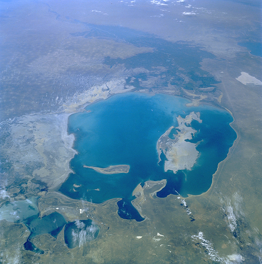
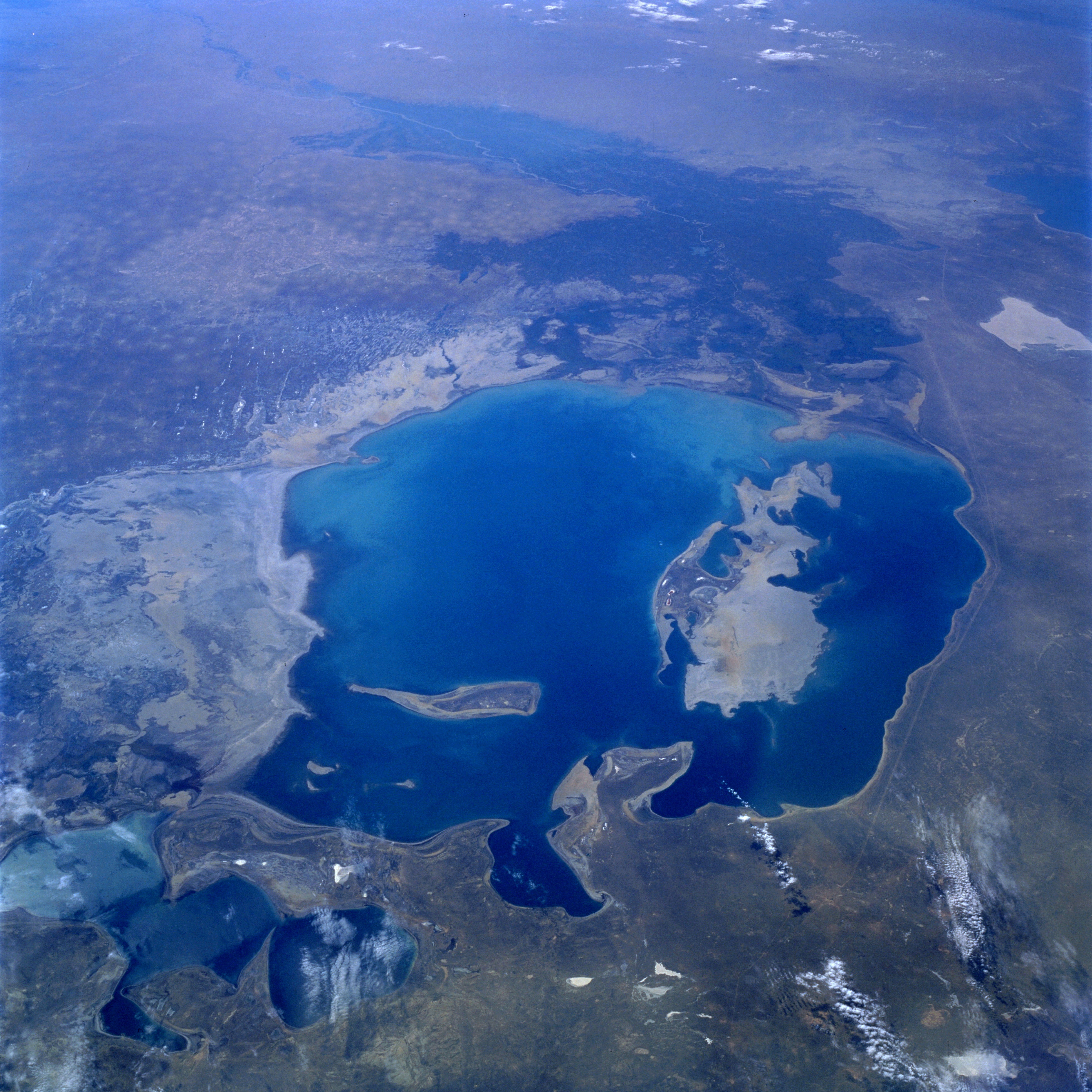
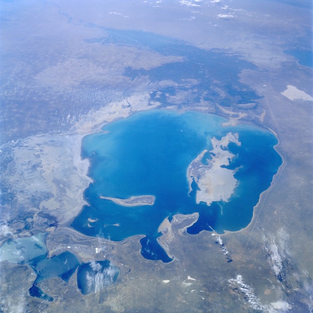
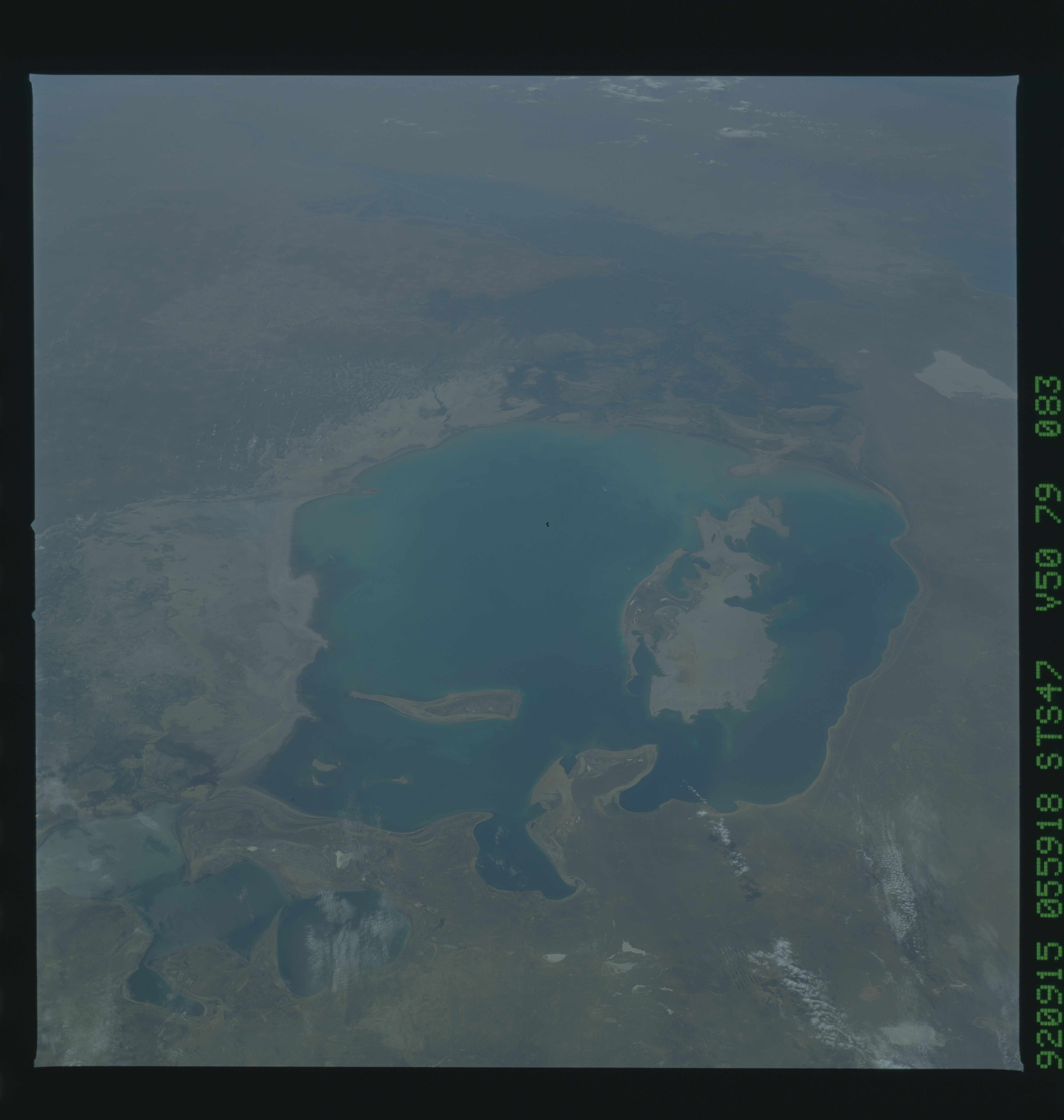
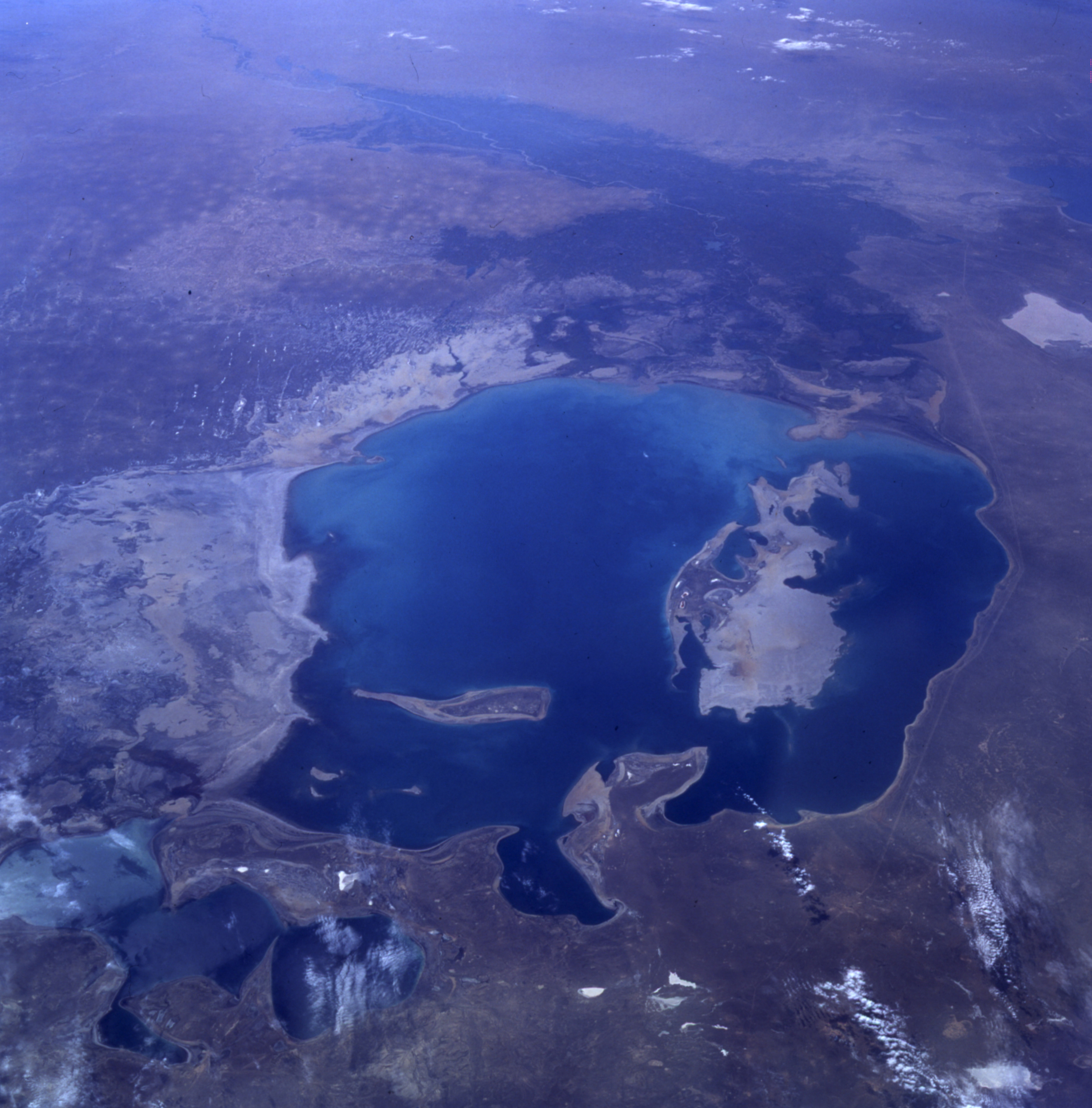
Image Caption: STS047-079-083 Aral Sea, Kazakhstan and Uzbekistan September 1992
A much depleted Aral Sea (refer to the July 1985 photograph STS-51F-036-0059) can be seen in this south-looking, low-oblique view. The emerging, pointed island of Barsa-Kel'mes and the expanding, broad Vozrozhdeniya Island are visible in the center of the sea. Vozrozhdeniya Island is expanding southward toward the Amu Darya River Delta and northward toward the growing Kulandy Peninsula. Continued shrinkage of the Aral Sea water levels will eventually cut off the western portion from the rest of the sea. This phenomenon has already occurred in the extreme northern portion of the sea. Because of dropping water levels, the Karatyup Peninsula (the stretch of land visible north of the main portion of the Aral Sea) has expanded eastward and connected with the delta of the Syr Darya River, cutting off the extreme northern portion from the larger main area of the Aral Sea. With no river inlet into this extreme north portion, it is only a matter of time before this area is reduced to a series of smaller lakes. East of the sea, more exposed shoreline is visible (whitish-gray). It is estimated that the Aral Sea water level has decreased 46 percent since 1960 and is continuing to decrease. The darker areas to the south are the irrigated agricultural lands of the Amu Darya River.
A much depleted Aral Sea (refer to the July 1985 photograph STS-51F-036-0059) can be seen in this south-looking, low-oblique view. The emerging, pointed island of Barsa-Kel'mes and the expanding, broad Vozrozhdeniya Island are visible in the center of the sea. Vozrozhdeniya Island is expanding southward toward the Amu Darya River Delta and northward toward the growing Kulandy Peninsula. Continued shrinkage of the Aral Sea water levels will eventually cut off the western portion from the rest of the sea. This phenomenon has already occurred in the extreme northern portion of the sea. Because of dropping water levels, the Karatyup Peninsula (the stretch of land visible north of the main portion of the Aral Sea) has expanded eastward and connected with the delta of the Syr Darya River, cutting off the extreme northern portion from the larger main area of the Aral Sea. With no river inlet into this extreme north portion, it is only a matter of time before this area is reduced to a series of smaller lakes. East of the sea, more exposed shoreline is visible (whitish-gray). It is estimated that the Aral Sea water level has decreased 46 percent since 1960 and is continuing to decrease. The darker areas to the south are the irrigated agricultural lands of the Amu Darya River.
