STS047-78-62

| NASA Photo ID | STS047-78-62 |
| Focal Length | 100mm |
| Date taken | 1992.09.15 |
| Time taken | 13:31:17 GMT |
Resolutions offered for this image:
5281 x 5277 pixels 640 x 639 pixels 5700 x 6000 pixels 500 x 526 pixels 640 x 480 pixels
5281 x 5277 pixels 640 x 639 pixels 5700 x 6000 pixels 500 x 526 pixels 640 x 480 pixels

Cloud masks available for this image:
Spacecraft nadir point: 47.1° N, 59.4° W
Photo center point: 46.0° N, 61.5° W
Photo center point by machine learning:
Photo center point: 46.0° N, 61.5° W
Photo center point by machine learning:
Nadir to Photo Center: Southwest
Spacecraft Altitude: 169 nautical miles (313km)
Country or Geographic Name: | CANADA-NS |
Features: | CAPE BRETON ISLAND |
| Features Found Using Machine Learning: | |
Cloud Cover Percentage: | 0 (no clouds present) |
Sun Elevation Angle: | 36° |
Sun Azimuth: | 134° |
Camera: | Hasselblad |
Focal Length: | 100mm |
Camera Tilt: | 40 degrees |
Format: | VELVI: Fuji, natural color positive, Velvia 50, CS 135-36, ASA 32, standard base |
Film Exposure: | Normal |
| Additional Information | |
| Width | Height | Annotated | Cropped | Purpose | Links |
|---|---|---|---|---|---|
| 5281 pixels | 5277 pixels | No | No | Earth From Space collection | Download Image |
| 640 pixels | 639 pixels | No | No | Earth From Space collection | Download Image |
| 5700 pixels | 6000 pixels | No | No | Download Image | |
| 500 pixels | 526 pixels | No | No | Download Image | |
| 640 pixels | 480 pixels | No | No | Download Image |
Download Packaged File
Download a Google Earth KML for this Image
View photo footprint information
Download a GeoTIFF for this photo
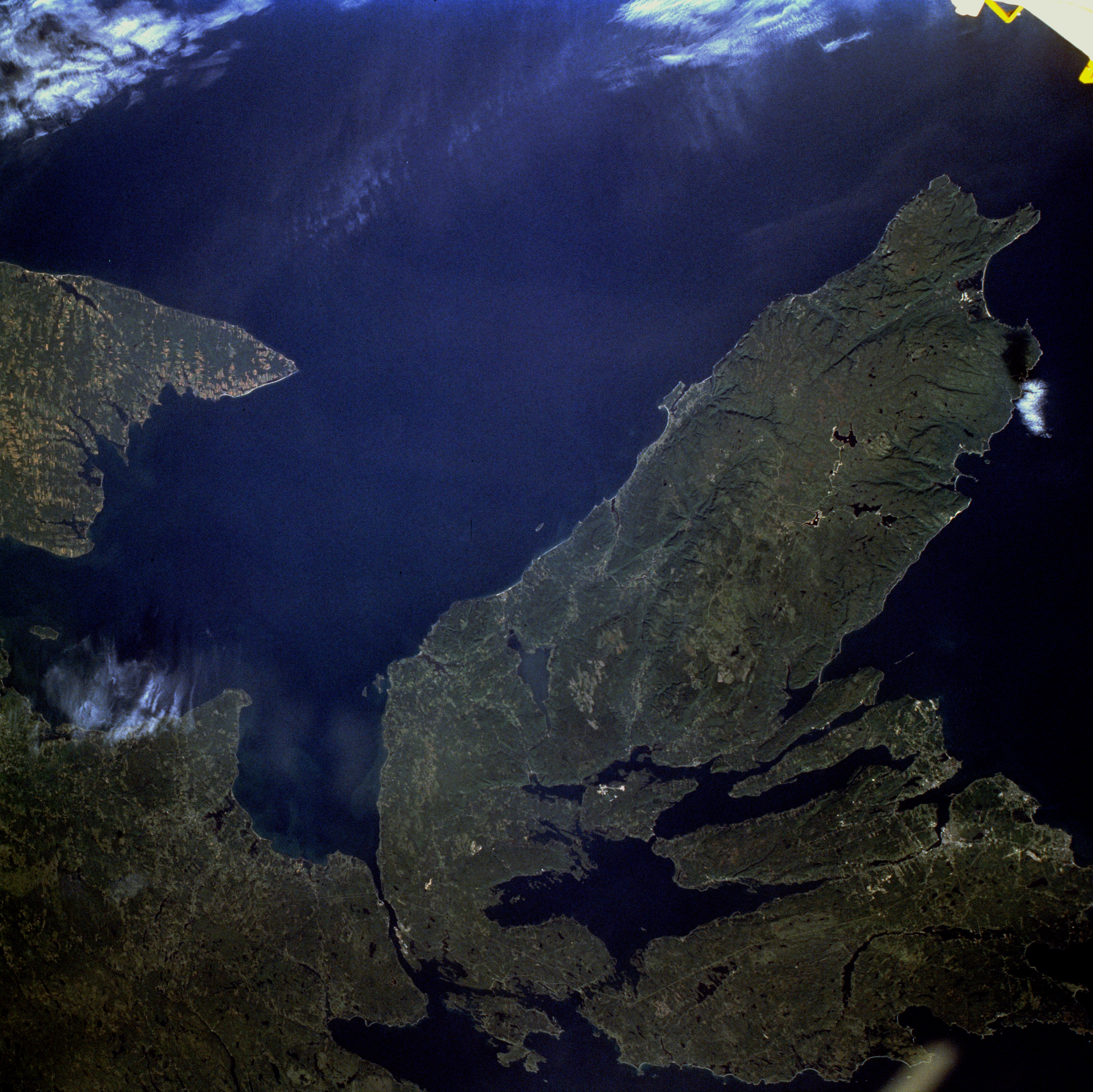
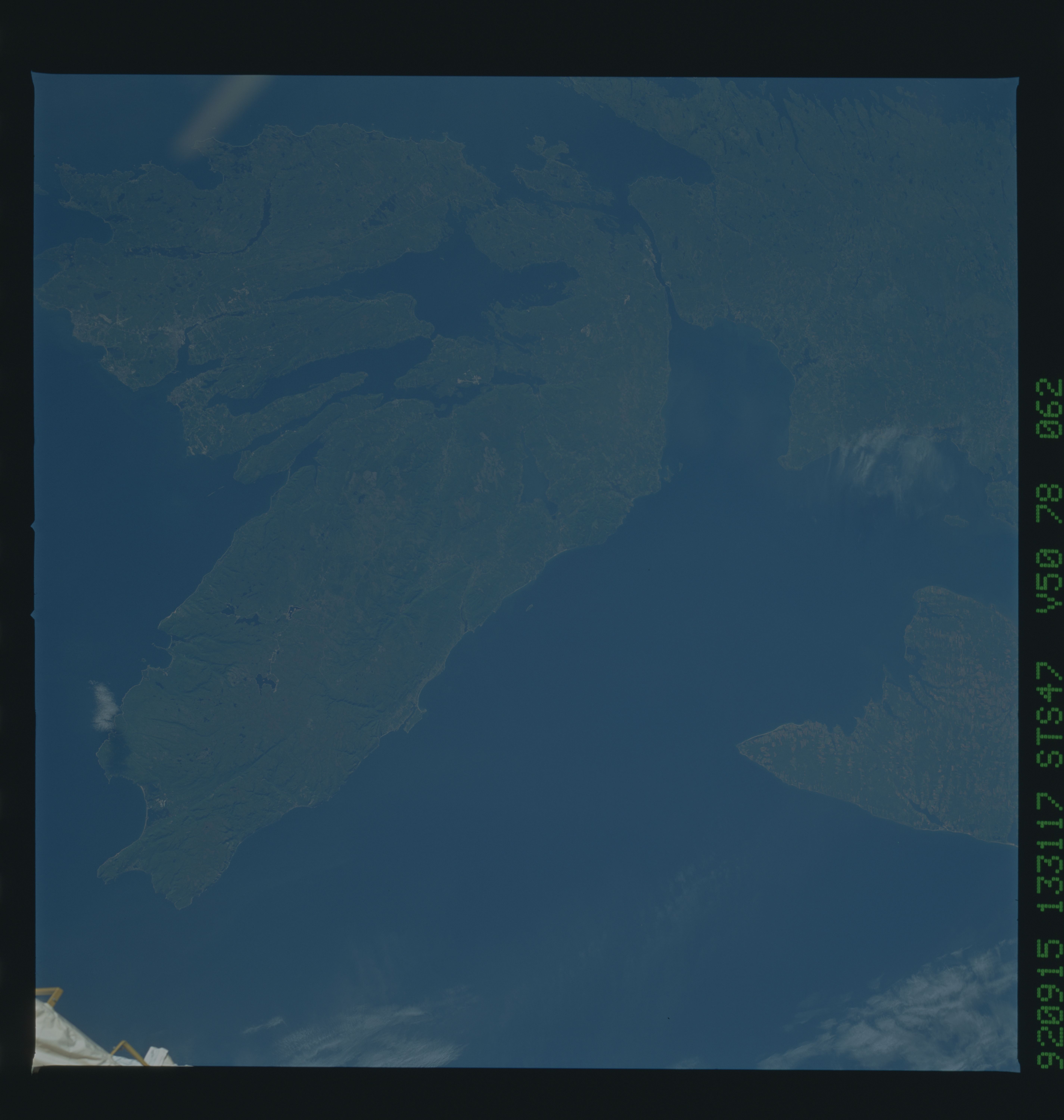
Image Caption: STS047-078-062 Cape Breton Island, Nova Scotia, Canada September 1992
The Canadian maritime province of Nova Scotia can be divided into two separate regions--Cape Breton Island and much larger, peninsular mainland Nova Scotia. Cape Breton Island is joined to the mainland by a causeway and a railroad spanning the narrow Strait of Canso. The small scale of this photograph helps to reveal the fragmented nature and the remoteness of the heavily forested landscape in the northeastern part of Nova Scotia. The Cape Breton Highlands on the larger peninsula that juts into the Gulf of St. Lawrence consist of steep cliffs and a rugged coastline, forming some of the most spectacular scenery in northeastern North America. St. George's Bay is the small bay west of the causeway, and the Northumberland Strait separates Cape Breton Island from the eastern end of Prince Edward Island, another maritime province of Canada (visible along the west margin of the photograph). Chedabucto Bay is the small bay east of the causeway bridges. Bras d'Or Lake is the large body of water in south-central Cape Breton Island, and St. Andrews Channel is the elongated, northeast-southwest-oriented water body north of Bras d'Or Lake. Cape Breton Island is noted for its superb fishing industry, coal mining operations around the city of Sydney, and its tourism industry. The port city of Sydney is visible along a highly reflective inverted Y-shaped inlet near the southeastern edge of the photograph.
The Canadian maritime province of Nova Scotia can be divided into two separate regions--Cape Breton Island and much larger, peninsular mainland Nova Scotia. Cape Breton Island is joined to the mainland by a causeway and a railroad spanning the narrow Strait of Canso. The small scale of this photograph helps to reveal the fragmented nature and the remoteness of the heavily forested landscape in the northeastern part of Nova Scotia. The Cape Breton Highlands on the larger peninsula that juts into the Gulf of St. Lawrence consist of steep cliffs and a rugged coastline, forming some of the most spectacular scenery in northeastern North America. St. George's Bay is the small bay west of the causeway, and the Northumberland Strait separates Cape Breton Island from the eastern end of Prince Edward Island, another maritime province of Canada (visible along the west margin of the photograph). Chedabucto Bay is the small bay east of the causeway bridges. Bras d'Or Lake is the large body of water in south-central Cape Breton Island, and St. Andrews Channel is the elongated, northeast-southwest-oriented water body north of Bras d'Or Lake. Cape Breton Island is noted for its superb fishing industry, coal mining operations around the city of Sydney, and its tourism industry. The port city of Sydney is visible along a highly reflective inverted Y-shaped inlet near the southeastern edge of the photograph.
