STS047-77-82

| NASA Photo ID | STS047-77-82 |
| Focal Length | 100mm |
| Date taken | 1992.09.14 |
| Time taken | 04:17:12 GMT |
Resolutions offered for this image:
5257 x 5047 pixels 640 x 614 pixels 5700 x 6000 pixels 500 x 526 pixels 640 x 480 pixels
5257 x 5047 pixels 640 x 614 pixels 5700 x 6000 pixels 500 x 526 pixels 640 x 480 pixels
Cloud masks available for this image:
Spacecraft nadir point: 43.1° N, 79.8° E
Photo center point: 42.5° N, 77.5° E
Photo center point by machine learning:
Photo center point: 42.5° N, 77.5° E
Photo center point by machine learning:
Nadir to Photo Center: West
Spacecraft Altitude: 169 nautical miles (313km)
Country or Geographic Name: | KYRGYZSTAN |
Features: | LAKE ISSYK-KUL |
| Features Found Using Machine Learning: | |
Cloud Cover Percentage: | 0 (no clouds present) |
Sun Elevation Angle: | 41° |
Sun Azimuth: | 132° |
Camera: | Hasselblad |
Focal Length: | 100mm |
Camera Tilt: | 40 degrees |
Format: | VELVI: Fuji, natural color positive, Velvia 50, CS 135-36, ASA 32, standard base |
Film Exposure: | Normal |
| Additional Information | |
| Width | Height | Annotated | Cropped | Purpose | Links |
|---|---|---|---|---|---|
| 5257 pixels | 5047 pixels | No | No | Earth From Space collection | Download Image |
| 640 pixels | 614 pixels | No | No | Earth From Space collection | Download Image |
| 5700 pixels | 6000 pixels | No | No | Download Image | |
| 500 pixels | 526 pixels | No | No | Download Image | |
| 640 pixels | 480 pixels | No | No | Download Image |
Download Packaged File
Download a Google Earth KML for this Image
View photo footprint information
Download a GeoTIFF for this photo
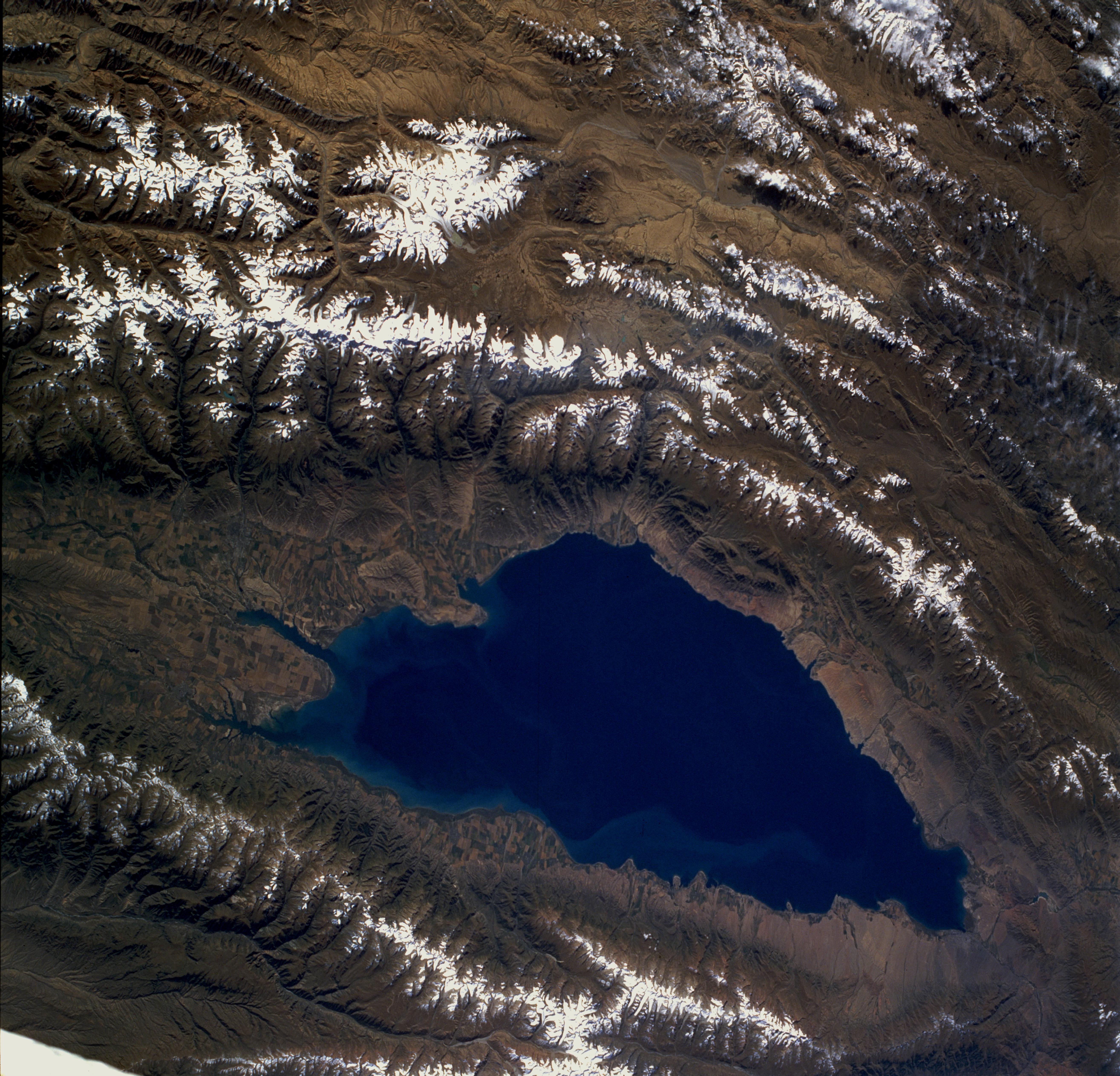
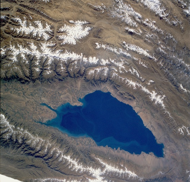
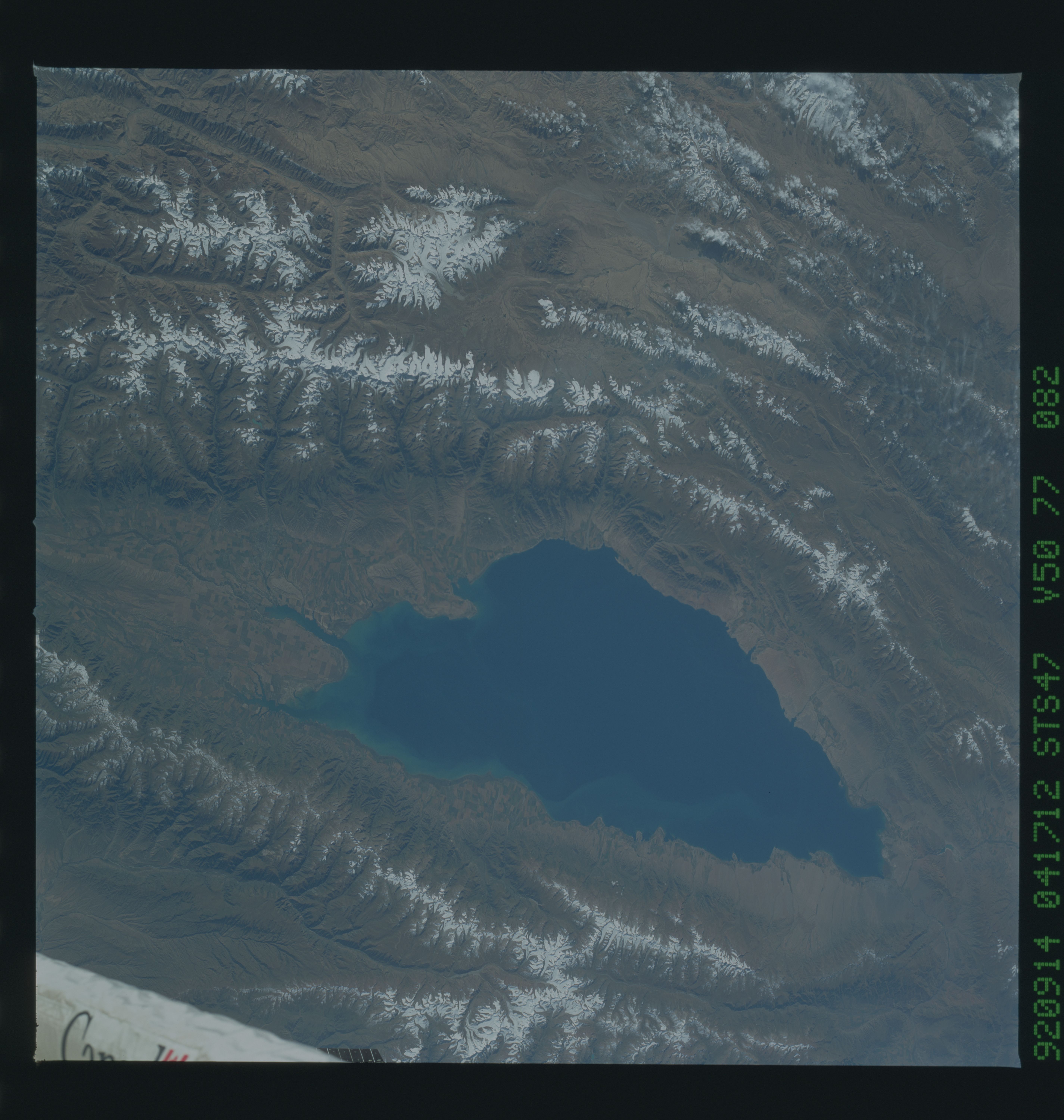
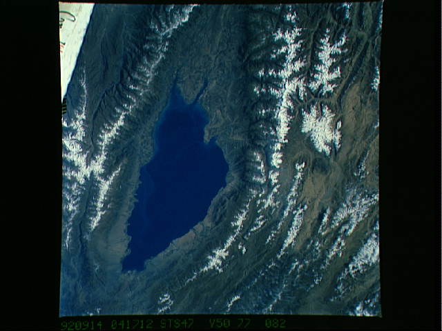
Image Caption: STS047-077-082 Lake Issyk-Kul', Kyrgystan September 1992
Lake Issyk-Kul', located in northeastern Kyrgystan, is a brackish lake surrounded by many of the lesser mountain ranges that comprise the formidable Tien Shan Range. Issyk-Kul', whose surface is approximately 1 mile (1.6 kilometers) above sea level, is an extremely deep lake, measuring 2303 feet (700 meters) at its deepest point. It is approximately 115 miles (195 kilometers) long and 38 miles (60 kilometers) at its maximum width. Cultivated field patterns can be seen around the periphery of the lake, with the most concentrated areas on the delta that has formed along the eastern end of the lake. The snowcapped mountain ranges to the north and south have peaks that vary in elevation from 13 000 to more than 18 000 feet (3960 to 5490 meters) above sea level. Practically all of the water needed for agriculture is obtained from the runoff from glaciers and snowmelt.
Lake Issyk-Kul', located in northeastern Kyrgystan, is a brackish lake surrounded by many of the lesser mountain ranges that comprise the formidable Tien Shan Range. Issyk-Kul', whose surface is approximately 1 mile (1.6 kilometers) above sea level, is an extremely deep lake, measuring 2303 feet (700 meters) at its deepest point. It is approximately 115 miles (195 kilometers) long and 38 miles (60 kilometers) at its maximum width. Cultivated field patterns can be seen around the periphery of the lake, with the most concentrated areas on the delta that has formed along the eastern end of the lake. The snowcapped mountain ranges to the north and south have peaks that vary in elevation from 13 000 to more than 18 000 feet (3960 to 5490 meters) above sea level. Practically all of the water needed for agriculture is obtained from the runoff from glaciers and snowmelt.
