STS047-77-58
| NASA Photo ID | STS047-77-58 |
| Focal Length | 100mm |
| Date taken | 1992.09.14 |
| Time taken | 03:05:34 GMT |
Cloud masks available for this image:
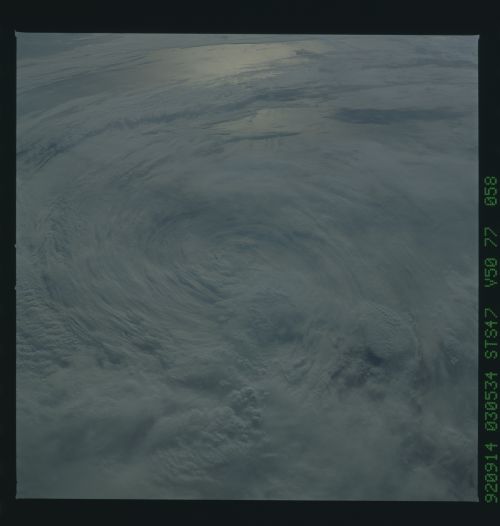
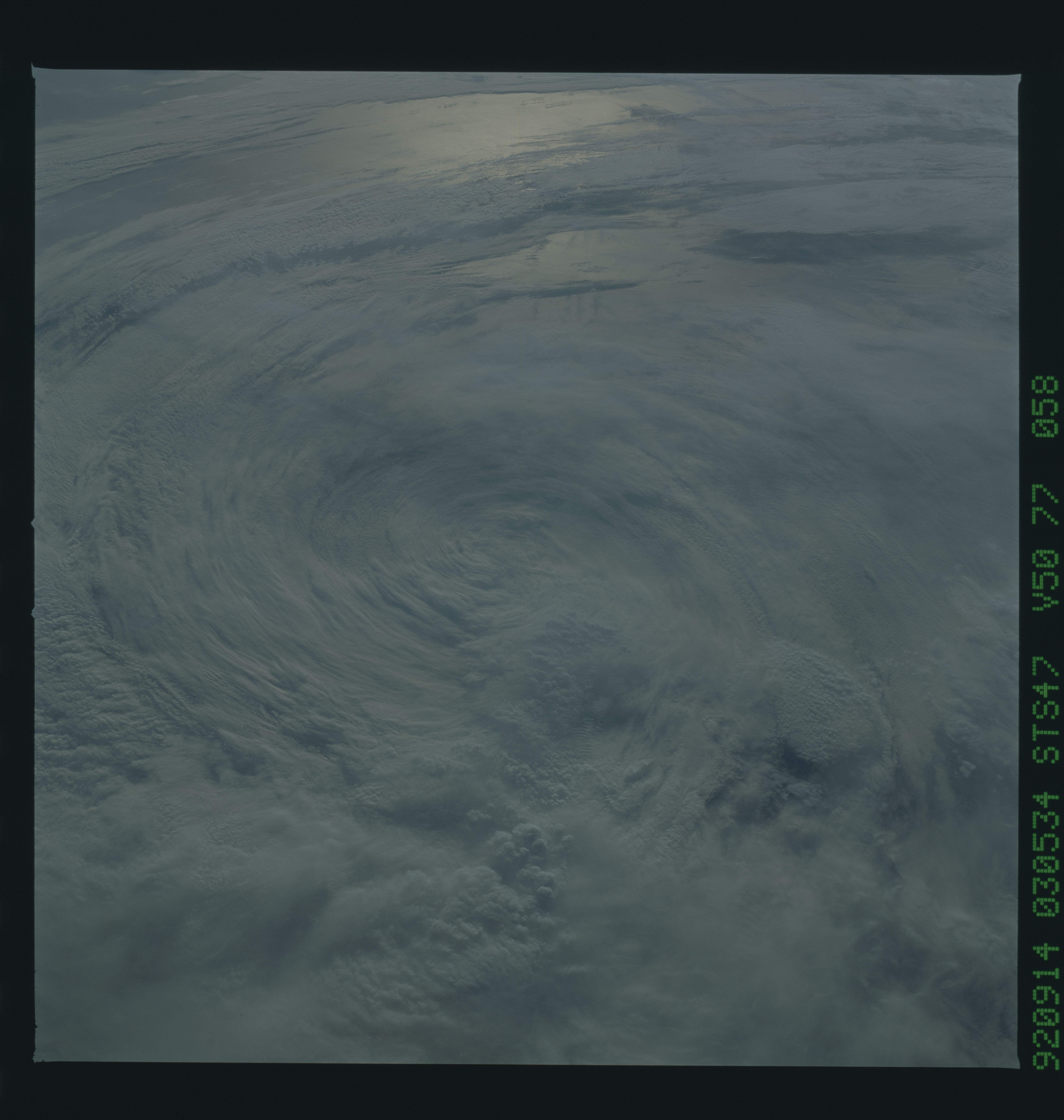
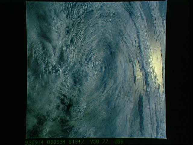
Spacecraft nadir point: 40.3° N, 152.5° W
Photo center point:
Photo center point by machine learning:
Photo center point:
Photo center point by machine learning:
Nadir to Photo Center:
Spacecraft Altitude: 169 nautical miles (313km)
Country or Geographic Name: | CLOUDS |
Features: | CYCLONTIC CIR., SUNGLINT |
| Features Found Using Machine Learning: | |
Cloud Cover Percentage: | 90 (76-100)% |
Sun Elevation Angle: | 15° |
Sun Azimuth: | 264° |
Camera: | Hasselblad |
Focal Length: | 100mm |
Camera Tilt: | Low Oblique |
Format: | VELVI: Fuji, natural color positive, Velvia 50, CS 135-36, ASA 32, standard base |
Film Exposure: | Under Exposed |
| Additional Information | |
| Width | Height | Annotated | Cropped | Purpose | Links |
|---|---|---|---|---|---|
| 5700 pixels | 6000 pixels | No | No | Download Image | |
| 500 pixels | 526 pixels | No | No | Download Image | |
| 640 pixels | 480 pixels | No | No | Download Image |
Download Packaged File
Download a Google Earth KML for this Image
View photo footprint information
Download a GeoTIFF for this photo
Image Caption: Tropical Storm Iniki in the North Pacific (40.5N, 152.5W) was dissipating from hurricane status when this photo was taken. Two days prior, as a full fledged hurricane, with winds of about 150 mph and waves of over 15 ft., it swept over the Hawaiian island of Kauai. But, as Iniki moved over the colder waters of the North Pacific, it began to weaken as can be seen by the lack of a tight spiral gyre and the absence of an eye in the center.
