STS047-75-82
| NASA Photo ID | STS047-75-82 |
| Focal Length | 250mm |
| Date taken | 1992.09.15 |
| Time taken | 04:40:32 GMT |
Resolutions offered for this image:
5266 x 5266 pixels 639 x 639 pixels 5700 x 6000 pixels 500 x 526 pixels 640 x 480 pixels
5266 x 5266 pixels 639 x 639 pixels 5700 x 6000 pixels 500 x 526 pixels 640 x 480 pixels


Cloud masks available for this image:
Spacecraft nadir point: 51.7° N, 156.1° E
Photo center point: 51.0° N, 155.5° E
Photo center point by machine learning:
Photo center point: 51.0° N, 155.5° E
Photo center point by machine learning:
Nadir to Photo Center: Southwest
Spacecraft Altitude: 171 nautical miles (317km)
Country or Geographic Name: | RUSSIAN FEDERATION |
Features: | KURIL I., ATLASOVA ISLAND |
| Features Found Using Machine Learning: | |
Cloud Cover Percentage: | 10 (1-10)% |
Sun Elevation Angle: | 27° |
Sun Azimuth: | 236° |
Camera: | Hasselblad |
Focal Length: | 250mm |
Camera Tilt: | 18 degrees |
Format: | VELVI: Fuji, natural color positive, Velvia 50, CS 135-36, ASA 32, standard base |
Film Exposure: | Normal |
| Additional Information | |
| Width | Height | Annotated | Cropped | Purpose | Links |
|---|---|---|---|---|---|
| 5266 pixels | 5266 pixels | No | No | Earth From Space collection | Download Image |
| 639 pixels | 639 pixels | No | No | Earth From Space collection | Download Image |
| 5700 pixels | 6000 pixels | No | No | Download Image | |
| 500 pixels | 526 pixels | No | No | Download Image | |
| 640 pixels | 480 pixels | No | No | Download Image |
Download Packaged File
Download a Google Earth KML for this Image
View photo footprint information
Download a GeoTIFF for this photo
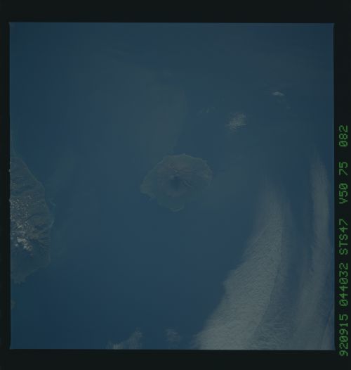
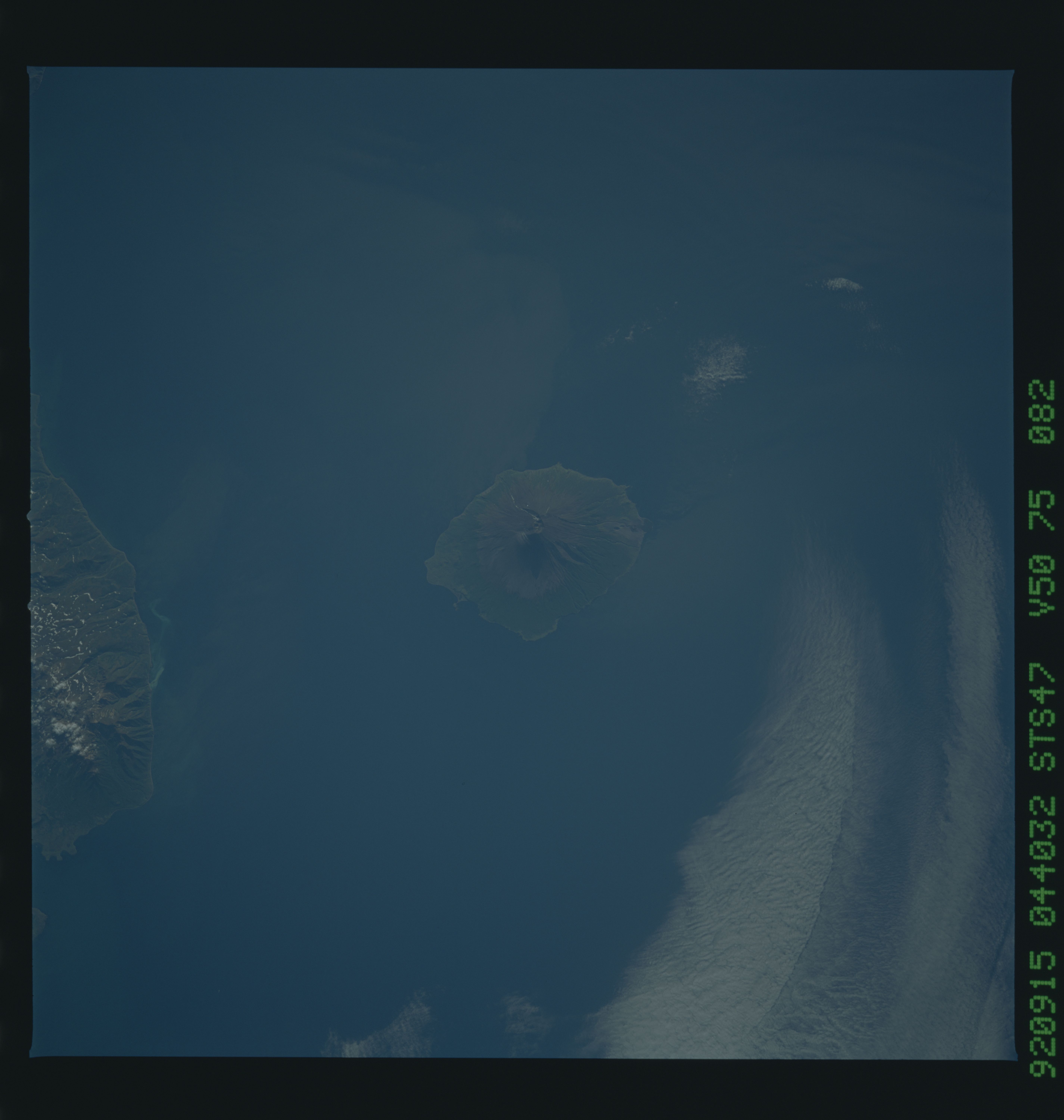
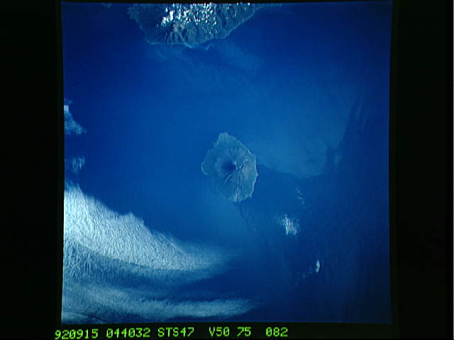
Image Caption: STS047-075-082 Atlasova Island, Kuril Islands, Russia September 1992
This low-oblique, southwest-looking photograph of Atlasova Island shows the classic radial drainage pattern seen in most stratovolcanoes. Atlasova Island is located at the northern end of the Kuril Islands arc about 60 miles (95 kilometers) west of the southern tip of Kamchatka Peninsula, Russia. This island's summit reaches 7675 feet (2340 meters) above sea level, making it the highest point in the Kuril chain. The other land visible in this photograph is the northern end of Paramushir Island, another volcanic island in the Kuril archipelago. The Kuril Islands are a continuation of the volcanic mountains of Kamchatka Peninsula to the north and the Japanese islands to the south. (Refer to STS-068-231-054 for a view of other Kuril Islands, including Onekotan Island.)
This low-oblique, southwest-looking photograph of Atlasova Island shows the classic radial drainage pattern seen in most stratovolcanoes. Atlasova Island is located at the northern end of the Kuril Islands arc about 60 miles (95 kilometers) west of the southern tip of Kamchatka Peninsula, Russia. This island's summit reaches 7675 feet (2340 meters) above sea level, making it the highest point in the Kuril chain. The other land visible in this photograph is the northern end of Paramushir Island, another volcanic island in the Kuril archipelago. The Kuril Islands are a continuation of the volcanic mountains of Kamchatka Peninsula to the north and the Japanese islands to the south. (Refer to STS-068-231-054 for a view of other Kuril Islands, including Onekotan Island.)
