STS047-73-56
| NASA Photo ID | STS047-73-56 |
| Focal Length | 250mm |
| Date taken | 1992.09.17 |
| Time taken | 23:08:12 GMT |
Resolutions offered for this image:
5285 x 5285 pixels 639 x 639 pixels 5700 x 6000 pixels 500 x 526 pixels 640 x 480 pixels
5285 x 5285 pixels 639 x 639 pixels 5700 x 6000 pixels 500 x 526 pixels 640 x 480 pixels

Cloud masks available for this image:
Spacecraft nadir point: 44.6° N, 120.9° W
Photo center point: 46.0° N, 122.0° W
Photo center point by machine learning:
Photo center point: 46.0° N, 122.0° W
Photo center point by machine learning:
Nadir to Photo Center: Northwest
Spacecraft Altitude: 169 nautical miles (313km)
Country or Geographic Name: | USA-WASHINGTON |
Features: | MT. ST. HELENS, RIFFE L. |
| Features Found Using Machine Learning: | |
Cloud Cover Percentage: | 20 (11-25)% |
Sun Elevation Angle: | 30° |
Sun Azimuth: | 240° |
Camera: | Hasselblad |
Focal Length: | 250mm |
Camera Tilt: | 32 degrees |
Format: | VELVI: Fuji, natural color positive, Velvia 50, CS 135-36, ASA 32, standard base |
Film Exposure: | Normal |
| Additional Information | |
| Width | Height | Annotated | Cropped | Purpose | Links |
|---|---|---|---|---|---|
| 5285 pixels | 5285 pixels | No | No | Earth From Space collection | Download Image |
| 639 pixels | 639 pixels | No | No | Earth From Space collection | Download Image |
| 5700 pixels | 6000 pixels | No | No | Download Image | |
| 500 pixels | 526 pixels | No | No | Download Image | |
| 640 pixels | 480 pixels | No | No | Download Image |
Download Packaged File
Download a Google Earth KML for this Image
View photo footprint information
Download a GeoTIFF for this photo
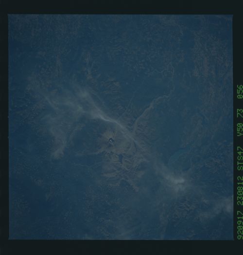
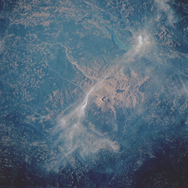
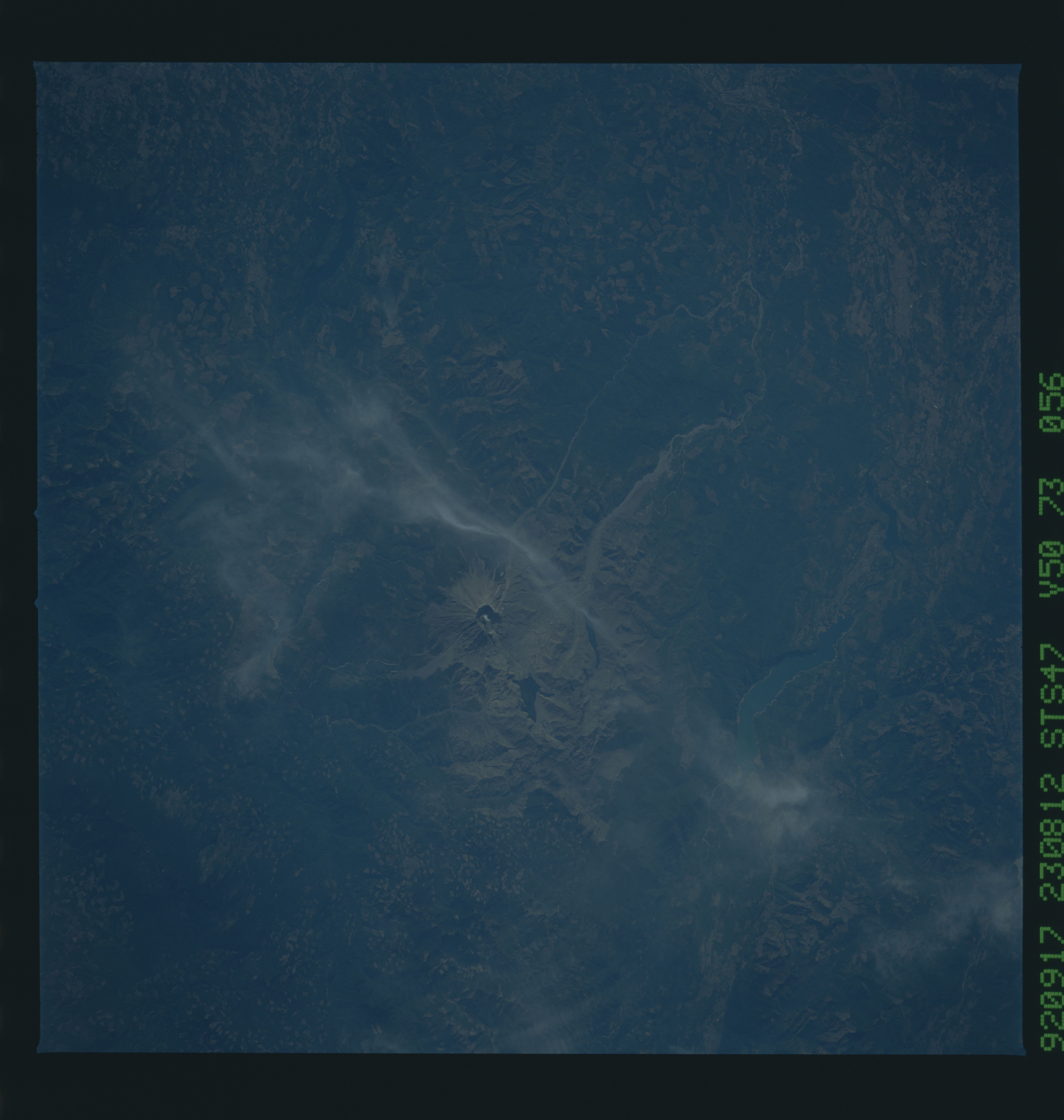
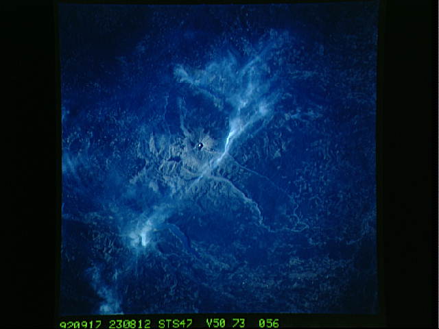
Image Caption: STS047-073-056 Mount Saint Helens Volcano, Washington, U.S.A. September 1992
The 230-square-mile (596-square-kilometer) blast zone from the eruption of Mount Saint Helens Volcano in May 1980 can be seen in this northwest-looking, low-oblique photograph. The former 9660-foot (2946-meter) volcanic mountain, part of the "Pacific Rim of Fire" that surrounds the Pacific Ocean Basin, lost 1300 feet (305 meters) as a result of the eruption. Hot ash and pumice, near-hurricane-force winds, and searing heat destroyed forest lands, wildlife, and human life in the blast zone. The photograph shows steam rising from the 1700-foot (518-meter) dome being built in the crater of the volcano. Tan ash and mud flows are still visible in the Toutle River Valley, which extends to the west of the volcano. Northwest of the volcano are the blue waters of Riffe Lake. Some clear-cut patterns are interspersed throughout the dark green Gifford Pinchot National Forest. (Refer to photographs STS-028-088-026 and STS-064-051-025 for more information about Mount Saint Helens Volcano.)
The 230-square-mile (596-square-kilometer) blast zone from the eruption of Mount Saint Helens Volcano in May 1980 can be seen in this northwest-looking, low-oblique photograph. The former 9660-foot (2946-meter) volcanic mountain, part of the "Pacific Rim of Fire" that surrounds the Pacific Ocean Basin, lost 1300 feet (305 meters) as a result of the eruption. Hot ash and pumice, near-hurricane-force winds, and searing heat destroyed forest lands, wildlife, and human life in the blast zone. The photograph shows steam rising from the 1700-foot (518-meter) dome being built in the crater of the volcano. Tan ash and mud flows are still visible in the Toutle River Valley, which extends to the west of the volcano. Northwest of the volcano are the blue waters of Riffe Lake. Some clear-cut patterns are interspersed throughout the dark green Gifford Pinchot National Forest. (Refer to photographs STS-028-088-026 and STS-064-051-025 for more information about Mount Saint Helens Volcano.)
