STS047-153-294
| NASA Photo ID | STS047-153-294 |
| Focal Length | 90mm |
| Date taken | 1992.09.16 |
| Time taken | 09:02:45 GMT |
Resolutions offered for this image:
640 x 480 pixels
640 x 480 pixels
Cloud masks available for this image:
Spacecraft nadir point: 30.8° N, 18.4° W
Photo center point: 27.0° N, 17.0° W
Photo center point by machine learning:
Photo center point: 27.0° N, 17.0° W
Photo center point by machine learning:
Nadir to Photo Center: South
Spacecraft Altitude: 166 nautical miles (307km)
Country or Geographic Name: | CANARY ISLANDS |
Features: | CIRCULAR CLOUDS, ISLANDS |
| Features Found Using Machine Learning: | |
Cloud Cover Percentage: | 20 (11-25)% |
Sun Elevation Angle: | 33° |
Sun Azimuth: | 121° |
Camera: | Linhof |
Focal Length: | 90mm |
Camera Tilt: | High Oblique |
Format: | QX868: Kodak, natural color positive, Ektachrome QX868(5017 emulsion), ASA 64, thin base |
Film Exposure: | Normal |
| Additional Information | |
| Width | Height | Annotated | Cropped | Purpose | Links |
|---|---|---|---|---|---|
| 640 pixels | 480 pixels | No | No | ISD 1 | Download Image |
Download Packaged File
Download a Google Earth KML for this Image
View photo footprint information
Download a GeoTIFF for this photo
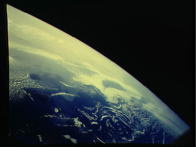
Image Caption:
Von Karman Vortices south of the Canary Islands STS047-153-294
(east) STS047-153-294 (west)
9/16/92 09:02:45GMT Good synoptic view of eddies formed when
maritime air is forced around an island barrier creating eddies
in the horizontal flow. These eddies are known as Von Karman
vortices. Also visible is African dust moving southeast from
Mauritania.
