STS047-153-288
| NASA Photo ID | STS047-153-288 |
| Focal Length | 90mm |
| Date taken | 1992.09.16 |
| Time taken | 07:37:10 GMT |
Resolutions offered for this image:
640 x 480 pixels
640 x 480 pixels
Cloud masks available for this image:
Spacecraft nadir point: 45.0° N, 20.8° E
Photo center point: 42.0° N, 22.0° E
Photo center point by machine learning:
Photo center point: 42.0° N, 22.0° E
Photo center point by machine learning:
Nadir to Photo Center: South
Spacecraft Altitude: 168 nautical miles (311km)
Country or Geographic Name: | MACEDONIA |
Features: | DINARIC ALPS, COAST, HAZE |
| Features Found Using Machine Learning: | |
Cloud Cover Percentage: | 5 (1-10)% |
Sun Elevation Angle: | 31° |
Sun Azimuth: | 117° |
Camera: | Linhof |
Focal Length: | 90mm |
Camera Tilt: | High Oblique |
Format: | QX868: Kodak, natural color positive, Ektachrome QX868(5017 emulsion), ASA 64, thin base |
Film Exposure: | Normal |
| Additional Information | |
| Width | Height | Annotated | Cropped | Purpose | Links |
|---|---|---|---|---|---|
| 640 pixels | 480 pixels | No | No | ISD 1 | Download Image |
Download Packaged File
Download a Google Earth KML for this Image
View photo footprint information
Download a GeoTIFF for this photo
Image Caption:
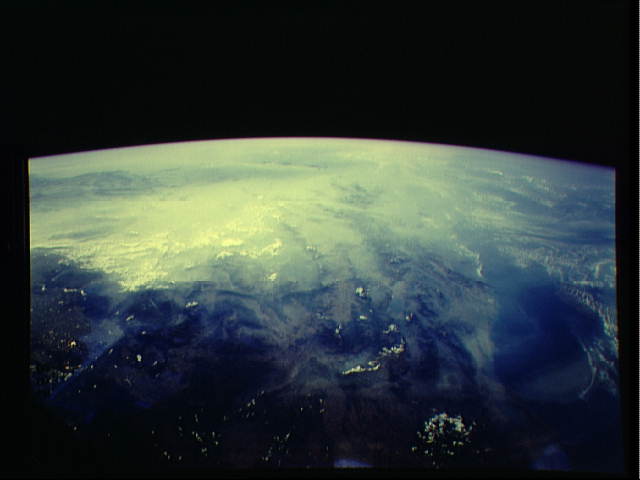
Danube Pollution 9/16/92 07:37:10GMT STS047-153-288
(east) STS047-153-288 (west)
This panoramic view south over the former Yugoslavia shows a vast
pollution pall. Pollution from the cities of Zagreb (Slovenia),
Belgrade (Serbia), and Budapest (Hungary) along the valley of the
Danube are point sources within this vast pall.
