STS047-153-193
| NASA Photo ID | STS047-153-193 |
| Focal Length | 250mm |
| Date taken | 1992.09.15 |
| Time taken | 02:54:54 GMT |
Cloud masks available for this image:
Spacecraft nadir point: 40.8° N, 91.8° E
Photo center point: 40.0° N, 91.0° E
Photo center point by machine learning:
Photo center point: 40.0° N, 91.0° E
Photo center point by machine learning:
Nadir to Photo Center: Southwest
Spacecraft Altitude: 168 nautical miles (311km)
Country or Geographic Name: | CHINA |
Features: | KUMTAG DES., LOP NUR |
| Features Found Using Machine Learning: | |
Cloud Cover Percentage: | 0 (no clouds present) |
Sun Elevation Angle: | 40° |
Sun Azimuth: | 166° |
Camera: | Linhof |
Focal Length: | 250mm |
Camera Tilt: | 22 degrees |
Format: | QX868: Kodak, natural color positive, Ektachrome QX868(5017 emulsion), ASA 64, thin base |
Film Exposure: | Normal |
| Additional Information | |
| Width | Height | Annotated | Cropped | Purpose | Links |
|---|---|---|---|---|---|
| 5643 pixels | 4457 pixels | No | No | Earth From Space collection | Download Image |
| 640 pixels | 505 pixels | No | No | Earth From Space collection | Download Image |
| 640 pixels | 480 pixels | No | No | ISD 1 | Download Image |
Download Packaged File
Download a Google Earth KML for this Image
View photo footprint information
Download a GeoTIFF for this photo
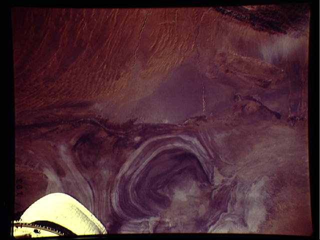
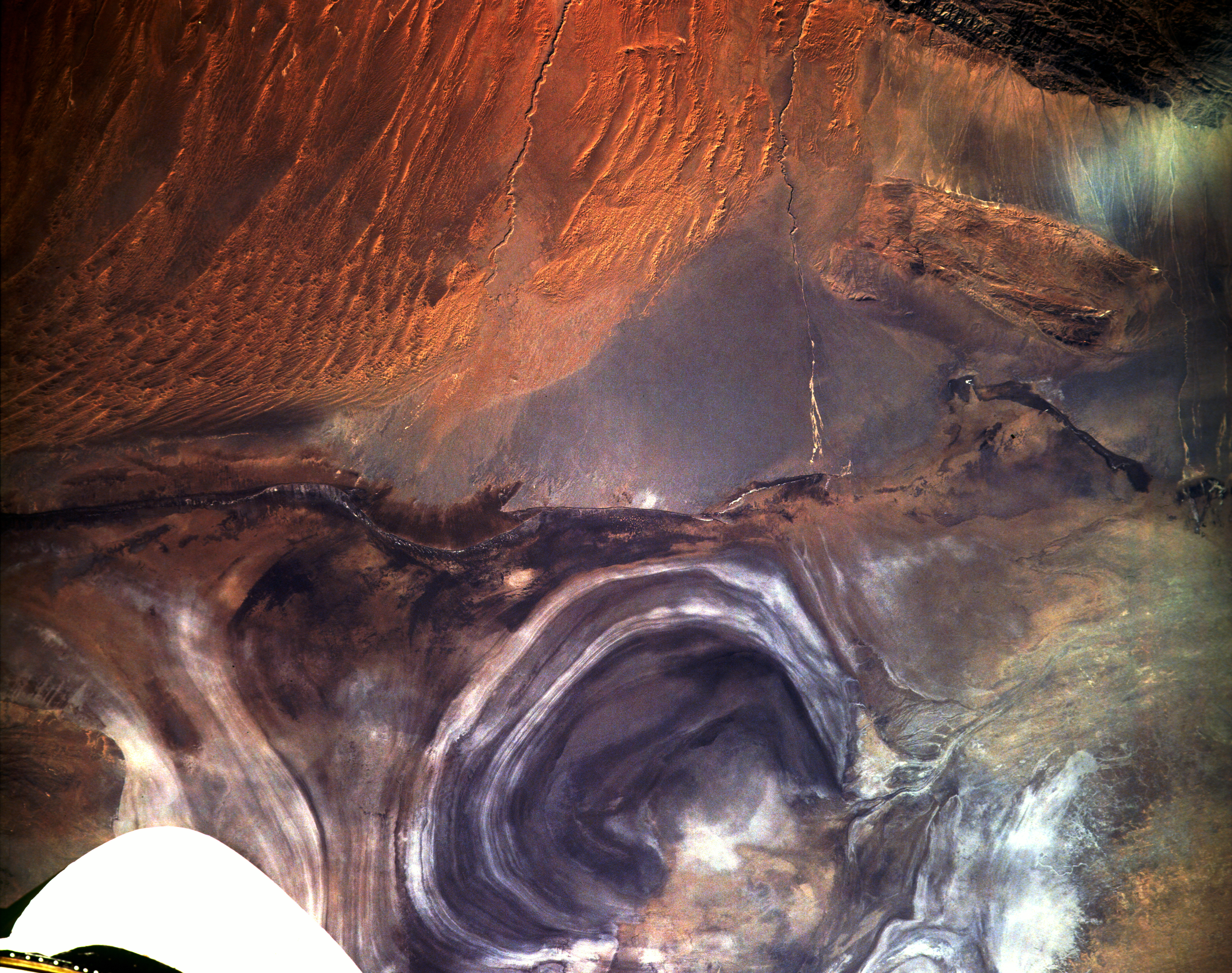
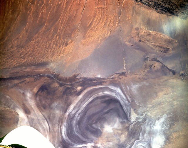
Image Caption: STS047-153-193 Lop Nur (Salt Lake), China September 1992
Lop Nur, on the Tarim Basin's eastern edge in western China's Zinjiang Province, was created by a series of water level oscillations within the former lake. The concentric rings formed as the water evaporated from the lake and left various mineral deposits, including highly reflective salts, along the new shoreline. The former lake, which now resembles a giant ear, is large enough for Space Shuttle astronauts to use as an identifiable landmark from orbital altitudes. Two entrenched drainage streambeds flow north toward the salt lake. Little water appears to have been transported to Lop Nur through these watercourses for many years. Visible are a small plateau approximately 3000 feet (915 meters) above the terrain south of Lop Nur and extensive sand dunes and sand ridges to the southeast.
Lop Nur, on the Tarim Basin's eastern edge in western China's Zinjiang Province, was created by a series of water level oscillations within the former lake. The concentric rings formed as the water evaporated from the lake and left various mineral deposits, including highly reflective salts, along the new shoreline. The former lake, which now resembles a giant ear, is large enough for Space Shuttle astronauts to use as an identifiable landmark from orbital altitudes. Two entrenched drainage streambeds flow north toward the salt lake. Little water appears to have been transported to Lop Nur through these watercourses for many years. Visible are a small plateau approximately 3000 feet (915 meters) above the terrain south of Lop Nur and extensive sand dunes and sand ridges to the southeast.
