STS047-151-488
| NASA Photo ID | STS047-151-488 |
| Focal Length | 90mm |
| Date taken | 1992.09.15 |
| Time taken | 18:03:59 GMT |

Cloud masks available for this image:
Spacecraft nadir point: 49.4° N, 123.9° W
Photo center point: 48.0° N, 123.0° W
Photo center point by machine learning:
Photo center point: 48.0° N, 123.0° W
Photo center point by machine learning:
Nadir to Photo Center: Southeast
Spacecraft Altitude: 169 nautical miles (313km)
Country or Geographic Name: | USA-WASHINGTON |
Features: | PUGET SOUND, VANCOUVER |
| Features Found Using Machine Learning: | |
Cloud Cover Percentage: | 15 (11-25)% |
Sun Elevation Angle: | 36° |
Sun Azimuth: | 139° |
Camera: | Linhof |
Focal Length: | 90mm |
Camera Tilt: | 31 degrees |
Format: | QX868: Kodak, natural color positive, Ektachrome QX868(5017 emulsion), ASA 64, thin base |
Film Exposure: | Normal |
| Additional Information | |
| Width | Height | Annotated | Cropped | Purpose | Links |
|---|---|---|---|---|---|
| 640 pixels | 480 pixels | No | No | ISD 1 | Download Image |
| 3000 pixels | 2362 pixels | No | No | Download Image | |
| 640 pixels | 503 pixels | No | No | Download Image |
Download Packaged File
Download a Google Earth KML for this Image
View photo footprint information
Download a GeoTIFF for this photo
Image Caption: STS047-151-488
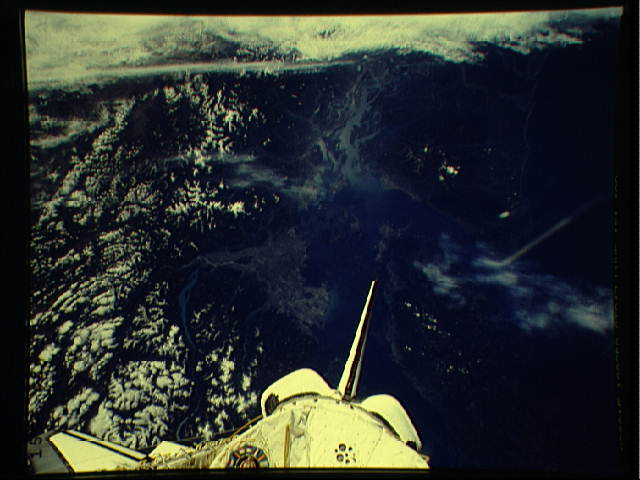
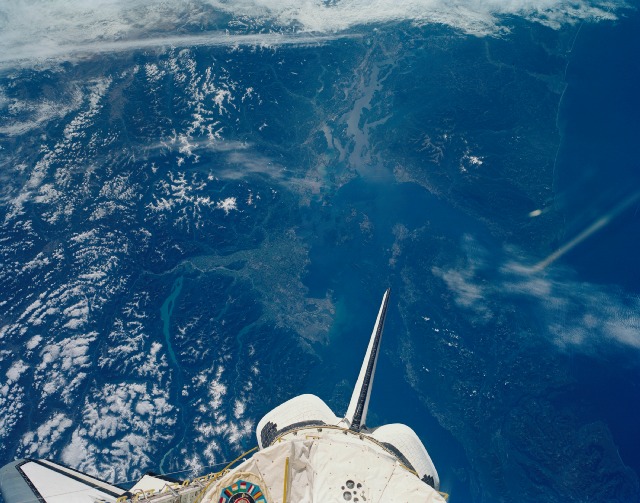
Vancouver, British Columbia, Canada The city of Vancouver, British
Columbia can be seen as a "V" shaped area to the left of the Shuttle
tail. Vancouver Island is to the right of the Shuttle, and the
northern part of the Olympic Peninsula is above the Shuttle tail.
North is towards bottom, center. T251
The Olympic Peninsula of NW Washington state, Puget Sound and the Cascade Range of British Columbia, Canada form the setting for this unusually clear photo of one of the most cloudy sections of North America (48.0N, 123.0W) where rainfall exceeds 120 inches anually. The cities of Seattle/Tacoma and Burlington, as well as the Canadian city of Vancouver can be seen in great detail along the heavily indented coastline of this glacier sculpted scene.
