STS047-151-222
| NASA Photo ID | STS047-151-222 |
| Focal Length | 250mm |
| Date taken | 1992.09.14 |
| Time taken | 02:53:43 GMT |
Resolutions offered for this image:
640 x 480 pixels
640 x 480 pixels
Cloud masks available for this image:
Spacecraft nadir point: 56.3° N, 140.0° E
Photo center point: 52.5° N, 139.5° E
Photo center point by machine learning:
Photo center point: 52.5° N, 139.5° E
Photo center point by machine learning:
Nadir to Photo Center: South
Spacecraft Altitude: 171 nautical miles (317km)
Country or Geographic Name: | RUSSIAN FEDERATION |
Features: | MOUTH OF AMUR RIVER |
| Features Found Using Machine Learning: | |
Cloud Cover Percentage: | 70 (51-75)% |
Sun Elevation Angle: | 37° |
Sun Azimuth: | 187° |
Camera: | Linhof |
Focal Length: | 250mm |
Camera Tilt: | 53 degrees |
Format: | QX868: Kodak, natural color positive, Ektachrome QX868(5017 emulsion), ASA 64, thin base |
Film Exposure: | Under Exposed |
| Additional Information | |
| Width | Height | Annotated | Cropped | Purpose | Links |
|---|---|---|---|---|---|
| 640 pixels | 480 pixels | No | No | ISD 1 | Download Image |
Download Packaged File
Download a Google Earth KML for this Image
View photo footprint information
Download a GeoTIFF for this photo
Image Caption:
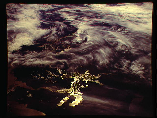
STS047-151-222, 223 LOWER AMUR RIVER PLAIN, Russian Far East.
This summer view of the lower Amur River basin shows large tracts
of lakes, anastomosing stream beds and swampy country, clearly
lit up in sunglint.
STS047-151-222, 223 LOWER AMUR RIVER PLAIN, Russian Far East.
This summer view of the lower Amur River basin shows large tracts
of lakes, anastomosing stream beds and swampy country, clearly
lit up in sunglint.
