STS047-151-103
| NASA Photo ID | STS047-151-103 |
| Focal Length | 250mm |
| Date taken | 1992.09.13 |
| Time taken | 22:25:10 GMT |

Cloud masks available for this image:
Spacecraft nadir point: 56.8° N, 128.9° W
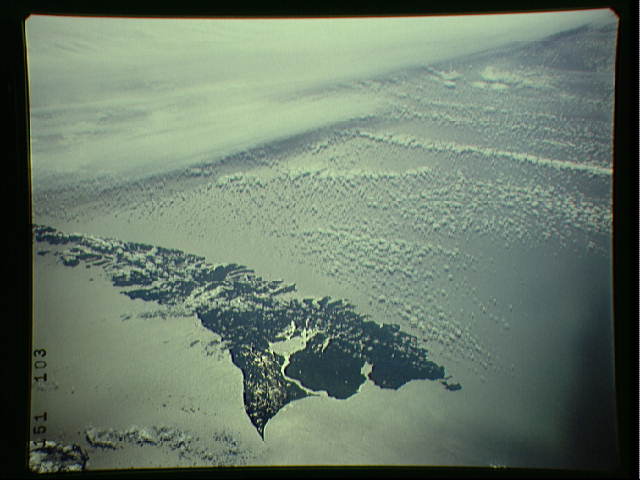
Photo center point: 53.0° N, 133.0° W
Photo center point by machine learning:
Photo center point: 53.0° N, 133.0° W
Photo center point by machine learning:
Nadir to Photo Center: Southwest
Spacecraft Altitude: 171 nautical miles (317km)
Country or Geographic Name: | CANADA-BC |
Features: | QUEEN CHARLOTTE ISLAND |
| Features Found Using Machine Learning: | |
Cloud Cover Percentage: | 50 (26-50)% |
Sun Elevation Angle: | 32° |
Sun Azimuth: | 214° |
Camera: | Linhof |
Focal Length: | 250mm |
Camera Tilt: | Low Oblique |
Format: | QX868: Kodak, natural color positive, Ektachrome QX868(5017 emulsion), ASA 64, thin base |
Film Exposure: | Over Exposed |
| Additional Information | |
| Width | Height | Annotated | Cropped | Purpose | Links |
|---|---|---|---|---|---|
| 7546 pixels | 6000 pixels | No | No | Scientist Request | Download Image |
| 640 pixels | 480 pixels | No | No | ISD 1 | Download Image |
Download Packaged File
Download a Google Earth KML for this Image
View photo footprint information
Download a GeoTIFF for this photo
Image Caption: none
