STS046-93-62
| NASA Photo ID | STS046-93-62 |
| Focal Length | 250mm |
| Date taken | 1992.08.08 |
| Time taken | 01:09:35 GMT |
Resolutions offered for this image:
4096 x 4096 pixels 640 x 640 pixels 5700 x 6000 pixels 500 x 526 pixels 640 x 480 pixels 612 x 622 pixels
4096 x 4096 pixels 640 x 640 pixels 5700 x 6000 pixels 500 x 526 pixels 640 x 480 pixels 612 x 622 pixels

Cloud masks available for this image:
Spacecraft nadir point: 17.9° N, 104.9° E
Photo center point: 20.0° N, 106.5° E
Photo center point by machine learning:
Photo center point: 20.0° N, 106.5° E
Photo center point by machine learning:
Nadir to Photo Center: Northeast
Spacecraft Altitude: 124 nautical miles (230km)
Country or Geographic Name: | VIETNAM |
Features: | RED RIVER DELTA, SEDIMNT |
| Features Found Using Machine Learning: | |
Cloud Cover Percentage: | 0 (no clouds present) |
Sun Elevation Angle: | 35° |
Sun Azimuth: | 82° |
Camera: | Hasselblad |
Focal Length: | 250mm |
Camera Tilt: | 52 degrees |
Format: | 2443: Kodak Aerochrome 2443, color IR, thin base, EA-5 process thru June 1999, E-6 process afterward |
Film Exposure: | Normal |
| Additional Information | |
| Width | Height | Annotated | Cropped | Purpose | Links |
|---|---|---|---|---|---|
| 4096 pixels | 4096 pixels | No | No | Earth From Space collection | Download Image |
| 640 pixels | 640 pixels | No | No | Earth From Space collection | Download Image |
| 5700 pixels | 6000 pixels | No | No | Download Image | |
| 500 pixels | 526 pixels | No | No | Download Image | |
| 640 pixels | 480 pixels | No | No | Download Image | |
| 612 pixels | 622 pixels | No | No | Download Image |
Download Packaged File
Download a Google Earth KML for this Image
View photo footprint information
Download a GeoTIFF for this photo
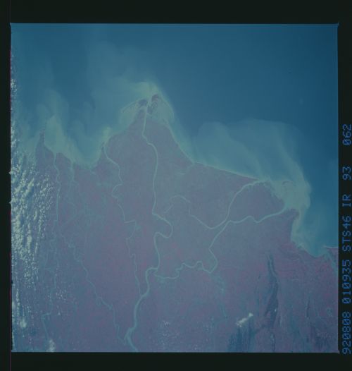
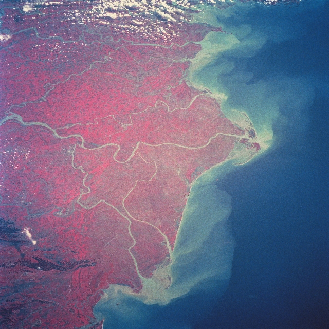
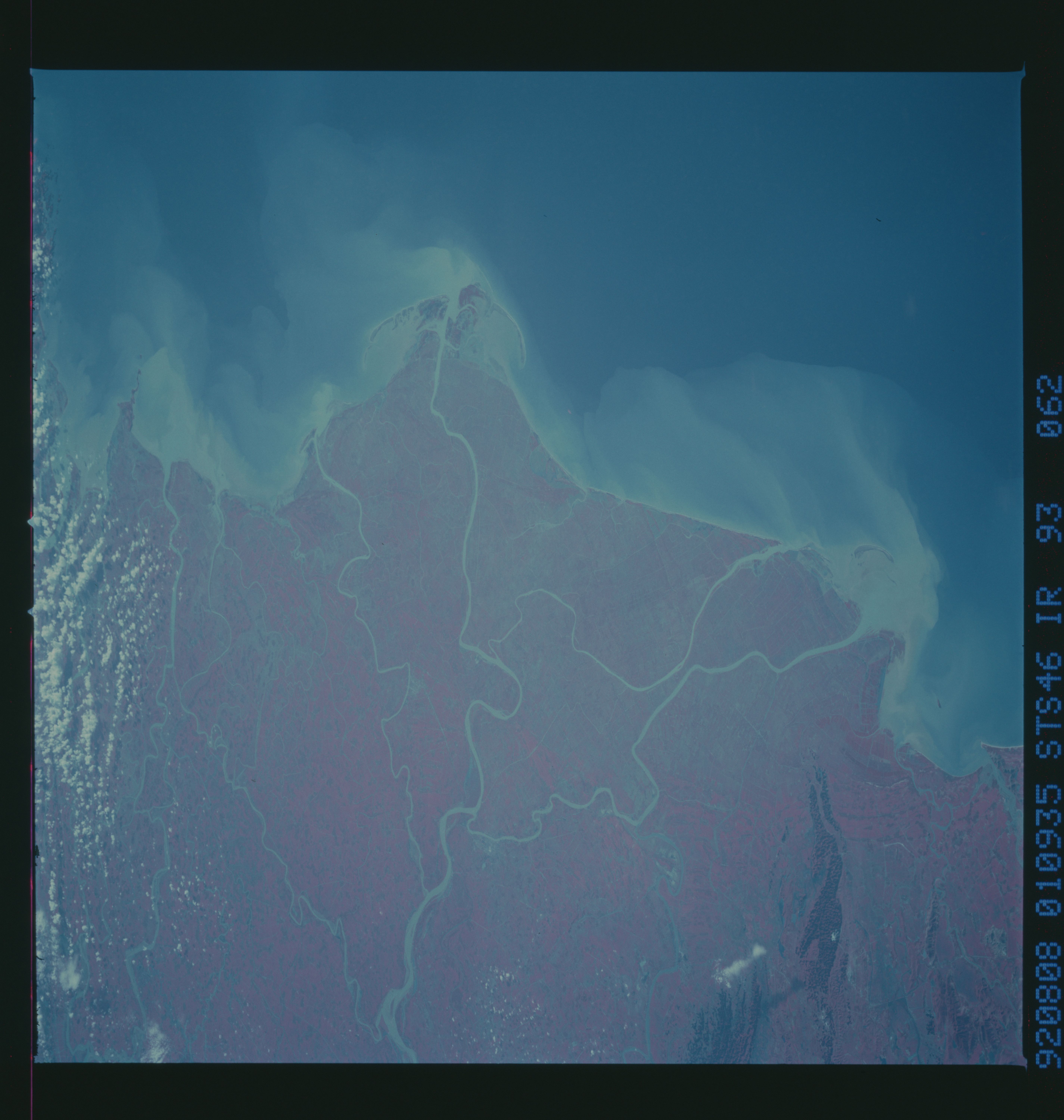
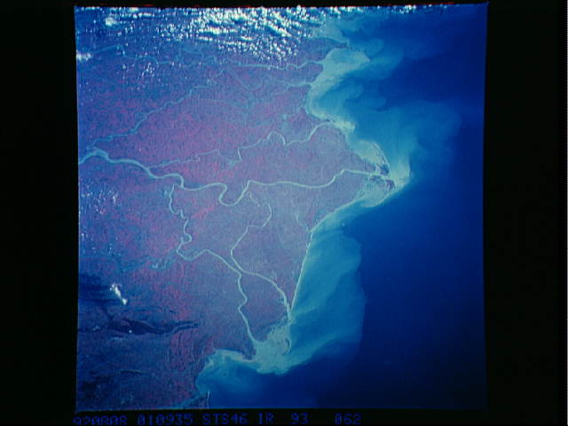
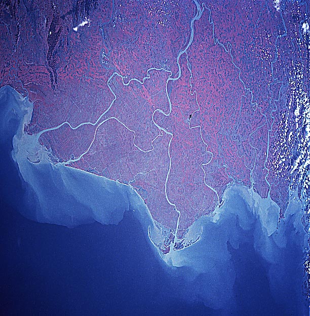
Image Caption: STS046-093-062 Red River Delta, Vietnam August 1992
Covering a total of 5790 sq. miles (15000 sq. km), the intensively cultivated delta of the Red River can be seen in this northeast-looking color infrared view. Though not visible due to clouds, the port city of Hai Phong is located near the top of the image. The Red River rises is Yunnan Province, South China. It flows 730 miles (1175 km) in a generally southeast direction through deep, narrow gorges. Near the city of Hanoi (not on image), the river forms its large delta. The Red River carries a large quantity of silt rich in iron oxide that gives it a red color. The river has an irregular flow and is subject to flooding, especially during the June-October high water period. Dikes and canals have been built to protect the delta from flooding. The Red River empties into the Gulf of Tonkin (South China Sea). Rice is the principal crop of the delta region.
Covering a total of 5790 sq. miles (15000 sq. km), the intensively cultivated delta of the Red River can be seen in this northeast-looking color infrared view. Though not visible due to clouds, the port city of Hai Phong is located near the top of the image. The Red River rises is Yunnan Province, South China. It flows 730 miles (1175 km) in a generally southeast direction through deep, narrow gorges. Near the city of Hanoi (not on image), the river forms its large delta. The Red River carries a large quantity of silt rich in iron oxide that gives it a red color. The river has an irregular flow and is subject to flooding, especially during the June-October high water period. Dikes and canals have been built to protect the delta from flooding. The Red River empties into the Gulf of Tonkin (South China Sea). Rice is the principal crop of the delta region.
