STS046-77-35
| NASA Photo ID | STS046-77-35 |
| Focal Length | 250mm |
| Date taken | 1992.08.08 |
| Time taken | 02:56:22 GMT |
Resolutions offered for this image:
3881 x 3904 pixels 636 x 639 pixels 5700 x 6000 pixels 500 x 526 pixels 640 x 480 pixels
3881 x 3904 pixels 636 x 639 pixels 5700 x 6000 pixels 500 x 526 pixels 640 x 480 pixels
Cloud masks available for this image:
Spacecraft nadir point: 14.6° S, 143.0° E
Photo center point: 14.0° S, 144.0° E
Photo center point by machine learning:
Photo center point: 14.0° S, 144.0° E
Photo center point by machine learning:
Nadir to Photo Center: Northeast
Spacecraft Altitude: 124 nautical miles (230km)
Country or Geographic Name: | AUSTRALIA-Q |
Features: | GRT. BARRIER REEF |
| Features Found Using Machine Learning: | |
Cloud Cover Percentage: | 0 (no clouds present) |
Sun Elevation Angle: | 59° |
Sun Azimuth: | 350° |
Camera: | Hasselblad |
Focal Length: | 250mm |
Camera Tilt: | 29 degrees |
Format: | 5017: Kodak, natural color positive, Ektachrome, X Professional, ASA 64, standard base |
Film Exposure: | Normal |
| Additional Information | |
| Width | Height | Annotated | Cropped | Purpose | Links |
|---|---|---|---|---|---|
| 3881 pixels | 3904 pixels | No | No | Earth From Space collection | Download Image |
| 636 pixels | 639 pixels | No | No | Earth From Space collection | Download Image |
| 5700 pixels | 6000 pixels | No | No | Download Image | |
| 500 pixels | 526 pixels | No | No | Download Image | |
| 640 pixels | 480 pixels | No | No | Download Image |
Download Packaged File
Download a Google Earth KML for this Image
View photo footprint information
Download a GeoTIFF for this photo
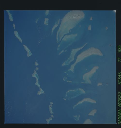
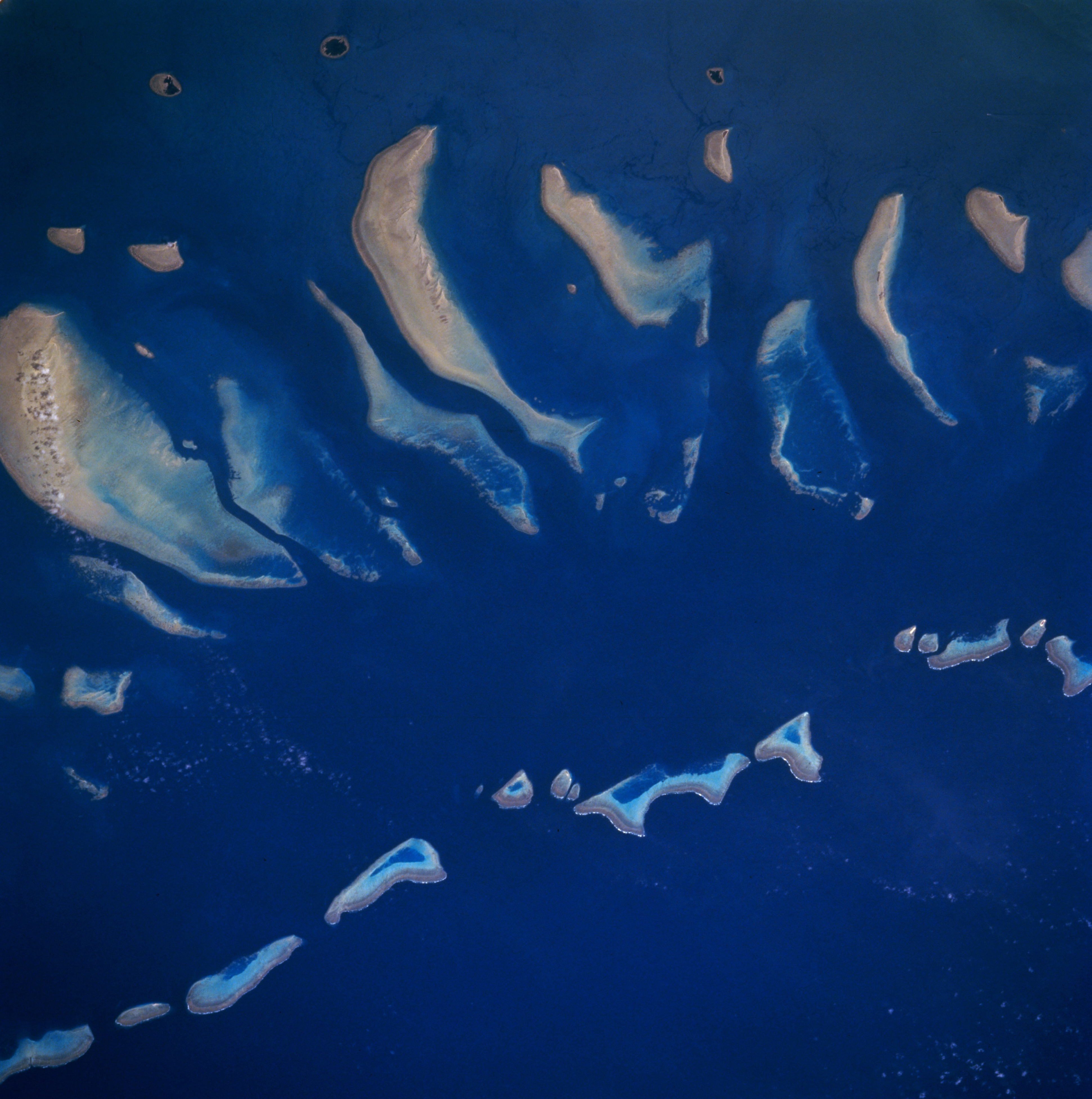
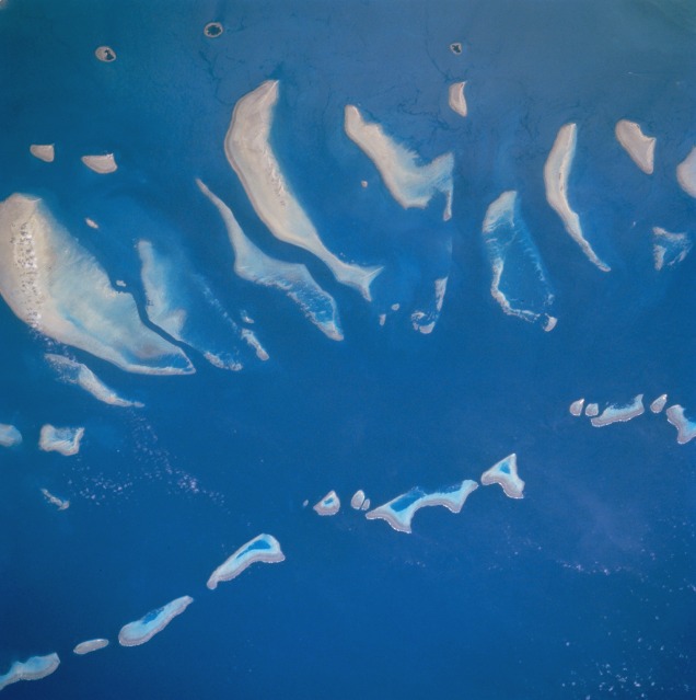
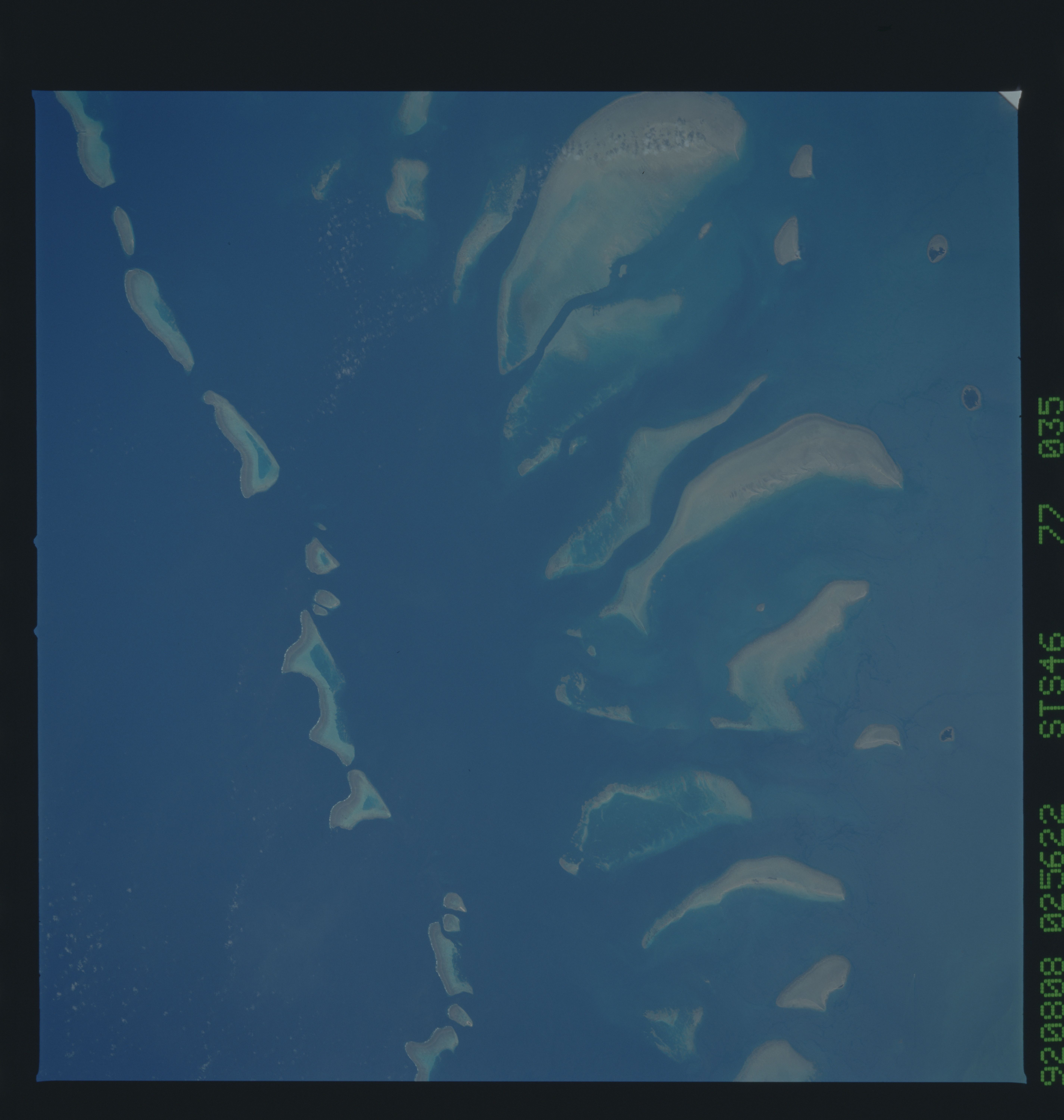
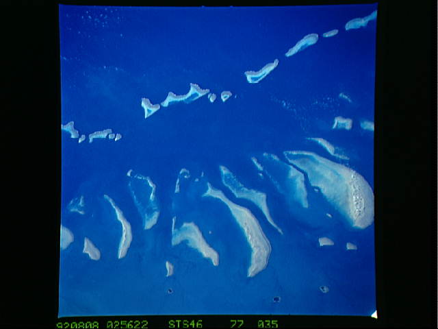
Image Caption: STS046-077-035 Great Barrier Reef, Queensland, Australia August 1992
The Great Barrier Reef is the largest coral reef in the world--measuring 1250 miles (2010 kilometers) in length and 45 miles (72 kilometers) in width at its widest point. The particular section of the reef in this picture is located northwest of Cape Melville just off of the eastern coast of the Cape York Peninsula in Queensland. Hundreds of varieties of coral grow on the Great Barrier Reef. The largest reef (bottom center) in the picture is Hedge Reef and Magpie Reef, the second largest reef in the image, is visible slightly northwest of Hedge Reef. The three roughly circular, dark-centered features along the left side of the image are small tropical islands that are part of the Claremont Isles. The Great Barrier Reef is recognized as a World Heritage Site and, as such, national as well as international ethical guidelines to protect the reef system are being implemented.
The Great Barrier Reef is the largest coral reef in the world--measuring 1250 miles (2010 kilometers) in length and 45 miles (72 kilometers) in width at its widest point. The particular section of the reef in this picture is located northwest of Cape Melville just off of the eastern coast of the Cape York Peninsula in Queensland. Hundreds of varieties of coral grow on the Great Barrier Reef. The largest reef (bottom center) in the picture is Hedge Reef and Magpie Reef, the second largest reef in the image, is visible slightly northwest of Hedge Reef. The three roughly circular, dark-centered features along the left side of the image are small tropical islands that are part of the Claremont Isles. The Great Barrier Reef is recognized as a World Heritage Site and, as such, national as well as international ethical guidelines to protect the reef system are being implemented.
