STS046-75-18
| NASA Photo ID | STS046-75-18 |
| Focal Length | 250mm |
| Date taken | 1992.08.04 |
| Time taken | 07:26:01 GMT |
Resolutions offered for this image:
5167 x 5167 pixels 639 x 639 pixels 5700 x 6000 pixels 500 x 526 pixels 640 x 480 pixels
5167 x 5167 pixels 639 x 639 pixels 5700 x 6000 pixels 500 x 526 pixels 640 x 480 pixels


Cloud masks available for this image:
Spacecraft nadir point: 21.6° N, 32.8° E
Photo center point: 24.0° N, 33.0° E
Photo center point by machine learning:
Photo center point: 24.0° N, 33.0° E
Photo center point by machine learning:
Nadir to Photo Center: North
Spacecraft Altitude: 162 nautical miles (300km)
Country or Geographic Name: | EGYPT |
Features: | ASWAN DAM, LAKE NASSER |
| Features Found Using Machine Learning: | |
Cloud Cover Percentage: | 0 (no clouds present) |
Sun Elevation Angle: | 55° |
Sun Azimuth: | 91° |
Camera: | Hasselblad |
Focal Length: | 250mm |
Camera Tilt: | 42 degrees |
Format: | 5017: Kodak, natural color positive, Ektachrome, X Professional, ASA 64, standard base |
Film Exposure: | Normal |
| Additional Information | |
| Width | Height | Annotated | Cropped | Purpose | Links |
|---|---|---|---|---|---|
| 5167 pixels | 5167 pixels | No | No | Earth From Space collection | Download Image |
| 639 pixels | 639 pixels | No | No | Earth From Space collection | Download Image |
| 5700 pixels | 6000 pixels | No | No | Download Image | |
| 500 pixels | 526 pixels | No | No | Download Image | |
| 640 pixels | 480 pixels | No | No | Download Image |
Download Packaged File
Download a Google Earth KML for this Image
View photo footprint information
Download a GeoTIFF for this photo
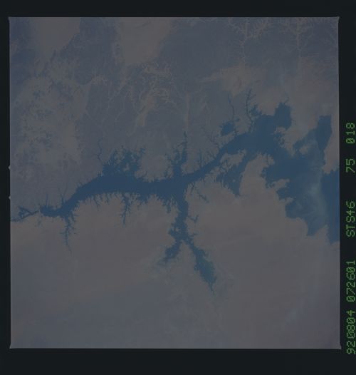
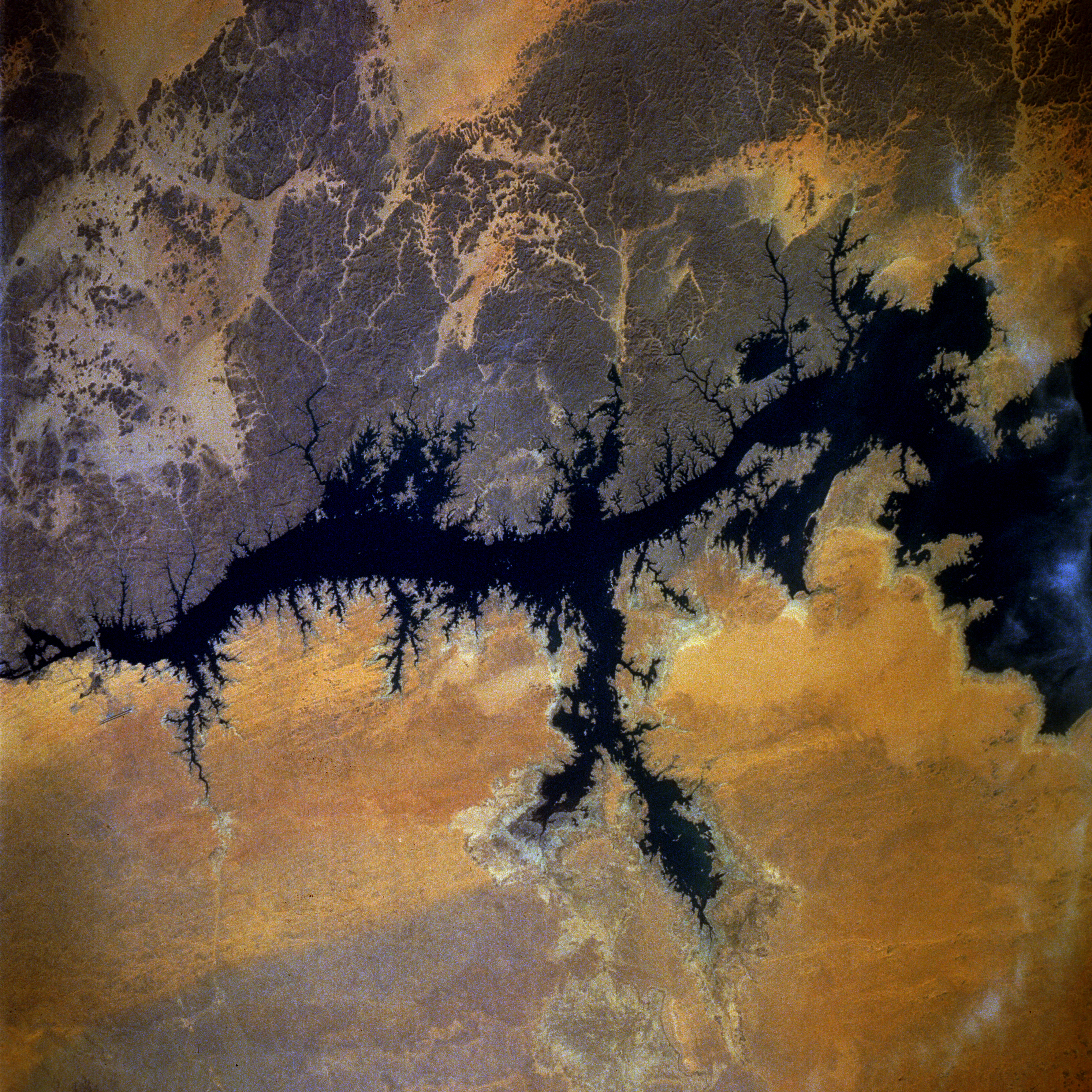
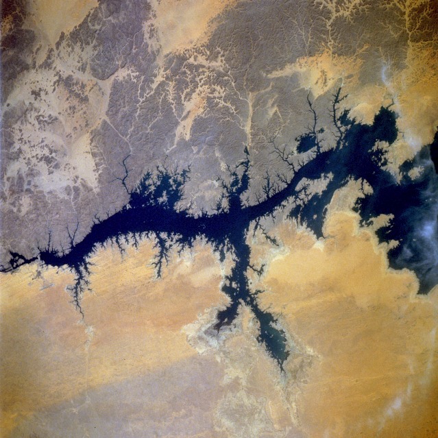
Image Caption: STS046-075-018 Nile River and Aswan Dam, Egypt August 1992
The Nile River is the longest river in the world and unquestionably the "life blood" of Egypt. Throughout Egypt's history the Nile River has provided water for drinking, irrigation, and replenishment of fertile soils. About 95 percent of Egypt's population lives within 12 miles (20 kilometers) of the river's banks or on its delta. This segment of the Nile River has been modified by the construction of the Aswan High Dam. The dam is barely visible toward the northern edge of the photograph. This project was begun in 1958, and the dam was dedicated in 1971. The 365-foot-high (110-meter-high) dam created Lake Nasser, one of the world's largest artificial lakes. A series of photographs of Lake Nasser, taken in different seasons and years, is useful in mapping the seasonally influenced fluctuating water levels in the lake. Water levels are normally lowest during April and May; then during the summer months the water level rises. The dam has dramatically (1) changed how Egyptians irrigate their fields, (2) increased oil-poor Egypt's hydroelectric power generation, and (3) curtailed flood control problems. The inundated area created behind the Aswan High Dam extends into a small area of north-central Sudan.
The Aswan High Dam, 2.5 miles across and 364 feet high, (24.0N, 33.0E) completed in 1971, was constructed to supply cheap hydroelectric power to both Egypt and Sudan by impounding, controling and regulating the flood waters of the Nile River in Lake Nasser, the world's second largest artifical lake. The lake extends over 500 miles in length, covers an area of some 2,000 square miles and is as much as 350 feet deep at the face of the dam.
