STS046-71-36

| NASA Photo ID | STS046-71-36 |
| Focal Length | 250mm |
| Date taken | 1992.08.01 |
| Time taken | 03:53:09 GMT |
Cloud masks available for this image:
Spacecraft nadir point: 27.1° N, 48.6° E
Photo center point: 27.0° N, 50.0° E
Photo center point by machine learning:
Photo center point: 27.0° N, 50.0° E
Photo center point by machine learning:
Nadir to Photo Center: East
Spacecraft Altitude: 233 nautical miles (432km)
Country or Geographic Name: | SAUDI ARABIA |
Features: | AL JUBAYL AREA |
| Features Found Using Machine Learning: | |
Cloud Cover Percentage: | 0 (no clouds present) |
Sun Elevation Angle: | 21° |
Sun Azimuth: | 80° |
Camera: | Hasselblad |
Focal Length: | 250mm |
Camera Tilt: | 20 degrees |
Format: | 5017: Kodak, natural color positive, Ektachrome, X Professional, ASA 64, standard base |
Film Exposure: | Normal |
| Additional Information | |
| Width | Height | Annotated | Cropped | Purpose | Links |
|---|---|---|---|---|---|
| 5700 pixels | 6000 pixels | No | No | Download Image | |
| 500 pixels | 526 pixels | No | No | Download Image | |
| 640 pixels | 480 pixels | No | No | Download Image |
Download Packaged File
Download a Google Earth KML for this Image
View photo footprint information
Download a GeoTIFF for this photo
Image Caption:
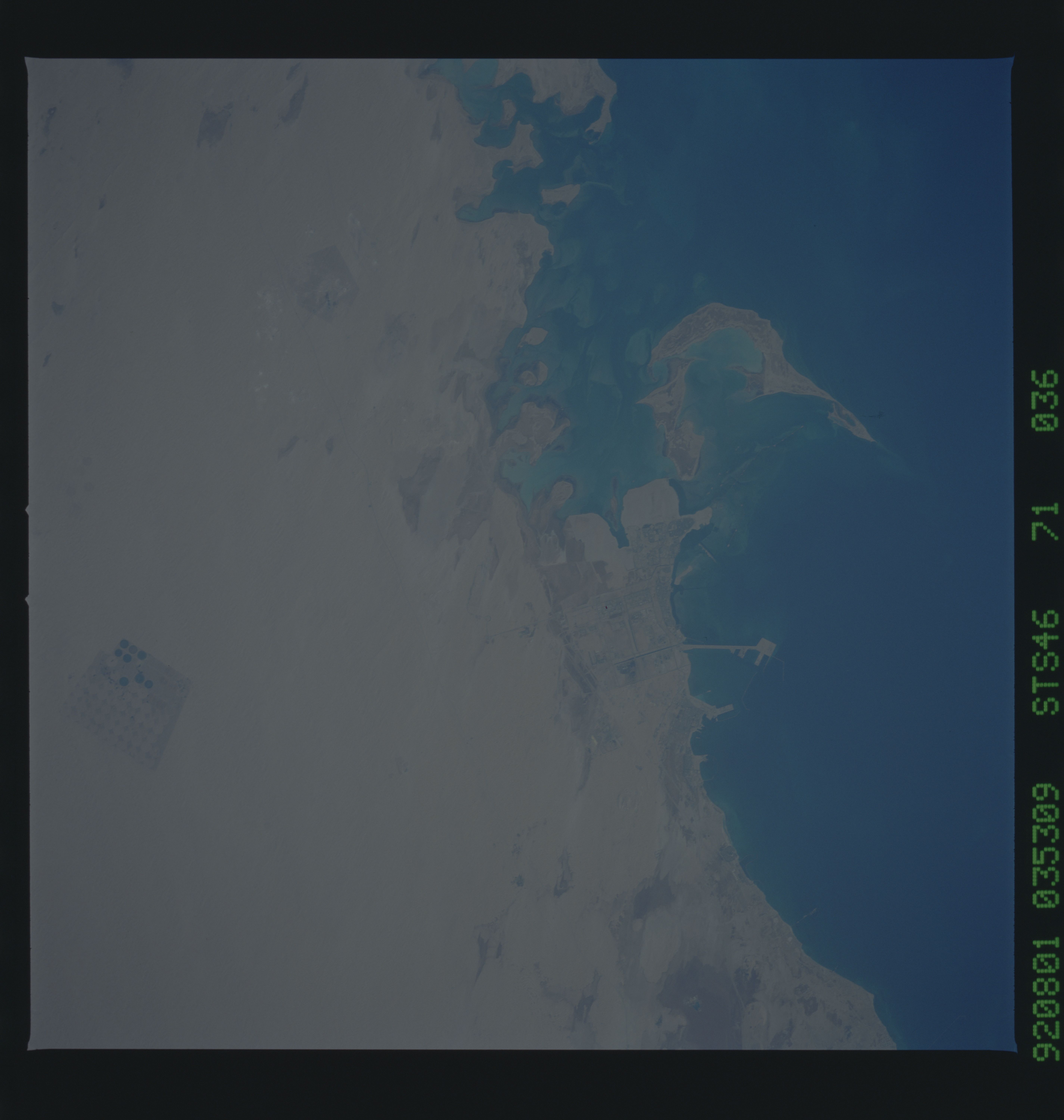
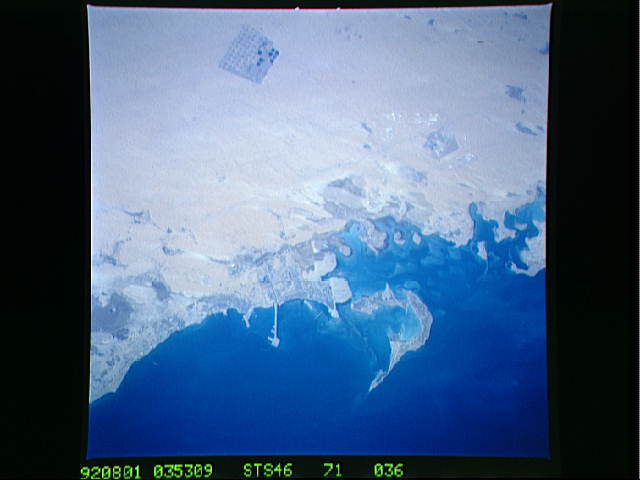
STS46-071-036. Abu Ali Island, Saudi Arabia, photographed on 1
August, 03:53 GMT, from an altitude of 230 n.mi. using a Hassel-
blad camera equipped with a 250 mm lens and CVIS film. Last
spring, this area of the Persian Gulf was the subject of an in-
tense study of the ecological impact of the 1991 Gulf war, funded
by NOAA and the IOC (International Oceanic Commission). Photo-
graphs such as this will be of use to the researchers in inter-
preting their data.
