STS045-81-30
| NASA Photo ID | STS045-81-30 |
| Focal Length | 100mm |
| Date taken | 1992.03.25 |
| Time taken | 10:55:17 GMT |
Cloud masks available for this image:
Spacecraft nadir point: 18.0° N, 97.3° E
Photo center point:
Photo center point by machine learning:
Photo center point:
Photo center point by machine learning:
Nadir to Photo Center:
Spacecraft Altitude: 162 nautical miles (300km)
Country or Geographic Name: | BAY OF BENGAL |
Features: | CLOUD LAYERS |
| Features Found Using Machine Learning: | |
Cloud Cover Percentage: | 90 (76-100)% |
Sun Elevation Angle: | 10° |
Sun Azimuth: | 269° |
Camera: | Hasselblad |
Focal Length: | 100mm |
Camera Tilt: | High Oblique |
Format: | 5017: Kodak, natural color positive, Ektachrome, X Professional, ASA 64, standard base |
Film Exposure: | Normal |
| Additional Information | |
| Width | Height | Annotated | Cropped | Purpose | Links |
|---|---|---|---|---|---|
| 5700 pixels | 6000 pixels | No | No | Download Image | |
| 500 pixels | 526 pixels | No | No | Download Image | |
| 640 pixels | 480 pixels | No | No | Download Image |
Download Packaged File
Download a Google Earth KML for this Image
View photo footprint information
Download a GeoTIFF for this photo
Image Caption:
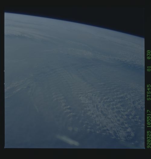
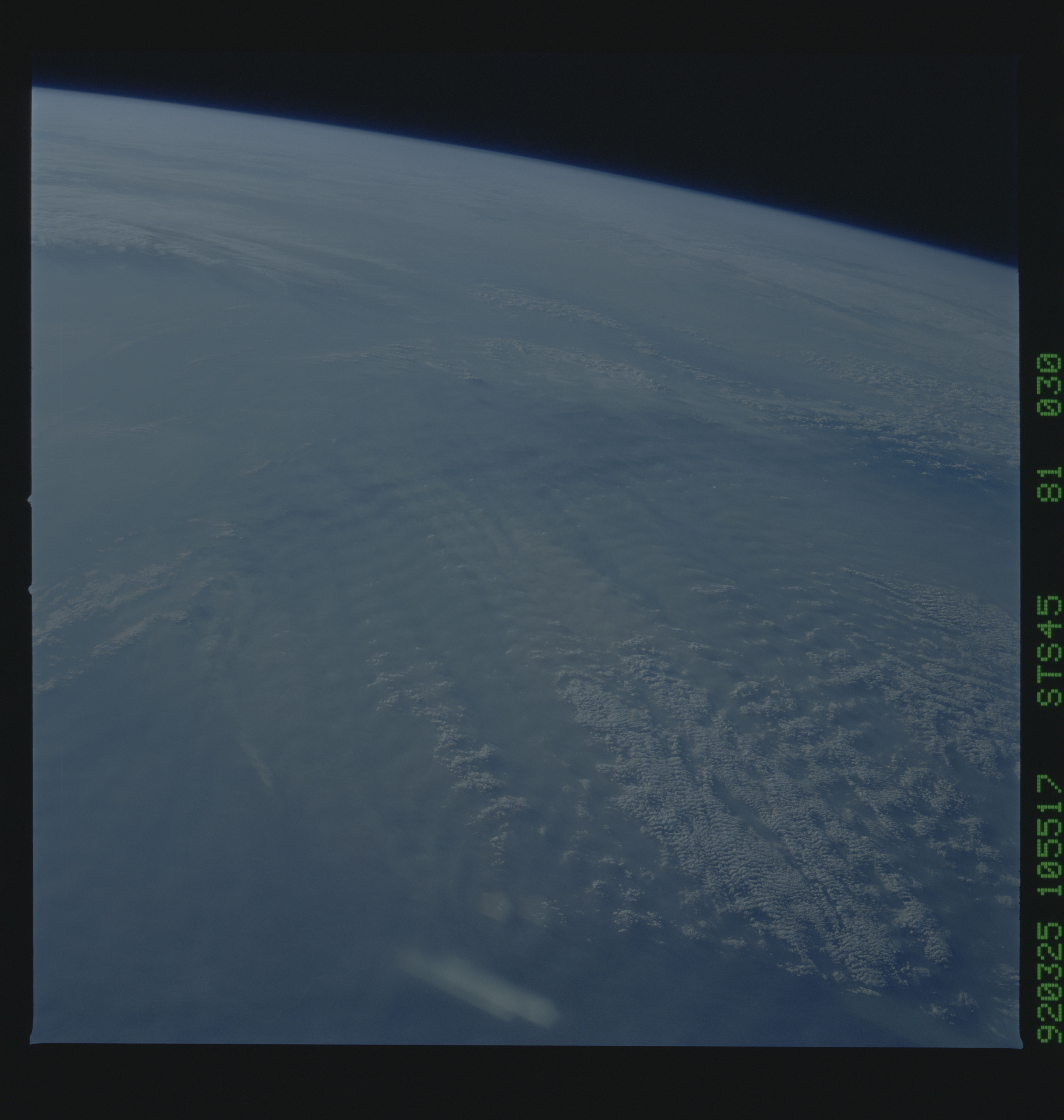
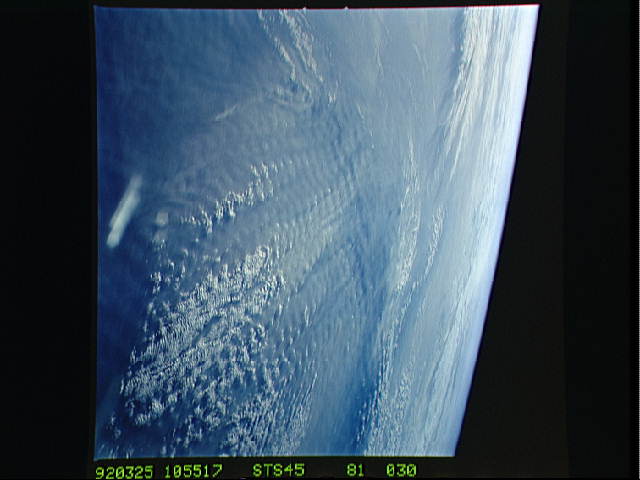
STS045-81-023 and STS45-81-030: Low-level Atmospheric Phenomena
(CLOUDS Payload) This pair illustrates low-level turbulence
created by strong winds blowing perpendicular to a mountain range
(Tien Shan Range, NW China) in the Gobi Desert. The winds have
picked up dust and provide this extraordinary view of low-level
turbulence flow by their wave-like patterns. As the mixed area
increases away from mountain range (source of the turbulence), so
does lift and therefore the formation of cloud layers (lenticular
clouds).
