STS045-76-9
| NASA Photo ID | STS045-76-9 |
| Focal Length | 100mm |
| Date taken | 1992.03.26 |
| Time taken | 15:28:26 GMT |

Cloud masks available for this image:
Spacecraft nadir point: 32.4° N, 10.2° E
Photo center point: 33.0° N, 12.5° E
Photo center point by machine learning:
Photo center point: 33.0° N, 12.5° E
Photo center point by machine learning:
Nadir to Photo Center: East
Spacecraft Altitude: 163 nautical miles (302km)
Country or Geographic Name: | TUNISIA |
Features: | DJERBA IS. TO TRIPOLI |
| Features Found Using Machine Learning: | |
Cloud Cover Percentage: | 5 (1-10)% |
Sun Elevation Angle: | 26° |
Sun Azimuth: | 256° |
Camera: | Hasselblad |
Focal Length: | 100mm |
Camera Tilt: | 41 degrees |
Format: | 5017: Kodak, natural color positive, Ektachrome, X Professional, ASA 64, standard base |
Film Exposure: | Normal |
| Additional Information | |
| Width | Height | Annotated | Cropped | Purpose | Links |
|---|---|---|---|---|---|
| 5700 pixels | 6000 pixels | No | No | Download Image | |
| 500 pixels | 526 pixels | No | No | Download Image | |
| 640 pixels | 480 pixels | No | No | Download Image |
Download Packaged File
Download a Google Earth KML for this Image
View photo footprint information
Download a GeoTIFF for this photo
Image Caption:
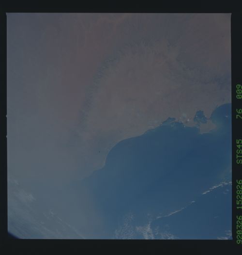
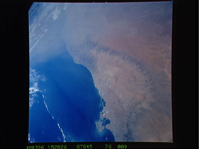
STS045-83-018, STS045-76-009, STS045-611-026: Mediterranean Dust
Storm STS045-83-018: The light-colored area (center--southern
Tunisia) can be seen here as the source of dust plumes. These
contributed to a large outbreak of wind-blown dust which ori-
ginated mainly in the western Sahara blowing northeast. Photo
STS045-76-009 shows that this same area of southern Tunisia was
not a contributor to the larger dust storm--seen in one corner of
the view--at other times during the mission. STS045-611- 026:
this great panorama shows the Mediterranean dust storm reaching
almost as far east as the Nile delta, with a subsidiary arm mov-
ing north up the Levantine coast over Israel and Lebanon. The
island of Cyprus, center right, can be seen modifying the flow
dust- laden air.
