STS044-94-29

| NASA Photo ID | STS044-94-29 |
| Focal Length | 250mm |
| Date taken | 1991.11.29 |
| Time taken | 02:31:41 GMT |
Cloud masks available for this image:
Spacecraft nadir point: 25.1° S, 56.1° E
Photo center point:
Photo center point by machine learning:
Photo center point:
Photo center point by machine learning:
Nadir to Photo Center:
Spacecraft Altitude: 197 nautical miles (365km)
Country or Geographic Name: | INDIAN OCEAN |
Features: | THUNDERSTORM |
| Features Found Using Machine Learning: | |
Cloud Cover Percentage: | 90 (76-100)% |
Sun Elevation Angle: | 37° |
Sun Azimuth: | 105° |
Camera: | Hasselblad |
Focal Length: | 250mm |
Camera Tilt: | |
Format: | 5017: Kodak, natural color positive, Ektachrome, X Professional, ASA 64, standard base |
Film Exposure: | Normal |
| Additional Information | |
| Width | Height | Annotated | Cropped | Purpose | Links |
|---|---|---|---|---|---|
| 5700 pixels | 6000 pixels | No | No | Download Image | |
| 500 pixels | 526 pixels | No | No | Download Image | |
| 640 pixels | 480 pixels | No | No | Download Image |
Download Packaged File
Download a Google Earth KML for this Image
View photo footprint information
Download a GeoTIFF for this photo
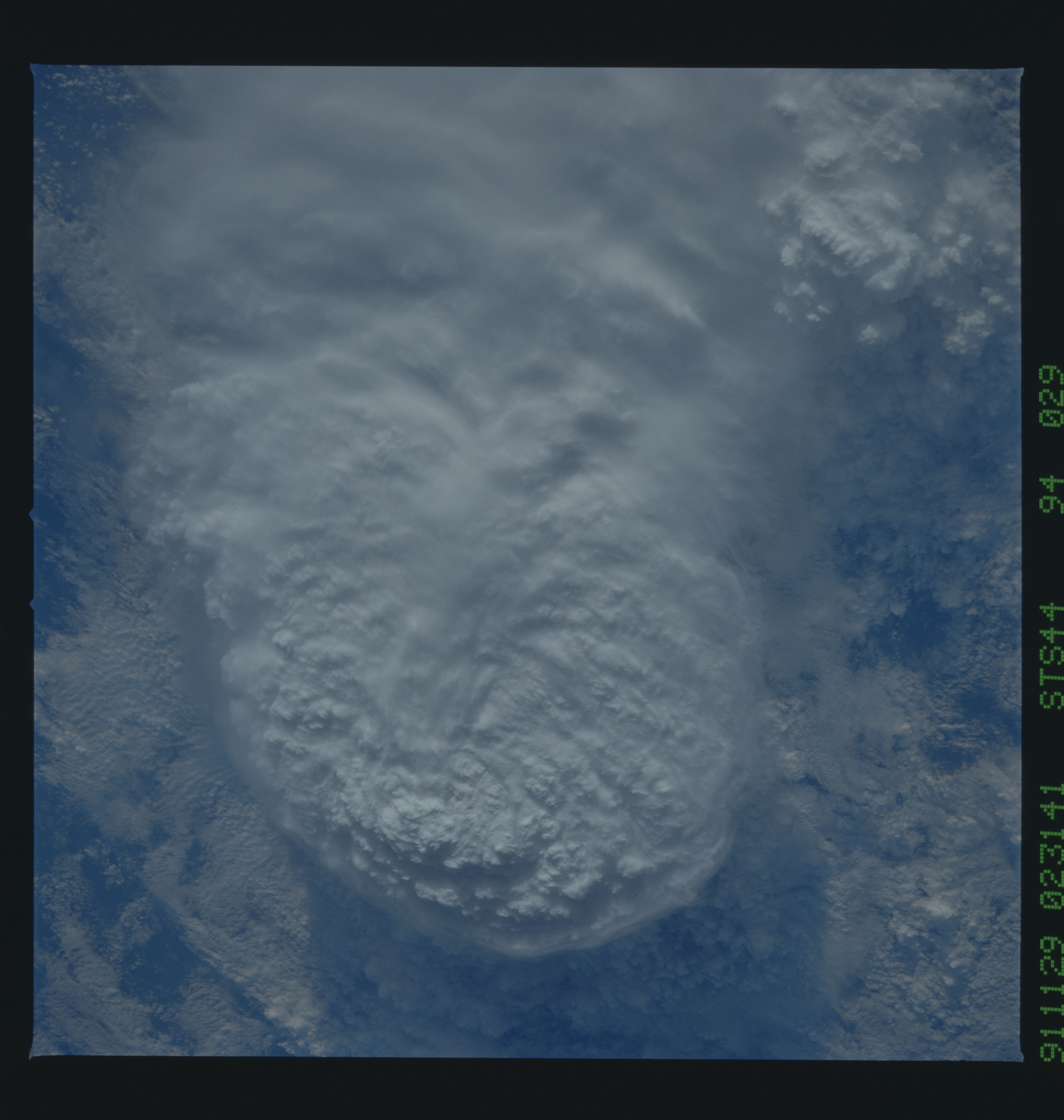
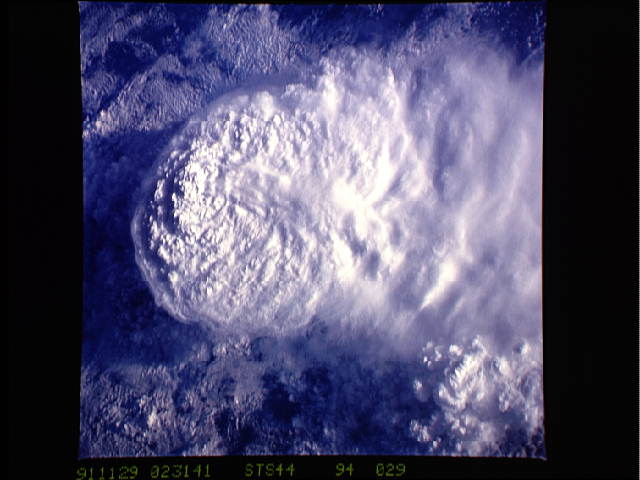
Image Caption: STS044-94-29: LARGE THUNDERSTORM EAST OF MADAGASCAR
This very large thunderstorm, occupying nearly the whole image, was photographed east of the island of Madagascar. The storm is approximately 65 nautical miles wide. There is cirrus blowoff to the east. On the west, it has an overshooting cloud top. Overshooting clouds result from strong updrafts rising from the troposphere, the part of the atmosphere nearest the Earth's surface where most of the weather activity occurs. The top reaches into the stratosphere at 45,000-50,000 feet (13,800-15,300 m) and casts strong shadows in the low sun.
This very large thunderstorm was photographed in the Indian Ocean, east of Madagascar (25.0N, 56.0E). The storm is about 65 nautical miles on a side and has an overshooting cloud top. Overshooting clouds result from strong updrafts rising from the troposphere, the portion of the atmosphere near the surface, where most of the Earth's weather occurs. The top reaches into the stratosphere at 45,000 to 50,000 ft. and casts long shadows in the low sun.
