STS044-93-80
| NASA Photo ID | STS044-93-80 |
| Focal Length | 250mm |
| Date taken | 1991.11.28 |
| Time taken | 04:03:56 GMT |
Resolutions offered for this image:
3965 x 3958 pixels 640 x 638 pixels 5700 x 6000 pixels 500 x 526 pixels 640 x 480 pixels 1935 x 1834 pixels
3965 x 3958 pixels 640 x 638 pixels 5700 x 6000 pixels 500 x 526 pixels 640 x 480 pixels 1935 x 1834 pixels


Cloud masks available for this image:
Spacecraft nadir point: 18.9° N, 140.1° E
Photo center point:
Photo center point by machine learning:
Photo center point:
Photo center point by machine learning:
Nadir to Photo Center:
Spacecraft Altitude: 196 nautical miles (363km)
Country or Geographic Name: | PACIFIC OCEAN |
Features: | TYPHOON YURI EYE |
| Features Found Using Machine Learning: | |
Cloud Cover Percentage: | 100 (76-100)% |
Sun Elevation Angle: | 23° |
Sun Azimuth: | 230° |
Camera: | Hasselblad |
Focal Length: | 250mm |
Camera Tilt: | Low Oblique |
Format: | 5017: Kodak, natural color positive, Ektachrome, X Professional, ASA 64, standard base |
Film Exposure: | Over Exposed |
| Additional Information | |
| Width | Height | Annotated | Cropped | Purpose | Links |
|---|---|---|---|---|---|
| 3965 pixels | 3958 pixels | No | No | Earth From Space collection | Download Image |
| 640 pixels | 638 pixels | No | No | Earth From Space collection | Download Image |
| 5700 pixels | 6000 pixels | No | No | Download Image | |
| 500 pixels | 526 pixels | No | No | Download Image | |
| 640 pixels | 480 pixels | No | No | Download Image | |
| 1935 pixels | 1834 pixels | No | No | Download Image |
Download Packaged File
Download a Google Earth KML for this Image
View photo footprint information
Download a GeoTIFF for this photo
Image Caption: STS044-093-080 Typhoon Yuri, Pacific Ocean November 1991
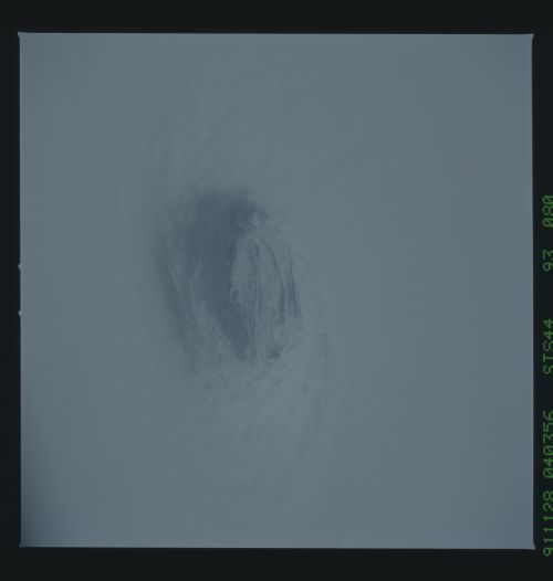
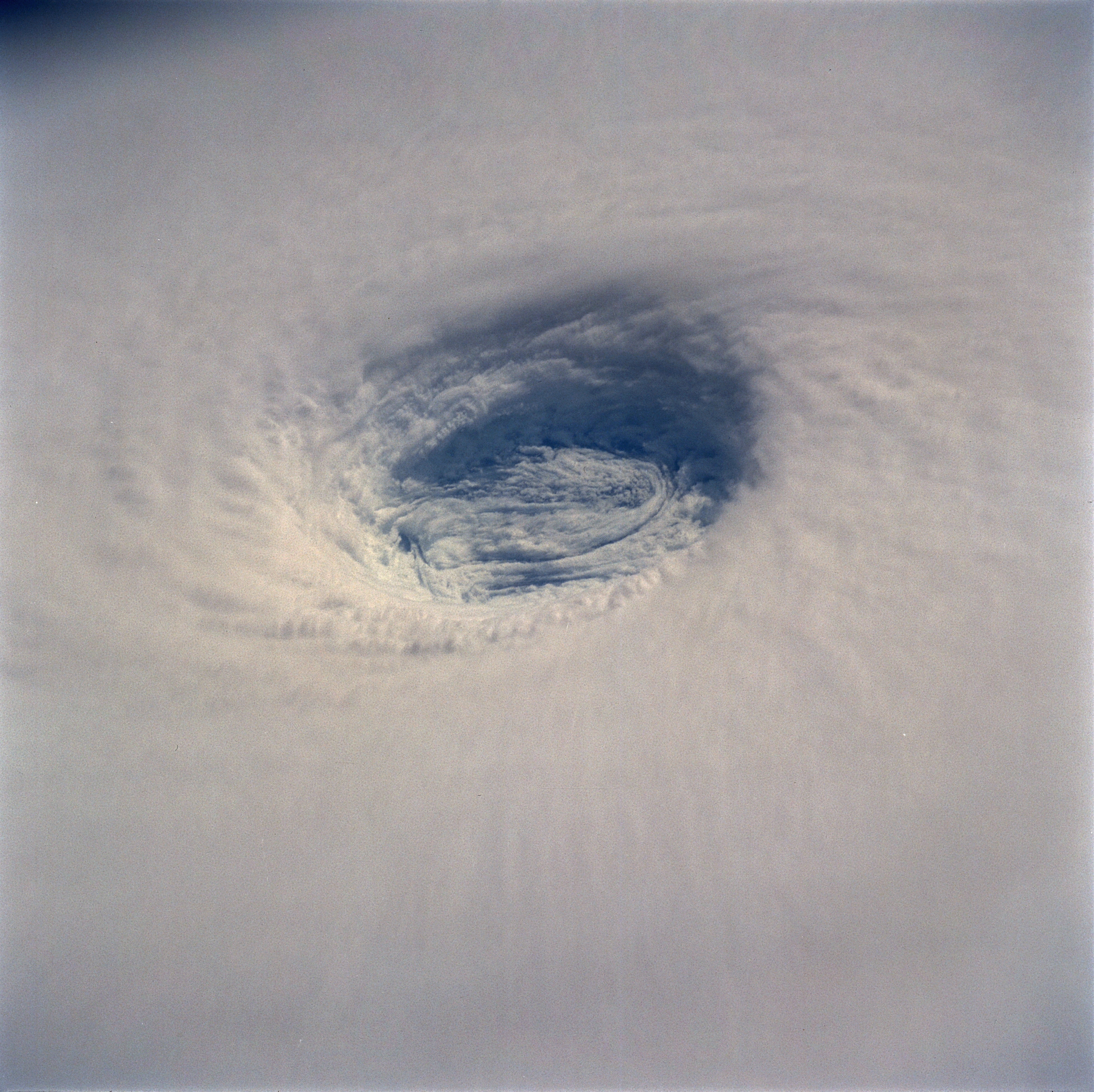
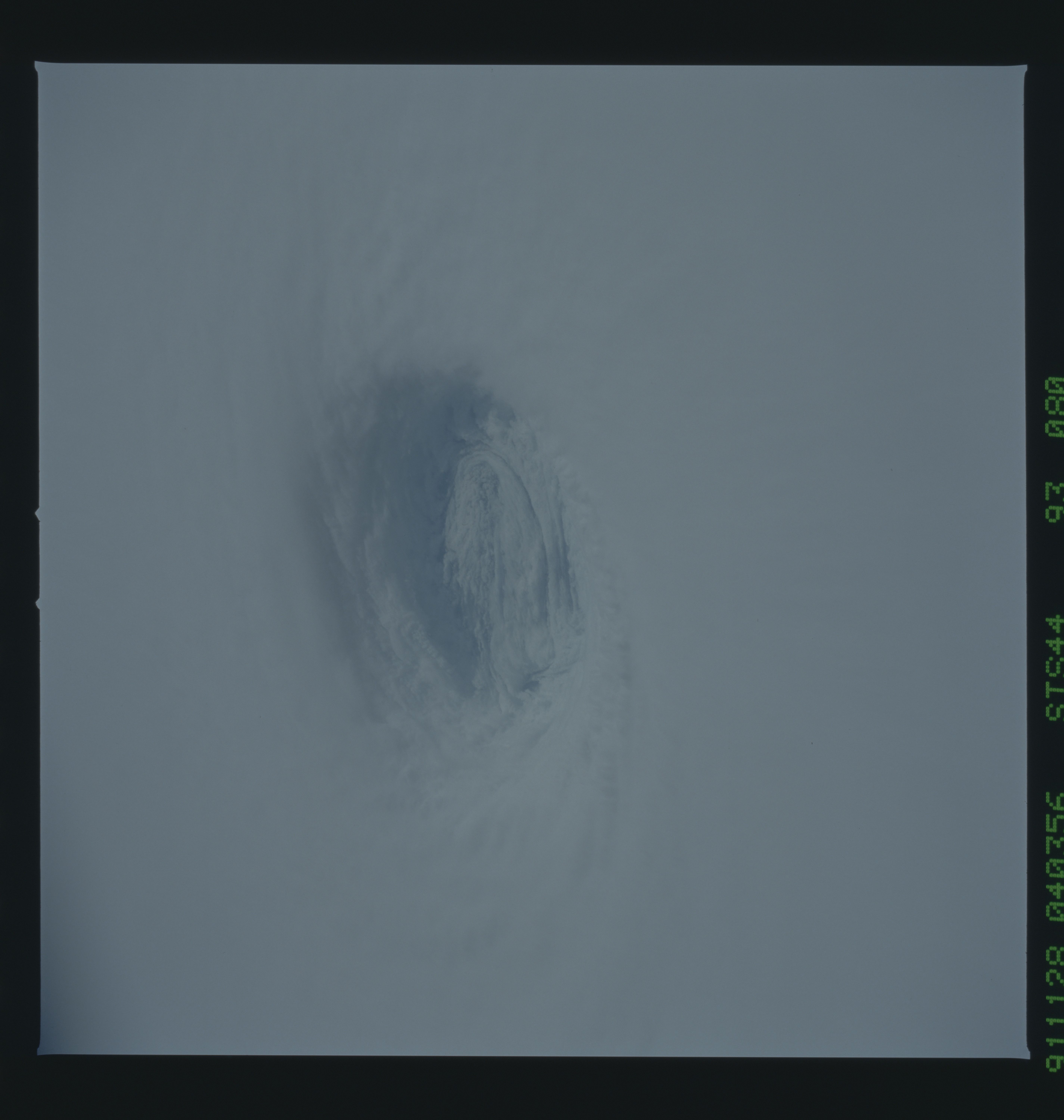
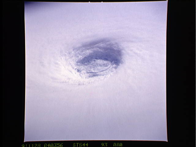
This spectacular, low-oblique photograph shows the bowl-shaped eye (center of photograph) of Typhoon Yuri in the western Pacific Ocean just west of the Northern Mariana Islands. The eye wall descends almost to the sea surface, a distance of nearly 45 000 feet (13 800 meters). In this case the eye is filled with clouds, but in many cases the sea surface can be seen through the eye. Yuri grew to super typhoon status, packing maximum sustained winds estimated at 165 miles (270 kilometers) per hour, with gusts reaching an estimated 200 miles (320 kilometers) per hour. The storm moved west toward the Philippine Islands before turning northeast into the north Pacific Ocean, thus avoiding any major landmass.
This detailed view of the eye of Supertyphoon Yuri (19.0N, 140.0E) shows the bowl shaped structure of the eye wall. The eye cylinder descends almost to the ocean surface, some 45,000 to 50,000 ft. In this case, the eye is filled with clouds but in most cases, the cylinder is at least partially clear so that the sea surface is visible. The storm at this time was at it's most intense with maximum sustained winds of 165 mph and gusting to 200 mph.
