STS044-93-73
| NASA Photo ID | STS044-93-73 |
| Focal Length | 250mm |
| Date taken | 1991.11.28 |
| Time taken | 03:59:47 GMT |

Cloud masks available for this image:
Spacecraft nadir point: 12.3° N, 125.6° E
Photo center point: 10.5° N, 125.0° E
Photo center point by machine learning:
Photo center point: 10.5° N, 125.0° E
Photo center point by machine learning:
Nadir to Photo Center: South
Spacecraft Altitude: 196 nautical miles (363km)
Country or Geographic Name: | PHILIPPINES |
Features: | LEYTE, OCEAN FEATURES |
| Features Found Using Machine Learning: | |
Cloud Cover Percentage: | 10 (1-10)% |
Sun Elevation Angle: | 37° |
Sun Azimuth: | 218° |
Camera: | Hasselblad |
Focal Length: | 250mm |
Camera Tilt: | 30 degrees |
Format: | 5017: Kodak, natural color positive, Ektachrome, X Professional, ASA 64, standard base |
Film Exposure: | Normal |
| Additional Information | |
| Width | Height | Annotated | Cropped | Purpose | Links |
|---|---|---|---|---|---|
| 5700 pixels | 6000 pixels | No | No | Download Image | |
| 500 pixels | 526 pixels | No | No | Download Image | |
| 640 pixels | 480 pixels | No | No | Download Image |
Download Packaged File
Download a Google Earth KML for this Image
View photo footprint information
Download a GeoTIFF for this photo
Image Caption:
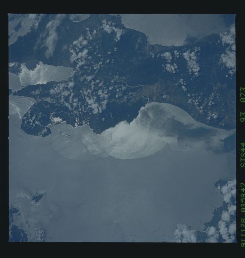
STS044-93-073: LEYTE, PHILIPPINES Color visible photograph of
sunglint along the coast of Leyte, Philippines (10.7! N, 125.1!
E). Smooth water adjacent to the coastline indicates the pres-
ence of cooler, possibly fresher coastal water. Internal waves
are visible approaching the southeast shoreline. These were
likely generated by the swift tidal flow through the narrow Suri-
gao Strait to the east.
The effects of Tropical Storm Thelma in November 1991, three weeks prior to the taking of this photo can still be seen on Leyte, (10.5N, 125.0E). Flash floods and mud slides triggered by the heavy rainfall and aggravated by logging operations on the mountain slopes, added to the general destruction caused by the storm. Fresh water runoff (lens) into the ocean are still evident as numerous bright semi circles around the island perimeter.
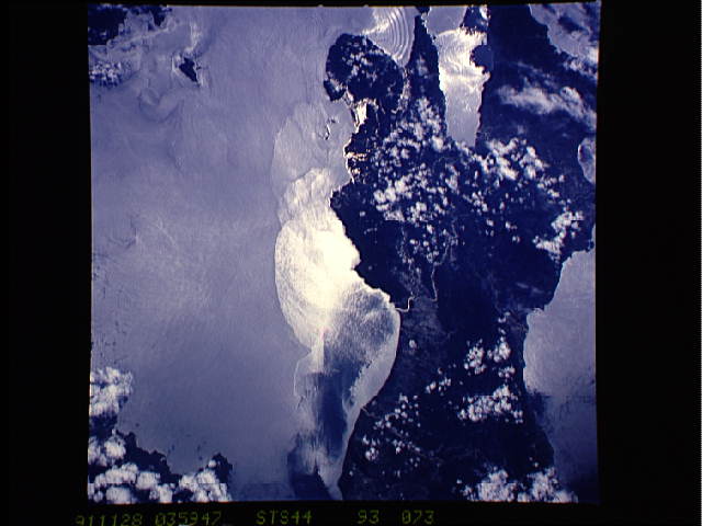
