STS044-83-20
| NASA Photo ID | STS044-83-20 |
| Focal Length | 250mm |
| Date taken | 1991.11.29 |
| Time taken | 07:13:52 GMT |


Cloud masks available for this image:
Spacecraft nadir point: 15.7° S, 12.8° E
Photo center point: 17.0° S, 12.5° E
Photo center point by machine learning:
Photo center point: 17.0° S, 12.5° E
Photo center point by machine learning:
Nadir to Photo Center: South
Spacecraft Altitude: 196 nautical miles (363km)
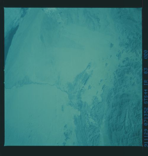
Country or Geographic Name: | ANGOLA |
Features: | CANENE RIVER |
| Features Found Using Machine Learning: | |
Cloud Cover Percentage: | 5 (1-10)% |
Sun Elevation Angle: | 55° |
Sun Azimuth: | 123° |
Camera: | Hasselblad |
Focal Length: | 250mm |
Camera Tilt: | 22 degrees |
Format: | 2443: Kodak Aerochrome 2443, color IR, thin base, EA-5 process thru June 1999, E-6 process afterward |
Film Exposure: | Normal |
| Additional Information | |
| Width | Height | Annotated | Cropped | Purpose | Links |
|---|---|---|---|---|---|
| 5700 pixels | 6000 pixels | No | No | Download Image | |
| 500 pixels | 526 pixels | No | No | Download Image | |
| 640 pixels | 480 pixels | No | No | Download Image |
Download Packaged File
Download a Google Earth KML for this Image
View photo footprint information
Download a GeoTIFF for this photo
Image Caption:
STS044-83-020: NAMIB DESERT Fingerlike wind streaks are well
developed in the Namib Desert of southern Angola. These are pro-
duced by strong, hot winds, like the Santa Ana of California,
which blow from the plateau down onto the coast.
STS044-83-020: NAMIB DESERT Fingerlike wind streaks are well
developed in the Namib Desert of southern Angola. These are pro-
duced by strong, hot winds, like the Santa Ana of California,
which blow from the plateau down onto the coast.
