STS044-82-33
| NASA Photo ID | STS044-82-33 |
| Focal Length | 100mm |
| Date taken | 1991.11.29 |
| Time taken | 04:29:12 GMT |
Resolutions offered for this image:
5700 x 6000 pixels 500 x 526 pixels 640 x 480 pixels 2356 x 2335 pixels
5700 x 6000 pixels 500 x 526 pixels 640 x 480 pixels 2356 x 2335 pixels
Cloud masks available for this image:
Spacecraft nadir point: 17.3° N, 121.2° E
Photo center point: 15.5° N, 120.0° E
Photo center point by machine learning:
Photo center point: 15.5° N, 120.0° E
Photo center point by machine learning:
Nadir to Photo Center: Southwest
Spacecraft Altitude: 196 nautical miles (363km)
Country or Geographic Name: | PHILIPPINES |
Features: | LINGAYE GULF, LUZON |
| Features Found Using Machine Learning: | |
Cloud Cover Percentage: | 30 (26-50)% |
Sun Elevation Angle: | 30° |
Sun Azimuth: | 222° |
Camera: | Hasselblad |
Focal Length: | 100mm |
Camera Tilt: | 33 degrees |
Format: | VELVI: Fuji, natural color positive, Velvia 50, CS 135-36, ASA 32, standard base |
Film Exposure: | Under Exposed |
| Additional Information | |
| Width | Height | Annotated | Cropped | Purpose | Links |
|---|---|---|---|---|---|
| 5700 pixels | 6000 pixels | No | No | Download Image | |
| 500 pixels | 526 pixels | No | No | Download Image | |
| 640 pixels | 480 pixels | No | No | Download Image | |
| 2356 pixels | 2335 pixels | Download Image |
Download Packaged File
Download a Google Earth KML for this Image
View photo footprint information
Download a GeoTIFF for this photo
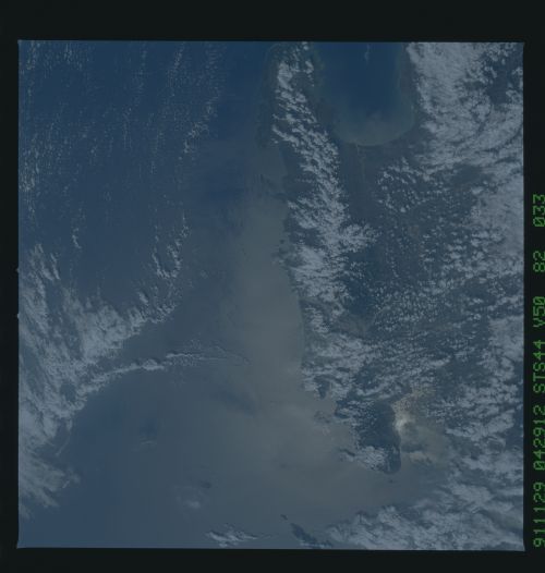
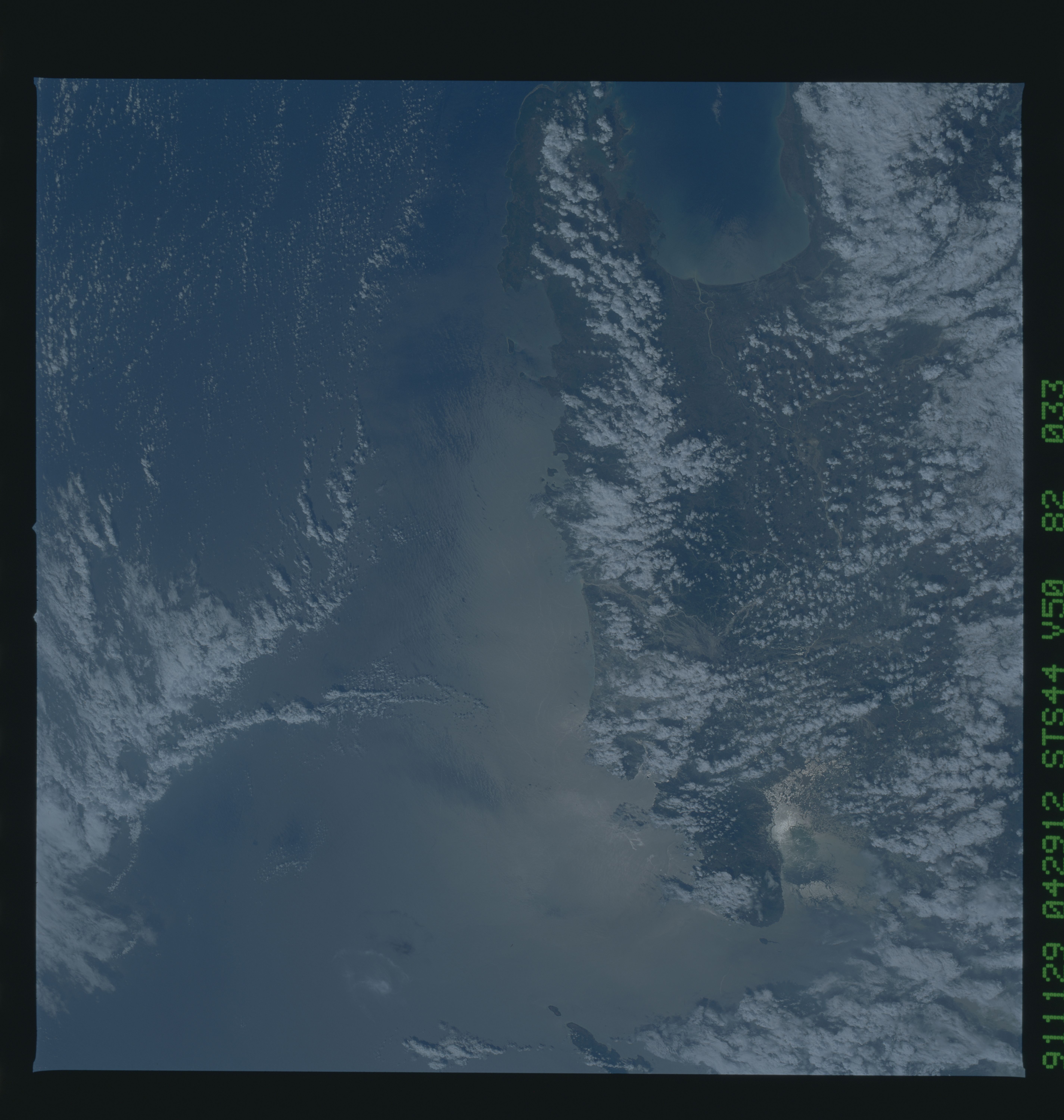
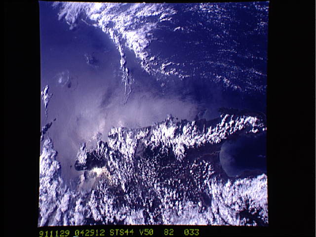
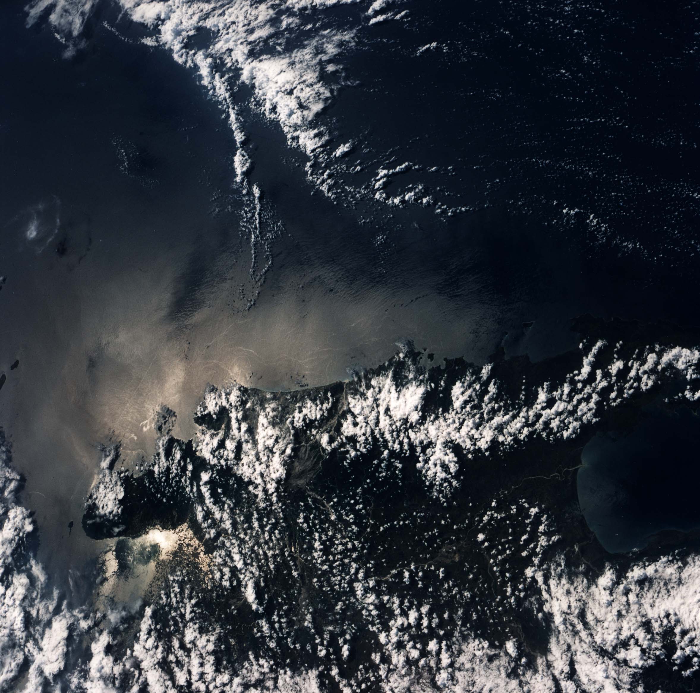
Image Caption: STS044-82-33: MT. PINATUBO, PHILIPPINE ISLANDS
Mt. Pinatubo on the island of Luzon, Philippines, erupted catastrophically in June 1991, after over 600 years of inactivity. This photograph is the first Shuttle photograph of Mt. Pinatubo and
its surroundings after the June eruption. The mountain, in thecenter of this south-looking photo, is clear of clouds. The north-facing crater is barely visible. The entire region surrounding the volcano, once heavily forested, is now covered in ash. All of the major rivers draining the area are choked with ash and debris, creating potential for more mud slides and floods with heavy rainfall. The sun glitters off Manila Bay, highlighting the wakes of ships leaving the bay. Corregidor island can be seen at the mouth of Manila Bay, but haze and low clouds obscure the city of Manila.
Mt. Pinatubo on the island of Luzon (15.5N, 120.0E) erupted catastrophically in June 1991 after over 600 years of inactivity. This is the first shuttle post eruption photo. The north facing crater is not obvious in this scene but the blowout area, in the once heavily forested region, is easily observed as lava flow, ash fallout, mud slide and debris trails mar the landscape. Clark AFB, once the crossroads of the SW Pacific can only partially be seen.
